Beach Mavarčica Čiovo: Rocky Lagoon Near Trogir


Profile
Beach Mavarčica, Čiovo Island: Rocky Lagoon and Open Sea Views on the Southern Shore
Croatia | Čiovo Island | Trogir Riviera
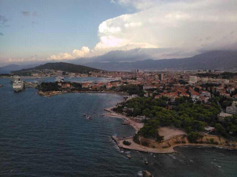
Čiovo Island sits in the perpetual shadow of its neighbours. It is connected to Trogir by a bridge — Trogir being a UNESCO World Heritage Site whose medieval stone core draws visitors from across Europe — and it lies within sight of Split across the channel to the east. Both cities are emphatically and repeatedly famous. Čiovo is not, which is precisely the condition that makes its southern shore worth knowing about. The island has less than 30 square kilometres of land and a coastline of bays, coves, and rocky inlets that the tourist infrastructure of its famous neighbours tends to direct visitors away from rather than toward.
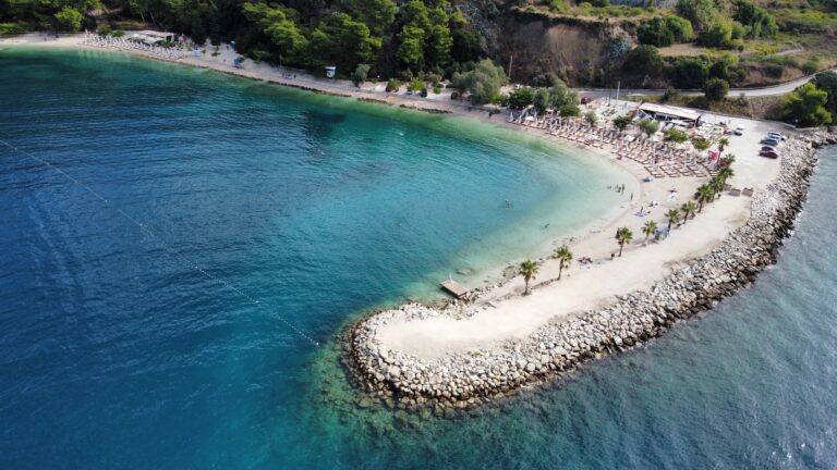
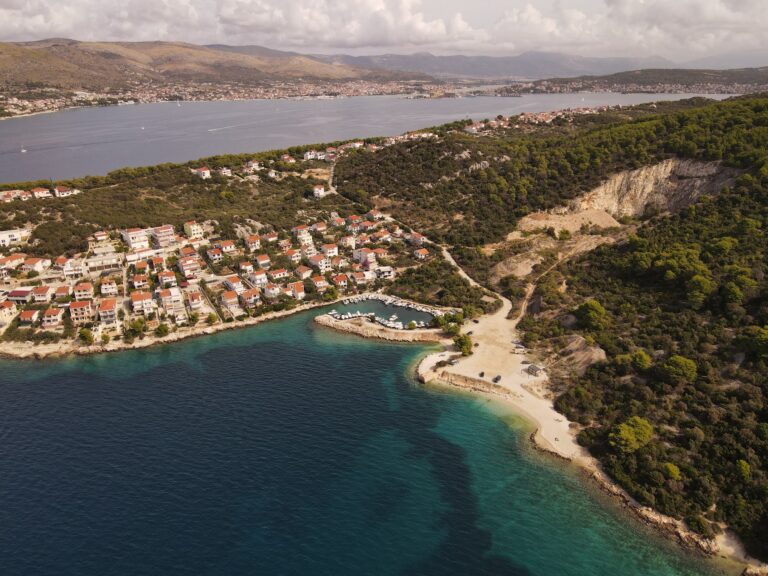
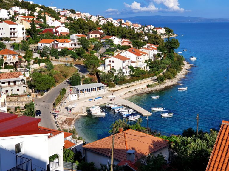
Beach Mavarčica occupies a lagoon on the island’s southern coast approximately 5 kilometres from Trogir and 1 kilometre from Okrug Donji. The bay is oriented south, facing the open Adriatic across a channel toward the islands of Šolta and Brač — the same archipelago visible from the south Dalmatian coast but here seen from the Čiovo shore at a particular angle and distance that gives the island silhouettes a depth and presence the mainland view does not provide. The lagoon itself is predominantly rocky, with a beach bar at its entrance and the smaller bay of Diruni — white gravel and rock — at its far end. The water quality the open southern exposure maintains is the defining characteristic of the swimming here.
Getting There: From Trogir Bridge South to Okrug Donji and on to the Mavarčica Village
From Trogir, the approach to Beach Mavarčica follows the road south across the bridge onto Čiovo Island and continues toward Okrug Gornji and then Okrug Donji, turning south toward the village of Mavarčica — a drive of approximately ten minutes from the bridge under normal summer conditions. The road into the village is narrow in places, consistent with the residential character of the southern Čiovo settlements, and organised parking is available within the village zone within walking distance of the shore.
On foot, the beach is accessible via several walking paths from the village centre that lead directly to the shore — the distances involved are short, which makes Mavarčica practical for visitors staying in local accommodation within the village or in Okrug Donji. By boat, taxi boats from Okrug Gornji serve the coves and bays of the southern shore through the summer season, and the approach from the water shows the lagoon’s geometry — the rocky arms of the bay enclosing the calm inner water — in a way the road approach through the village does not. The southern cliff line of Čiovo is best understood from the sea, and arriving by water at least once gives the bay its proper context.
For visitors based in Trogir who want to reach Mavarčica without a car, the taxi boat services that connect Trogir harbour to Okrug Gornji — running from mid-May to mid-October at regular intervals through the summer — provide the closest water-based access point, from which Mavarčica is reachable by road within a few minutes.
The Lagoon: Rocky Shore, Pebble Coves, and the Diruni Bay at the Far End
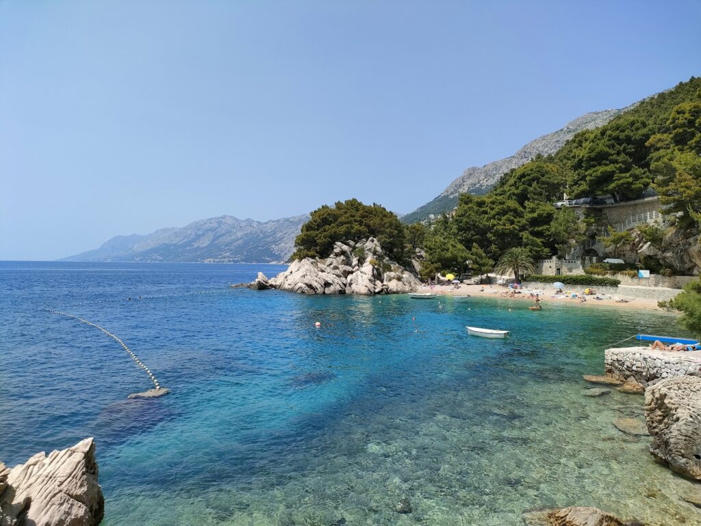
The Mavarčica lagoon is predominantly rocky in character — the natural stone of the Čiovo southern coast, worn and shaped by the open Adriatic exposure, forming the shore that lines both arms of the bay. Within the lagoon’s structure, smaller pebble and gravel sections appear between the rock formations, providing the softer underfoot entry points that families and less confident swimmers tend to gravitate toward. The variety of surface within a single bay — rock plateau, pebble, gravel — means visitors can choose their position based on preference and need without leaving the lagoon.
The beach bar at the lagoon entrance is the social anchor of the bay — a simple provision that marks the point where the path from the village meets the water and that serves coffee and drinks to the swimmers and sunbathers distributed along the rocky shore on either side. Beyond it, the lagoon extends south and opens at its far end into the bay of Diruni — a smaller, slightly more sheltered cove of white gravel and rock that is quieter than the main lagoon entrance area and that rewards the short walk along the shore to reach it.
The Dalmatian islands on the southern horizon — Šolta directly south, Brač to the southeast — are the constant visual element of the bay. Brač in particular carries the pale limestone mass that makes it one of the more visually substantial islands in this section of the Adriatic, and its ridge-line catches the afternoon light across the channel in a way that is particular to this southern Čiovo viewing angle.
Water Quality and Swimming at Beach Mavarčica
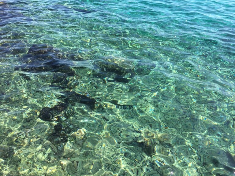
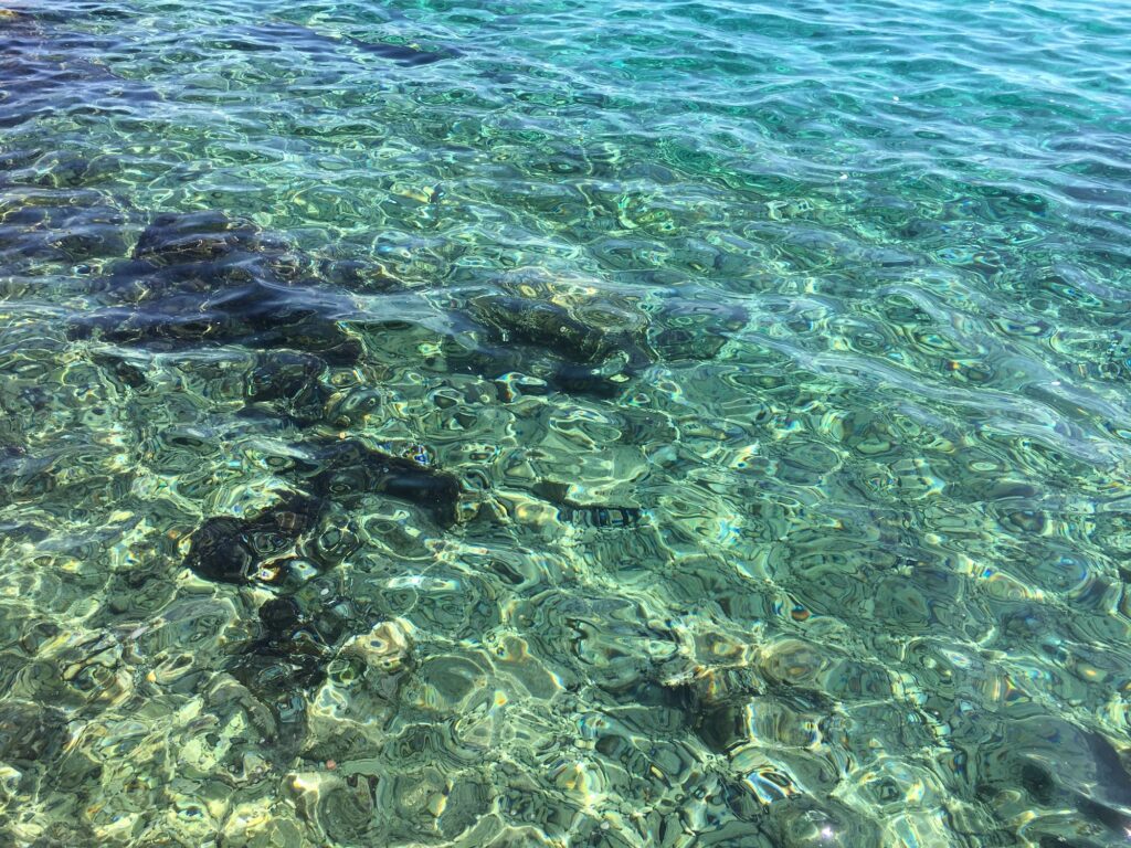
The water quality at Beach Mavarčica reflects the bay’s position on the open southern coast of Čiovo — facing the Adriatic directly across the channel toward Šolta and Brač without the enclosed position that gives calm water at the cost of circulation. The open exposure keeps the water at Mavarčica consistently clean and well-refreshed, with the visibility and colour characteristic of clean, well-circulated Dalmatian channel water: vibrant turquoise in the shallows above the pale rock and gravel bottom, deepening to cobalt as the bay floor drops away.
The rocky underwater formations that extend from the shore into the lagoon make the bay productive for snorkelling — the stone provides the substrate for the marine life that accumulates on submerged rock in clean water, and the visibility is sufficient to follow it at depth without specialised equipment. The variety of underwater topography within the lagoon — rock faces, gravel patches, deeper sections toward the bay’s mouth — gives snorkelling here more variety than a uniform pebble seabed provides.
The bay is naturally protected from the northern winds by the Čiovo landmass above it, which keeps the water within the lagoon calmer than the fully exposed conditions that the open southern orientation might otherwise produce. In practice, the summer conditions at Mavarčica are reliably suitable for swimming and snorkelling through the peak season, with the open southern exposure producing the water quality and the surrounding land providing the wind shelter that makes the two compatible.
Facilities at Beach Mavarčica
The facilities at Beach Mavarčica are minimal in a way that is consistent with the village character of the southern Čiovo shore and with the deliberately quieter identity the bay maintains relative to the fully organised resort beaches elsewhere on the island. Freshwater showers and changing cabins are available near the beach access points. Sunbed and umbrella rental is provided for those who want organised comfort on the rocky shore. The beach bar at the lagoon entrance covers the basic food and drink provision.
There is no permanent lifeguard tower. The bay’s natural calm and the clear visibility through the water provide the safety conditions that the source text identifies as inherent to the location — the absence of heavy boat traffic within the lagoon and the clear underwater visibility contribute to a swimming environment that is manageable for confident swimmers without formal supervision. Visitors with young children or who are less confident in open water should factor the absence of lifeguard provision into their planning.
The Trogir Diving Centre operates in the area, offering guided underwater exploration of the bay’s marine life and underwater rock formations — both beginner discovery dives and excursions for more experienced divers — which is consistent with the underwater quality that the Čiovo southern coast’s clear water and rocky seabed produces.
Beach Mavarčica with Families and Children
The mix of rocky and pebble sections within the lagoon gives families some options for finding a comfortable entry point, though Mavarčica does not have the uniformly gradual pebble entry of the more organised beaches on the island. The pebble and gravel sections between the rock formations provide the gentler access points, and the calm lagoon water reduces the surface conditions concern. Water shoes are practical for the rocky sections and recommended for children navigating the shore between swimming spots.
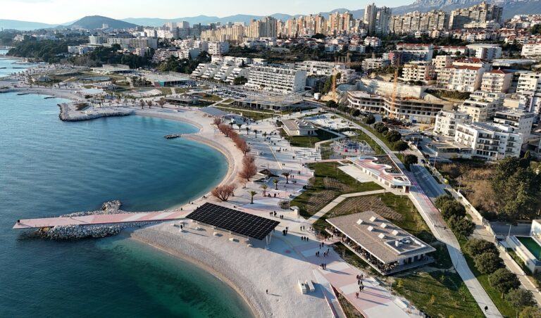
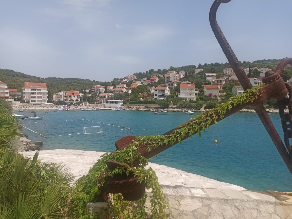
The absence of loud crowds and heavy boat traffic within the bay is the quality that the source text correctly identifies as a practical advantage for families who find the intensity of the fully organised resort beaches less suited to a day with young children. Mavarčica is quieter than Copacabana Beach Okrug Gornji — the long organised beach 3 kilometres north that is the primary resort destination of the Trogir Riviera — and that difference in character is the reason to choose it rather than a deficiency to be compensated for.
For families who want the full resort infrastructure alongside similar southern Čiovo water quality, Slatine Beach Čiovo Island on the eastern end of the island offers a well-equipped organised beach in a village setting, and is accessible from Trogir by boat through the summer season.
Food and Drink: Dalmatian Fish Tavernas in Mavarčica Village
The beach bar at the lagoon entrance provides the on-site social provision. For a full meal, the village of Mavarčica and the nearby settlement of Okrug Donji carry the tavernas that serve the Dalmatian coastal kitchen in the context of the southern Čiovo fishing village tradition — octopus salad, grilled sardines, fresh fish from the channel prepared simply with olive oil and local herbs. The cooking here is the food of a working fishing coast rather than a resort kitchen, and the quality reflects that origin.
Dining with the view south across the channel to Šolta and Brač as the light shifts through the afternoon and the island silhouettes change colour toward the evening is the specific pleasure that the Mavarčica bay orientation provides at table — a view that the enclosed northern bays of Čiovo do not have and that justifies the extra few kilometres of road between the village and Trogir’s more serviced restaurant offer.
Mavarčica Among the Čiovo Southern Shore Bays
The southern coast of Čiovo between Okrug Donji and the eastern cape carries a series of bays — Mavarčica, Diruni, Tatinja, Rastići, Duga, Duboka — each with its own geometry and character, each sharing the open southern exposure and the clear water quality that the Adriatic channel circulation maintains along this section of the island. Mavarčica is the most westerly of that series and the closest to Trogir, which gives it the practical advantage of accessibility without the full resort development that proximity to a major tourist town typically brings.
The bays of Duga and Duboka further east on the same southern coast are considered among the finest swimming locations on the island — deeper enclosed bays with exceptionally clean water — but require more road travel and are primarily boat-accessible in the way that the more remote Čiovo coves demand. Mavarčica is the entry point to the southern shore character for visitors arriving by car from Trogir and provides that character — the open sea view, the rocky lagoon, the village scale — within a distance that makes it viable as a half-day excursion from the old town.
Beach Mavarčica on Čiovo Island is a beach that asks something of the visitor in return for what it offers — the five kilometres from Trogir, the rocky shore that requires water shoes, the absence of a lifeguard tower. What it offers in return is the open southern Adriatic view to Šolta and Brač, the clean water that the channel exposure maintains, and the quiet village character that the southern Čiovo shore has preserved precisely because it is five kilometres from Trogir rather than adjacent to it.
Follow the road south from the bridge, through Okrug Donji, into Mavarčica village. Park where the road narrows.
The path to the lagoon is short. The islands on the horizon are worth the drive.

Map
Sorry, no records were found. Please adjust your search criteria and try again.
Sorry, unable to load the Maps API.
Near by places: