Livadaki Beach Samos: Free Kayaks in a Fjord Cove
Profile
Livadaki Beach, Samos: The 100m “Little Meadow” Cove at the End of a 2.5km Dirt Road, Free Sunbeds With a Drink, Free Kayaks, and a Wind Warning
Greece | Agia Paraskevi | Samos, Northeast Aegean Islands
Livadaki means little meadow in Greek. The name doesn’t prepare you for a beach, which is partly the point — the small meadow above the cove, the dirt road through it, and the sudden reveal of turquoise water at the bottom are the specific arrival sequence that visitor accounts consistently describe as the reward for the drive.
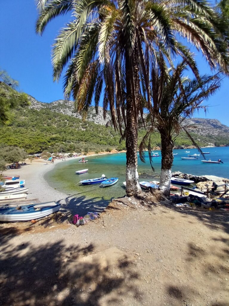
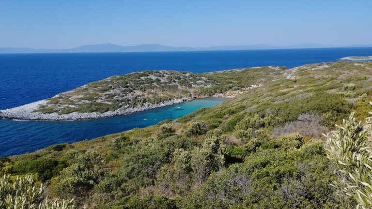
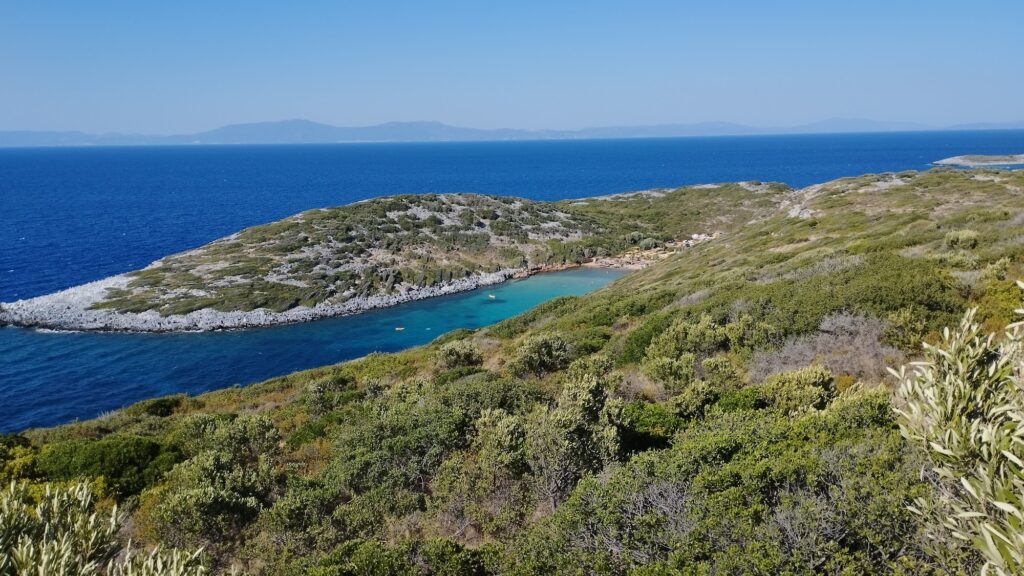
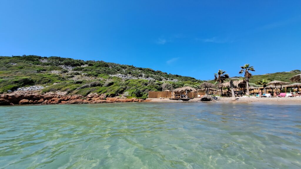
Livadaki beach is a small, very beautiful sandy beach with turquoise crystal clear and shallow sea, giving the impression of an exotic beach. North of the capital, in a small and narrow bay lies Livadaki beach, about 100 metres long. Between the rocks lies a well-hidden small exotic beach with light sand, shallow and turquoise waters.
The “fjord-like” description in the Lonely Planet entry and the Discover Greece guide is the most accurate characterisation of the bay geometry. This beach is located within a fjord and as such sheltered from the wind and ideal when the waves are high. The rocky channel concentrates the turquoise colour of the shallow sandy bottom — the cove is narrow enough that the reflective quality of the water is more intense than at an open beach. On a calm day, the colour is genuinely unusual for the North Aegean.
The honest caveat that the source article doesn’t mention: always pay attention to the wind, if too windy then prefer somewhere else. The fjord that provides shelter when the sea is rough can also funnel wind directly down the channel when the wind direction aligns with it. Checking conditions before the 2.5km dirt road drive in is time well spent.
Getting There: 13km From Vathy, 9.5km Paved Then 2.5km Dirt, Arrive Early, Limited Parking
From Samos Town (Vathy), head north following the coastal road towards Kotsika and Agia Paraskevi. Continue for approximately 9.5 km until you see a sign for Livadaki Beach. Turn north onto the dirt road and follow it for about 2.5 km to reach the beach. Parking is available in a clearing near the beach club. Be cautious on the unpaved road.
All that beauty and limited size mean that Livadaki beach does get busy, so it’s worth coming in the morning or in the late afternoon. The small parking clearing fills and latecomers either park on the approach road and walk, or turn around. A standard rental car manages the dirt road carefully; the gradient is the main concern, not the surface.
Follow the north-coast road out of Vathy for 10km and look for a signposted dirt road to the left leading to Livadaki Beach.
By sea, renting a small boat from Vathy and arriving through the bay mouth is the approach for anyone who wants to see the fjord from the water rather than the top. Here, tropical azure waters lap against soft sand in a long-sheltered cove with facing islets.
The Beach: Pebbles at the Start, Sandy Shallow Bottom, Free Sunbeds and Kayaks With Minimum Consumption
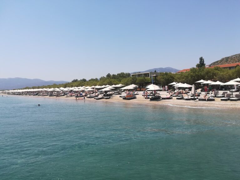
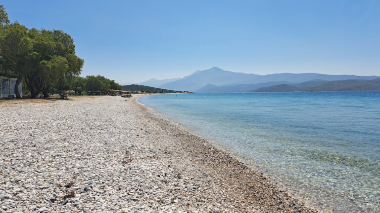
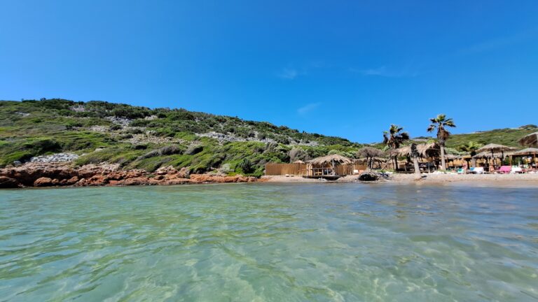
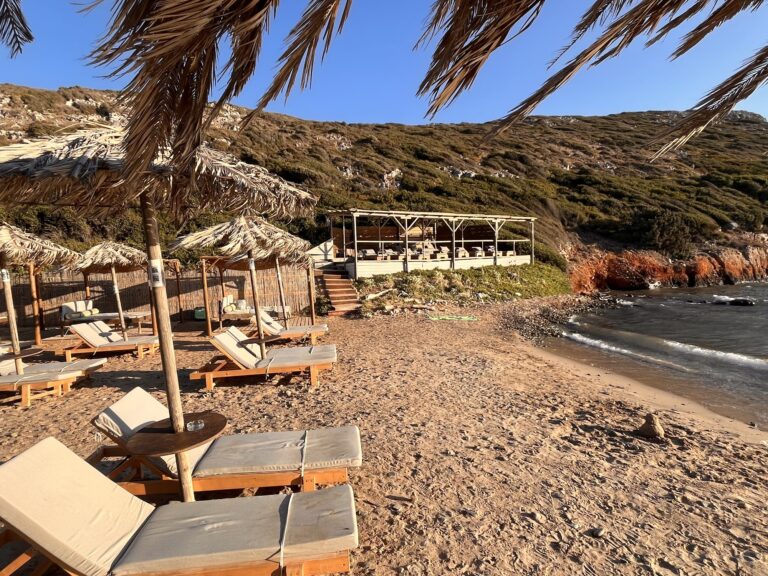
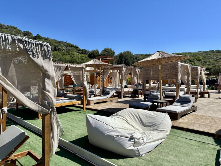
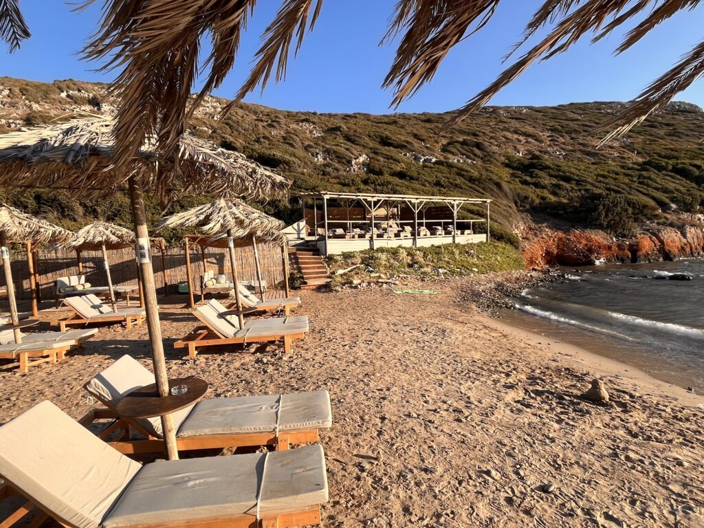
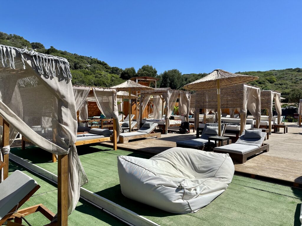
The first stretch to access the sea is with pebbles, but then there is fine sand and the sea is transparent. The water remains shallow for many metres. Sunbeds and umbrella are not charged, but ask for at least one drink.
The pebble entry at the waterline is the one practical point to prepare for — water shoes for the first few steps, then fine sand underfoot for the rest. The depth stays shallow for a long way, which combined with the calm water makes the beach particularly good for families.
The management provides free kayaks for those who want to use them. Free kayaks with minimum food or drink consumption is the specific commercial model that makes Livadaki unusually generous by Greek beach standards. The kayaks allow exploration of the rocky channel and the view back toward the beach from the bay mouth.
For the active visitor, there’s a beach volleyball court and the option to borrow a kayak to explore the coastline.
The Small Islet and the Rocky Channel
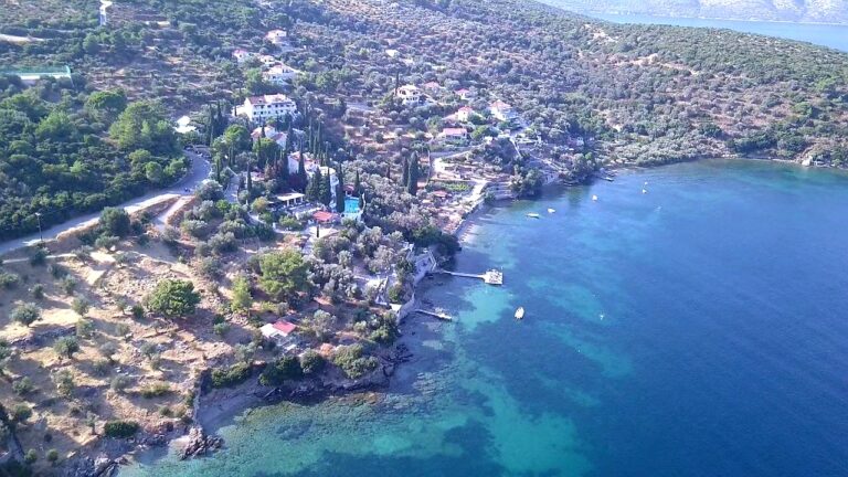
The rocks form a sea strip at the beginning of which there is a small islet. The islet at the mouth of the channel is the specific geographical feature that makes Livadaki look unlike any other Samos beach from above. The drone photographs that circulate on social media show the narrow channel, the islet at the entrance, and the turquoise water inside — the composition that earned the beach its Instagram reputation.
Snorkelling along the rocky edges of the channel is productive: bring snorkelling gear to explore the rocky coastline and crystal-clear waters.
Agia Paraskevi: The Taverna Village on the Main Road
For a classic taverna, get back on the main road and drive down to the hamlet of Agia Paraskevi, where you can enjoy a meditative lunch or dinner with the backdrop of multicoloured boats moored in a picturesque bay.
Agia Paraskevi — the small hamlet on the coast road just below the Livadaki turning — is the dining alternative for visitors who want a proper village taverna after the beach bar experience. The bay there has the fishing boats that Livadaki lacks, and the food comes from the same local context.
The Potami Beach and Waterfall Connection
The Potami waterfall hike — covered in the Potami Beach Samos Greece article — starts at the river mouth 3.5 kilometres further west along the same north coast road. For visitors with a hire car and a full day, the combination of Livadaki in the morning (get there early for parking) and the Potami waterfall hike in the afternoon makes the most of the northwestern corner of Samos — the turquoise cove and the forest canyon in the same day.
Livadaki Beach on Samos is the 100-metre little-meadow cove in a fjord-like bay 13 kilometres northwest of Vathy — 9.5km of paved road then 2.5km of dirt to the small parking clearing, arrive early, pebbles at the water entry then fine sandy shallow bottom, free sunbeds and free kayaks with minimum one drink consumption, beach volleyball court, the small islet at the bay mouth, wind can funnel down the channel (check forecast before driving in), and Agia Paraskevi village taverna on the main road for lunch.
Drive the dirt road early. Take a kayak to the mouth. Paddle back when the channel turns deep blue.
Map
Sorry, no records were found. Please adjust your search criteria and try again.
Sorry, unable to load the Maps API.
Near by places: