Psatha Beach West Attica: Bring the Mat the Name Demands
Profile
Psatha Beach West Attica Greece: A Beach Named After the Mat You Need to Bring
Greece | Psatha | Mandra-Eidyllia, West Attica
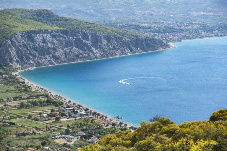
The name carries its own mild joke. Psathi, the reed plant from which woven beach mats are made, grows so abundantly around this bay that the settlement took its name from it — and those same mats are precisely what you need to bring if you come here, since most of the 2.5-kilometre pebble shore operates without rentable sunbeds. A beach named after the mat you are expected to carry. The detail appears in local folklore as something worth recording, and it is, in the specific way that names derived from practical necessity rather than mythology or geography tend to be.
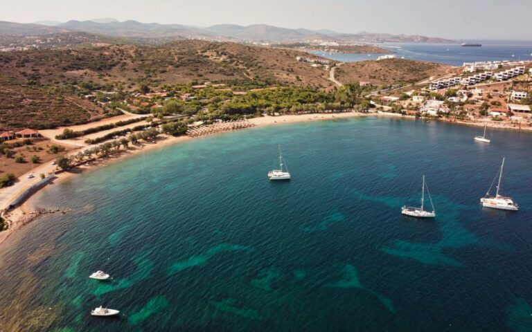
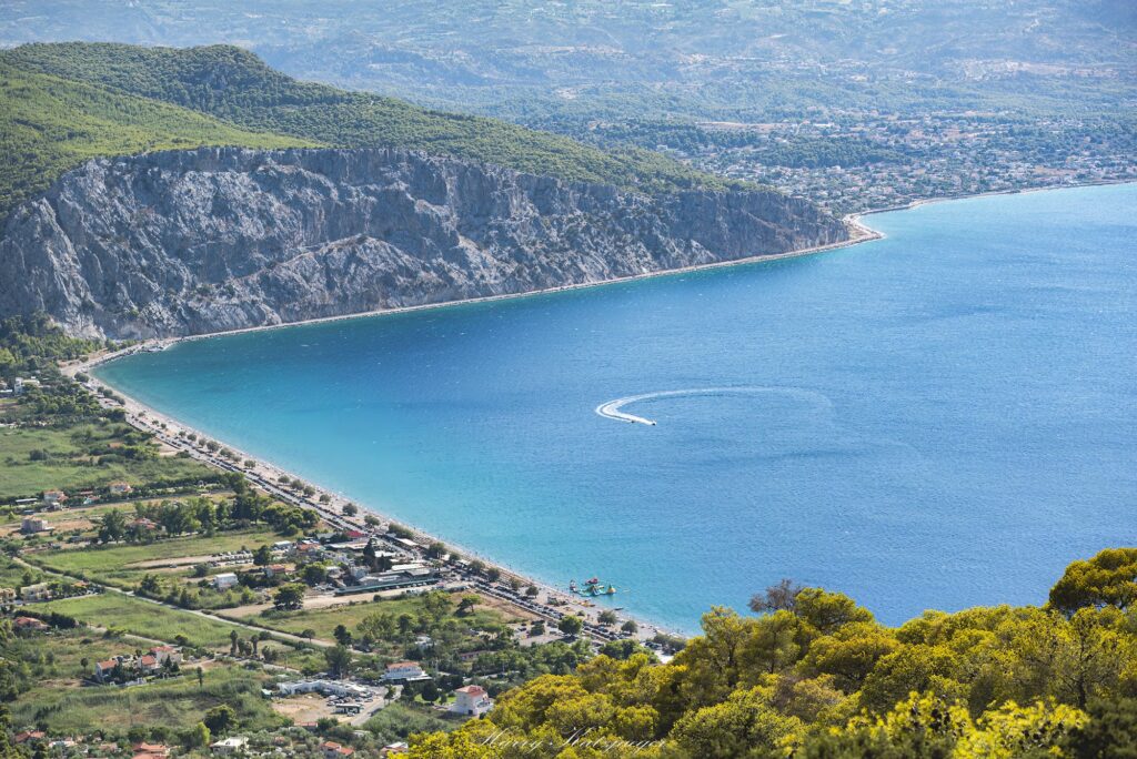
The bay was not always called Psatha. In antiquity, the natural harbour here was named Panormos and belonged to the city of Pagae — the settlement now called Alepochori, three kilometres along the coast — which used this port as its maritime outlet on the Corinthian Gulf. Excavations at Alepochori revealed the acropolis of the ancient city and a temple, and Pausanias, writing in the 2nd century AD, described the wider area in his Description of Greece. The harbour at Psatha is now small rather than strategic, home to fishing boats and pleasure craft rather than ancient commerce, the headlands of Akrotiri Mytikas framing the bay on either side in the way the classical sources described.
Getting to Psatha Beach West Attica Greece: Over Kithaeron or Along the Gulf
Two approaches exist, and they are genuinely different experiences. The direct route from Athens uses the A8 motorway toward Corinth, exiting at Elefsina and following the signs through Mandra and then west to the coast via Alepochori, arriving at the eastern end of the Psatha bay — total distance around 65 kilometres, under an hour and a quarter in normal conditions. The alternative route climbs into the mountains: through Mandra and Vilia, crossing the forested shoulder of Mount Kithaeron before descending through Mount Pateras toward the sea, arriving at the western end of the bay with the whole 2.5-kilometre stretch ahead.
Vilia itself, the largest settlement of the municipality, was formerly called Eidyllia — its name apparently corrupted over centuries through Dyllia to the current form — and its inhabitants are Arvanites, part of the medieval migration from what is now Albania and Epirus that shaped the population of much of rural Attica. The village sits amphitheatrically on a pine-covered slope at 500 to 600 metres, and the road down from it toward Psatha passes through Malia Psatha at 560 metres, from which the bay and the Corinthian Gulf spread below in a panorama that makes the longer route worth choosing at least once over the faster coastal approach.
Mount Kithaeron, at 1,409 metres the dominant peak of the northwest, carries mythological weight that the coastal drive does not. It was on Kithaeron that Oedipus was left to die as an infant, tied by his feet — his name meaning “swollen foot” referencing that binding. It was on Kithaeron that the hunter Actaeon stumbled upon Artemis bathing and was turned into a stag and torn apart by his own hounds. The mountain’s mythology runs toward violence and abandonment, which gives the descent from it toward a beach this peaceful a particular contrast.
Parking at Psatha is available along the coastal road and in informal areas behind the beach. The beach fills on summer weekends and arriving before ten in the morning on a Saturday secures a position with the full bay still visible.
Psatha Beach West Attica Greece: Pebble Shore, Pine Forest, About 10% Organised
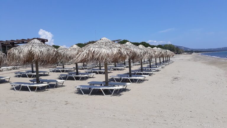
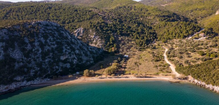
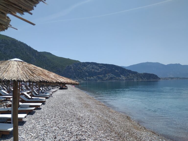
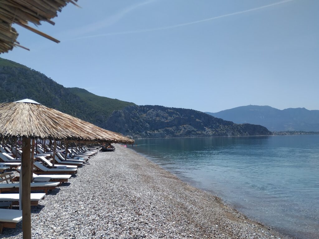
The beach is 2.5 kilometres of coloured pebbles, the descent to the water gradual enough not to require water shoes, the sea deepening faster than the shallow family bays further east along the Attic coast but still manageable for confident swimmers of any age. The density of the Mount Pateras pine forest above and behind the beach gives the air a specific combination of salt and resin that several accounts of the place single out independently, and the trees come close enough to the shore that the boundary between beach and forest is not as clearly defined as at most comparable stretches of coast.
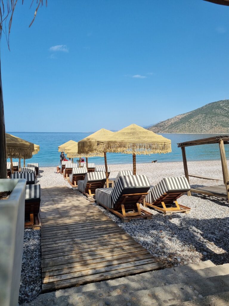
The organised section occupies roughly ten percent of the beach — sunbeds and umbrellas provided free with the purchase of a drink at the beach bars managing them — while the remaining ninety percent is entirely free and public. The beach is large enough that even on a crowded summer Saturday, both ends retain open stretches where laying out a towel does not require negotiating with neighbours. The Alkyonides Islands are visible offshore, the same islands whose formation was discussed in the Alyki piece — seven islets separated from the mainland when an earthquake sank the connecting land in 426 BC.
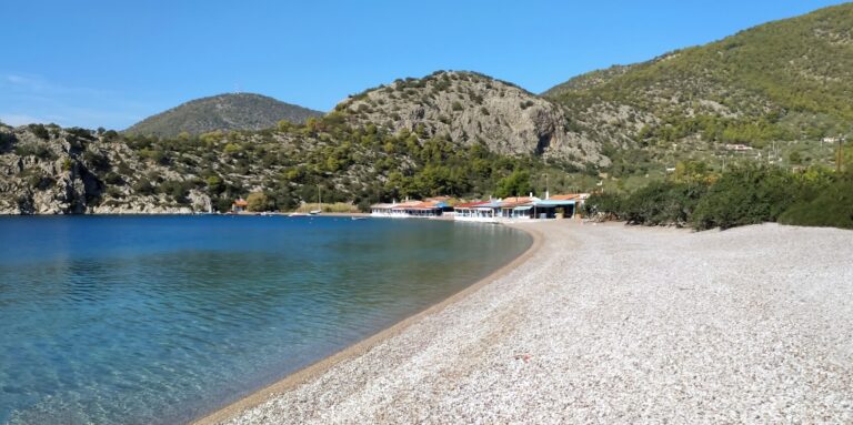
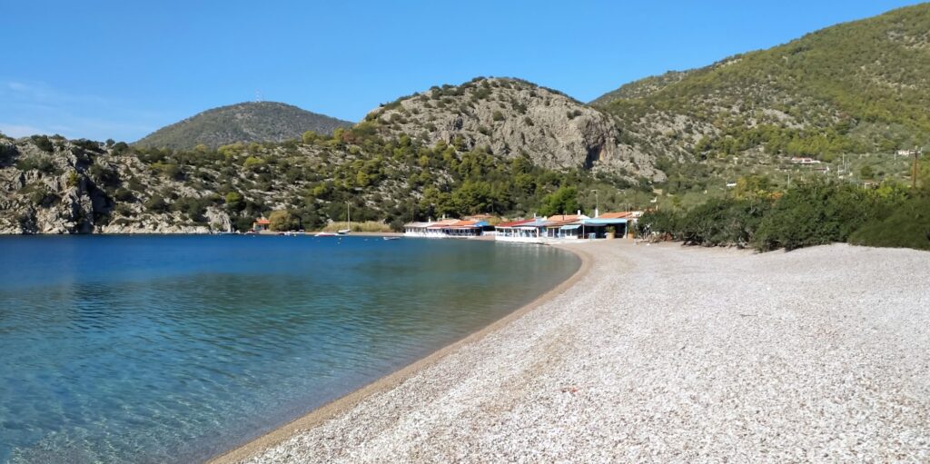
The tavernas on the north end of the beach are built directly in front of the water, close enough that the tables sit essentially at the tide line. Several sources note these constructions are technically illegal under coastal zone regulations — they predate the enforcement of those regulations and have remained rather than been removed — which gives the dining experience a specific quality: tables that feel exactly as close to the sea as they look.
Mount Pateras, the Monastery Above, and the Walking Routes
The mountain directly above the beach, Mount Pateras rather than the more distant Kithaeron, carries its own historical layer. On the slope of the mountain above Ano Alepochori, a monastery of the Transfiguration of the Savior dates its main church, the katholikon, to the 13th century, built in a position specifically chosen to remain unseen from the coast during the period when pirate raids were targeting the settlements of West Attica. The monastery is enclosed by a wall and functions today as a maintained, working religious site. Its location — visible from above and invisible from below — remains as deliberate as it was when it was chosen.
Hiking routes from Psatha climb through the Pateras pine forest, with panoramic views of the Corinthian Gulf and the Alkyonides Islands available from the higher sections. The driving route from Vilia passes through the same landscape, but the walking routes from the beach access it in a way the road does not — the forest at sea level connecting upward to the mountain terrain rather than being crossed in a vehicle.
Alepochori, Porto Germeno, and the Wider Coast
Psatha sits between Alepochori to the east and Porto Germeno to the west, the three settlements forming the inhabited coastal strip of the Vilia municipal unit. Alepochori stands on the site of the ancient Pagae, the city whose port Psatha once was, and the beach there carries small pebbles and a similar pine-backed character. Porto Germeno, at the end of the Germeno bay where Kithaeron and Pateras both descend to the sea, has its own archaeological site: the ancient fortress of Aigosthena, with circuit walls and towers surviving in visible condition.
Alyki Beach Boeotia Greece and Paralia Saranti Beach Boeotia Greece lie on the opposite side of the Corinthian Gulf, the Boeotian coast visible across the water from Psatha on clear days. The geography of the gulf — mountains descending to the sea on both sides, the water between them narrow enough to carry the outlines of settlements across — makes the view from Psatha outward toward Boeotia a piece of landscape that works in both directions simultaneously.
The beach is best in September, after the height of the Athenian summer day-trip season. The water is warmer than in June, the crowd smaller than in August, and the pine forest above the beach still holds the heat of the summer in its resin. Bring a mat. The name is specific in its instruction.
Map
Sorry, no records were found. Please adjust your search criteria and try again.
Sorry, unable to load the Maps API.
Near by places: