Kako Lagadi Beach Kefalonia: Read the 1953 Earthquake
Profile
Kako Lagadi Beach Kefalonia Greece: What the 1953 Earthquake Left in the Rock
Greece | Asprogerakas | Kefalonia, Ionian Islands
On 12 August 1953, an earthquake of magnitude 7.2 struck the southern Ionian Islands and destroyed most of Kefalonia within minutes. The island rose by approximately one and a half metres along its southern coast, and that abrupt geological change is visible at Kako Lagadi in a way that requires no signage or explanation to read — the rock at the base of the cliffs carries the unmistakeable horizontal line of the former waterline, the old sea level pressed into stone like a tide mark that never washed off. Standing at the edge of the cove and looking at the cliffs on either side, the earthquake is not a historical fact but a physical one, written into the specific geology of this particular place.
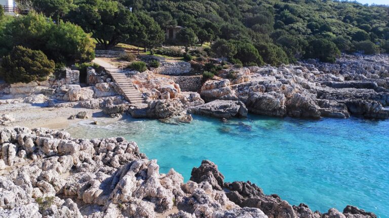
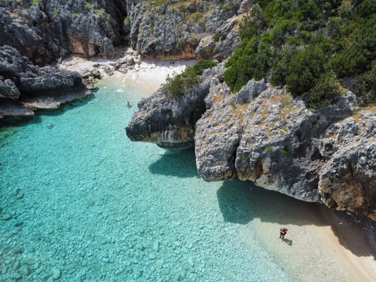
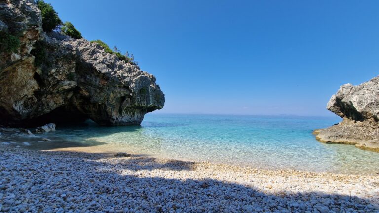
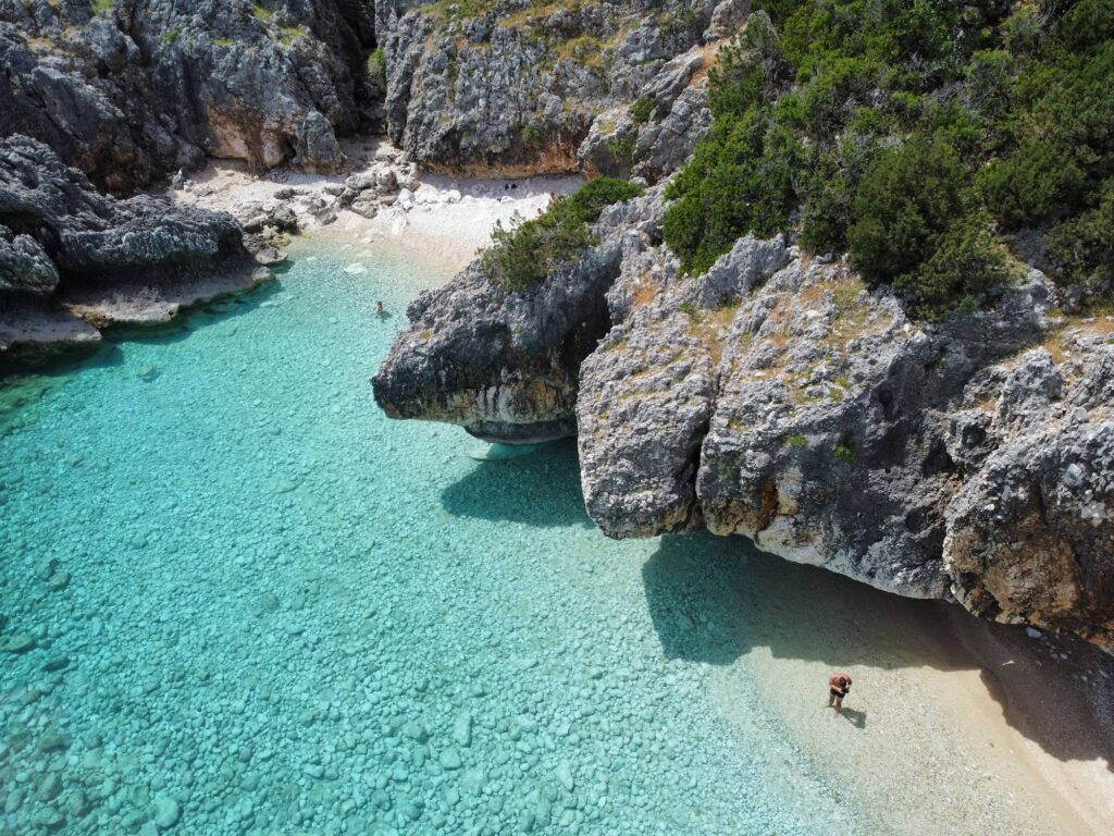
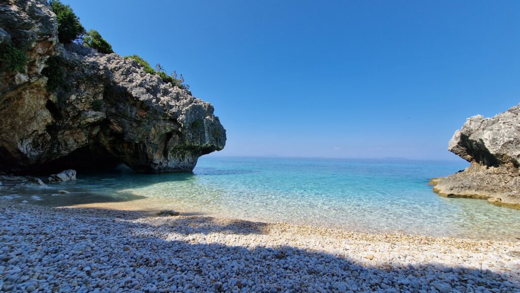
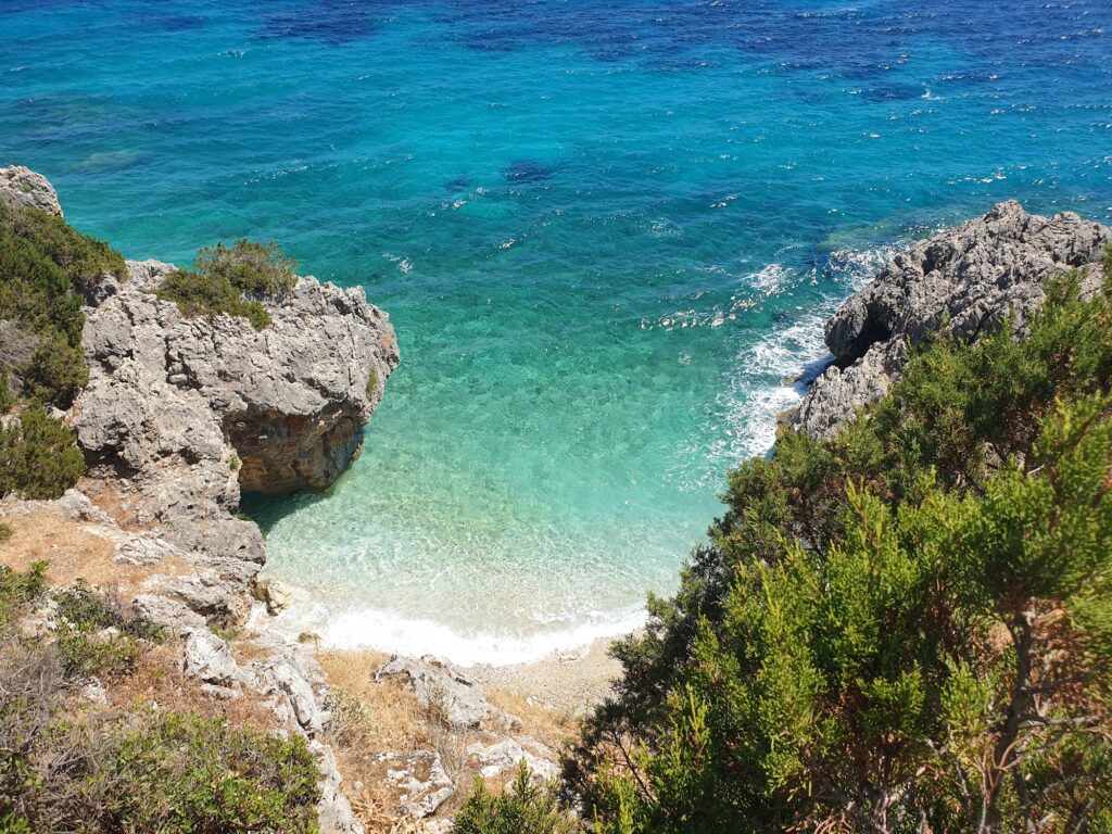
The beach itself sits between Skala and Poros, invisible from the coastal road that passes above it. Most drivers on that road have no idea the cove exists; the descent begins at a point in the roadside vegetation that gives nothing away until you are already committed to the path. The beach is no more than 40 metres long, several tiny coves separated by rock and cave, the shore covered in rounded smooth pebbles that the sea has been working on for longer than the road above existed. There are no facilities of any kind. This is not a framing for what the beach lacks — it is a description of what the place is.
Getting to Kako Lagadi Beach Kefalonia Greece: The Roadside Descent Between Skala and Poros
The access point lies on the coastal road connecting Skala to Poros, approximately 4 kilometres from Poros and 8 kilometres from Skala. Nothing marks it obviously from the road. Drivers who know what they are looking for pull over where a handful of other cars are parked at the roadside, identify the gap in the vegetation, and begin the descent. Those using the road for the first time should accept that the first visit will involve some searching, and that the second visit will be immediate.
The path descends steeply through limestone rock, narrowing at one section to a passage that requires care rather than agility — the difficulty is not technical but demands confident footing and appropriate footwear. Water shoes or sturdy sandals are the right choice rather than flip flops, and the path is not suitable for small children or anyone with significant mobility limitations. The descent takes around ten minutes at a careful pace.
The alternative is arriving by sea. Boats depart from Poros harbour, and the approach from the water gives a view of the cove’s caves and the cliff structure that the land route does not. Several boat operators running excursions from the harbour include Kako Lagadi as a stop, and private rental of a small motorboat from Poros makes it possible to time arrival and departure without depending on a fixed schedule.
The Cove: Forty Metres of Pebble, Caves on Both Sides, Water That Deepens Quickly
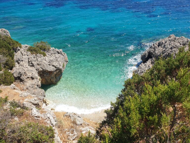
The beach occupies a small bay enclosed by limestone on three sides. The pebbles are smooth and rounded, and the water is the kind of clear that makes depth difficult to judge from above — it looks shallower than it is until you are in it, at which point the depth comes as a mild surprise. The seabed is rock rather than sand, and water shoes are useful for the entry as well as the descent.
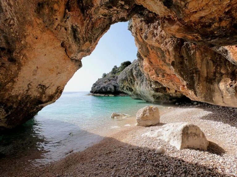
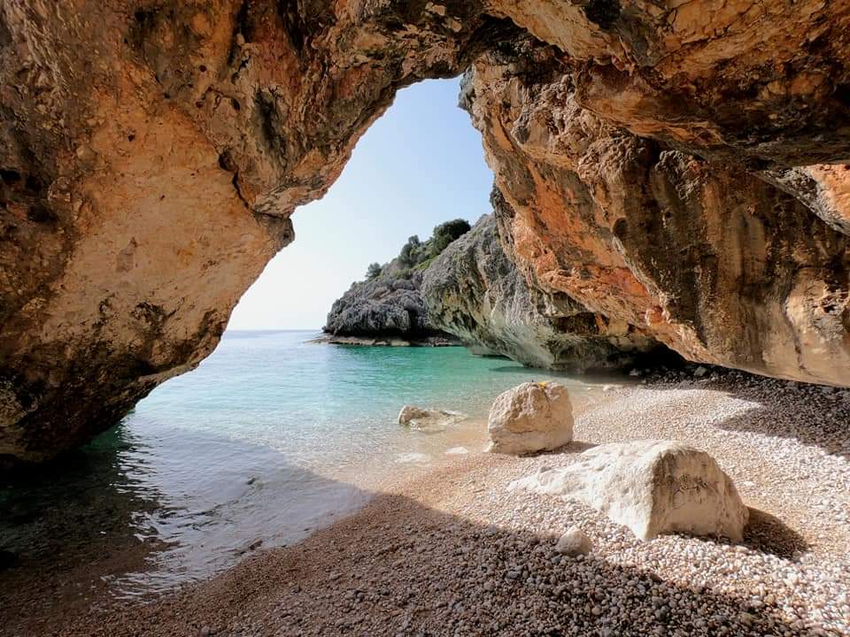
The caves along the cliff edges at both ends of the cove are the primary reason the underwater landscape rewards a mask. The rock formations inside and adjacent to the caves hold marine life in the way that sheltered underwater structures always do, and the light inside the cave entrances shifts between the turquoise of the open water and a darker blue as you move in from the surface. The cave entrances are swimmable rather than requiring any diving equipment, and the visibility in calm conditions is sufficient to see clearly without needing specialist gear.
Nothing is available to purchase, rent, or eat at Kako Lagadi. The cove is entirely without services, which is the most direct practical consequence of its inaccessibility and the reason it remains genuinely undeveloped. Bringing water, food, and everything else needed for a full morning is not a suggestion but a requirement.
The Earthquake Evidence: What the Cliffs Carry That the History Books Describe
The 1953 earthquake that destroyed most of Kefalonia raised the southern coastline by approximately 1.5 metres. At Kako Lagadi, this change is specifically visible in the rock faces on either side of the cove — the old sea level is recorded in the horizontal erosion line that runs across the cliff surfaces at a height that no longer corresponds to where the water actually sits. The cliffs carry that line clearly enough that once you know what it represents, the eye goes to it naturally and keeps returning.
The Kefalonia that exists today — most of its buildings, all of its major roads, its current configuration of harbours and seafronts — was built after 1953. The island’s tourism infrastructure, the Poros harbour from which boats depart to this cove, the road above that nobody named specifically in relation to this beach — all of it postdates the earthquake that preserved at Kako Lagadi a physical record of where the sea used to sit. The beach itself predates the earthquake. The rock around it simply records what happened.
What Lies Along This Section of the Southern Coast
The coast between Skala and Poros holds several beaches along its length, most of them considerably more accessible than Kako Lagadi and correspondingly busier. Skala beach runs three kilometres of sand and shingle south of the town, with sun loungers, beach bars, and the marine traffic of a well-established resort. Ragia Beach Poros Kefalonia Greece, covered separately, sits on the Poros side of this same stretch — a Blue Flag pebble shore close to a working fishing harbour, with the same view of the southeastern Ionian that Kako Lagadi shares but with a taverna and beach bar available. Platis Gialos Beach Kefalonia Greece, on the south coast near Lassi, represents a different point of comparison — a longer, more organised beach with a tourist infrastructure that makes Kako Lagadi and its complete absence of services look exactly as different as it actually is.
The southernmost Kefalonian coast from Skala down to the Mounda turtle nesting beach forms a distinct region from the rest of the island — flatter, lower, and warmer than the mountainous north, with a specific character that draws visitors who want the Ionian without the drama of the clifftop roads and the extreme terrain of Myrtos and the northern peninsula.
The path down is the commitment. Once you are at the cove, the decision has already been made, and the effort is behind you rather than ahead. The water at Kako Lagadi is exactly as clear as photographs suggest — not a case of photographic enhancement but of a small enclosed bay with a pebble floor and no disturbance from boat traffic or organised beach activity. Bring everything. Leave everything exactly as you found it. The earthquake line in the cliff will still be there when you leave.
Map
Sorry, no records were found. Please adjust your search criteria and try again.
Sorry, unable to load the Maps API.
Near by places: