Gerolimenas Deep Mani: Sacred Harbour, Pirates, Hippola


Profile
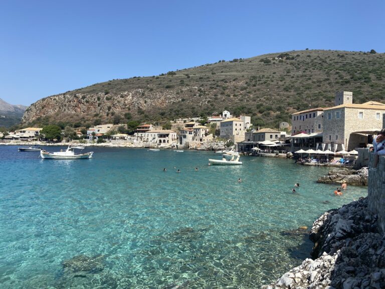
Gerolimenas, Deep Mani: The Sacred Harbour of 88 People, Reached Mainly by Boat Until the 1970s, Built on the Port of Ancient Hippola Below the Cliffs of Cavo Grosso
Greece | Gerolimenas | Oitylo Municipal Unit, East Mani, Laconia, Peloponnese
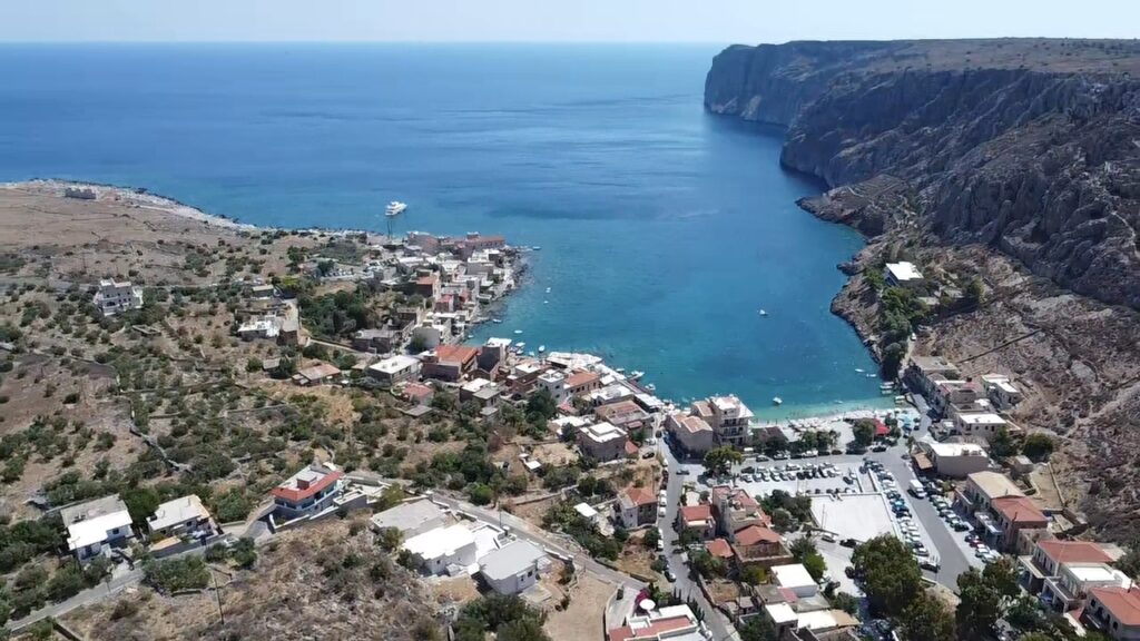
The name Gerolimenas is widely translated as “Old Harbour,” but the more precise origin is the ancient Ieros Limen — Sacred Harbour. The settlement was the port for two ancient Laconian cities, Messa and Hippola, located inland to the northwest. Visit Peloponnese identifies it as the very likely site of ancient Hippola itself, built directly on the ancient port location. The sacred designation suggests a religious significance to the harbour in antiquity that the surviving sources do not fully explain, but the continuity of use — ancient port, Ottoman-era pirate stronghold, 19th-century fishing centre, modern tourist village — is documented across every period.
Until the 1870s, the narrow sheltered inlet at Gerolimenas was the refuge and stronghold of Greek pirates operating from the central of the three southern capes of the Peloponnese. The position — tucked beneath the steep cliff of Cavo Grosso, accessible by sea but difficult by land — made it ideal for the specific maritime economy that piracy required: ships could enter and shelter without being observed or approached easily from inland.
When the piracy ended, the village transitioned to legitimate fishing infrastructure: a shipyard, substantial ice supplies for preserving catch, and a fish market that served the wider Deep Mani. The 2021 census recorded a population of just 88 people, including the neighbouring village of Ochia — one of the smallest permanent populations of any settlement covered in this series, a reflection of how genuinely isolated Gerolimenas remained until modern roads reached it. Until the 1970s, the most reliable way to reach the village was by boat.
Getting There: 25km South of Areopoli (25–30 Minutes), Through the Ghost Village of Vathia, 100km From Kalamata, 50km From Gytheio
From Areopoli, the capital of the Deep Mani, follow the main road south toward Cape Tainaron. The well-paved but winding road passes through Vathia — the abandoned tower-house village, one of the most photographed ghost settlements in Greece, its stone towers standing empty on the hillside as a frozen image of 19th-century Maniot clan architecture. The full drive to Gerolimenas takes 25 to 30 minutes and covers approximately 25 kilometres.
From Kalamata, the total distance is approximately 100 kilometres; from Gytheio, approximately 50 kilometres. We covered Mavrovouni Beach Gytheio Greece and Vathi Beach Gytheio Greece along the same southward route from Gytheio into the Mani.
Parking is at the village entrance and near the harbour — small enough that every spot is within a 3-minute walk of the water.
The Beach: Small Pebbly Cove, Calm Clear Emerald Water, Stone Village as Backdrop, Hotel-Provided Sunbeds on Small Jetties, More Beaches (Some Sandy) Nearby
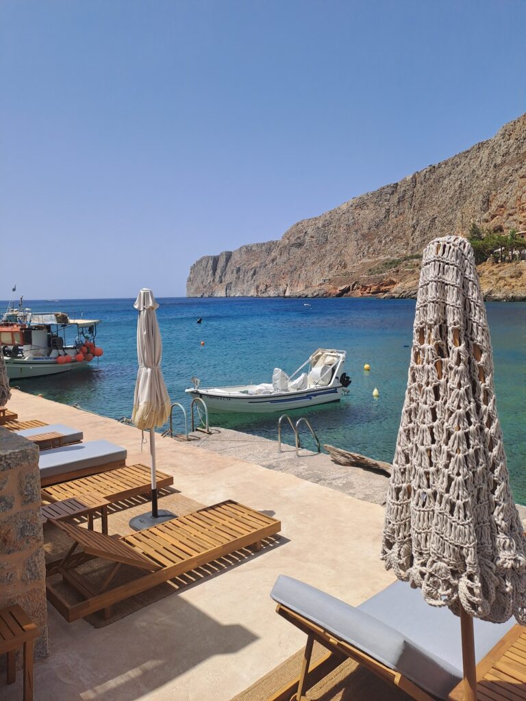
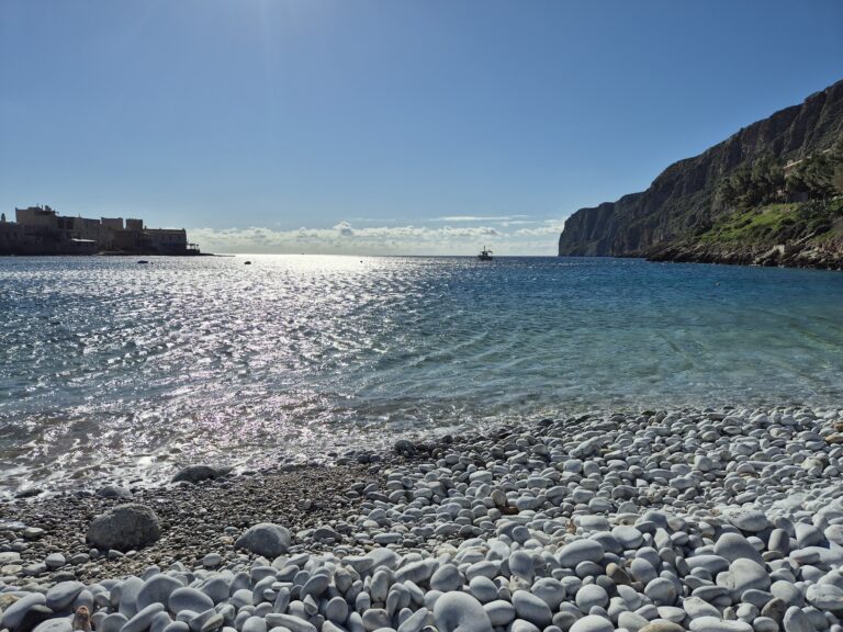
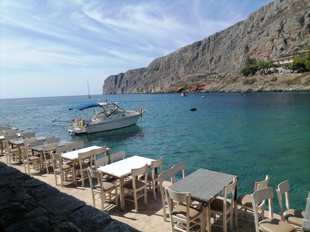
The beach at Gerolimenas is small and pebbly, set directly against the backdrop of the stone village — the houses that the AllOverGreece description notes “literally touch the sea.” The water is calm, crystal clear, and emerald, sheltered by the natural geometry of the inlet beneath Cavo Grosso. It functions as the village’s cooling-off point rather than a destination beach in its own right — the swim that follows a meal or precedes one, rather than the focus of a planned day trip.
Around Gerolimenas, additional beaches exist, some sandy — the specific local knowledge that residents and repeat visitors use to extend a stay beyond the small harbour pebbles. The KaSeas Boutique Hotel, converted from a former grocery store using the same native stone construction as the rest of the village, provides a private beach club arrangement directly across from its entrance — umbrellas and loungers on the natural harbour.
The Two Churches of Agios Nikolaos
Two separate churches dedicated to Agios Nikolaos — the patron saint of sailors, appropriate for a settlement whose entire historical identity is maritime — stand in Gerolimenas. Both are noted as significant religious monuments within the small village, reflecting the Maniot pattern (seen also at Kotronas, covered in Kotronas Beach Eastern Mani Greece) of clan-specific church foundations accumulating within a small settlement.
Vathia: The Ghost Village 10km North
Vathia — passed on the approach road from Areopoli — is among the best-preserved abandoned settlements in Greece: dozens of stone tower houses standing on a hilltop, largely empty since the mid-20th century when the population left for Athens and abroad. The towers, the architectural signature of the southern Maniot clans, stand as an open-air museum of the defensive domestic architecture that defined this part of the peninsula for centuries — taller towers signifying stronger families, the specific visual hierarchy of clan power expressed in stone.
Gerolimenas in the Deep Mani is the Sacred Harbour (Ieros Limen) of 88 residents — reached mainly by boat until the 1970s, built on the likely site of ancient Hippola, pirate stronghold until the 1870s, later a fishing centre with shipyard and ice supplies, small pebbly beach with calm clear emerald water against the stone village backdrop, two churches of Agios Nikolaos, the KaSeas Boutique Hotel’s harbour-front beach club, additional sandy beaches nearby, Vathia ghost village 10km north on the approach road, 25km from Areopoli, 50km from Gytheio, 100km from Kalamata.
Drive south from Areopoli. Pass through Vathia. Park at the harbour. Swim against the stone village backdrop.

Map
Sorry, no records were found. Please adjust your search criteria and try again.
Sorry, unable to load the Maps API.
Near by places: