Kotronas Beach Eastern Mani: Sunken City, Skopa Citadel


Profile
Kotronas Beach, Eastern Mani: The Largest Village on the Eastern Mani Coast, Built on the Sunken Ancient City of Tefthroni, Connected by a 300-Metre Pebble Strip to the Skopa Peninsula Where the Ancient Citadel Stands
Greece | Kotronas | Eastern Mani Municipality, Laconia, Peloponnese
The ancient city of Tefthroni is underwater. It was one of the cities of the Eleftherolacones — the Free Laconians, the communities that Rome under Augustus designated as autonomous, exempt from Spartan control, self-governing. Tefthroni had its citadel on Cape Skopa — a natural elevated position above the bay that Pausanias describes, and that the ancient geographers assigned a specific distance of 150 stadia from Cape Tainaron to the south. Then an earthquake in the 3rd century AD dropped the city into the sea.
Fishermen and divers have been finding the ruins ever since — not systematically, accidentally. Obsidian, ceramics, stone axes, burial jars in the shallow water near the Skopa peninsula. The ruins are not excavated, not exhibited, not formally managed. They are simply there, beneath the water that Kotronas residents have been fishing for two millennia since the earthquake. Some of the stones that came from Tefthroni were not left on the seabed: the tower houses in Kotronas have ancient capitals and inscriptions embedded in their brickwork, incorporated when the houses were built centuries after the city sank.
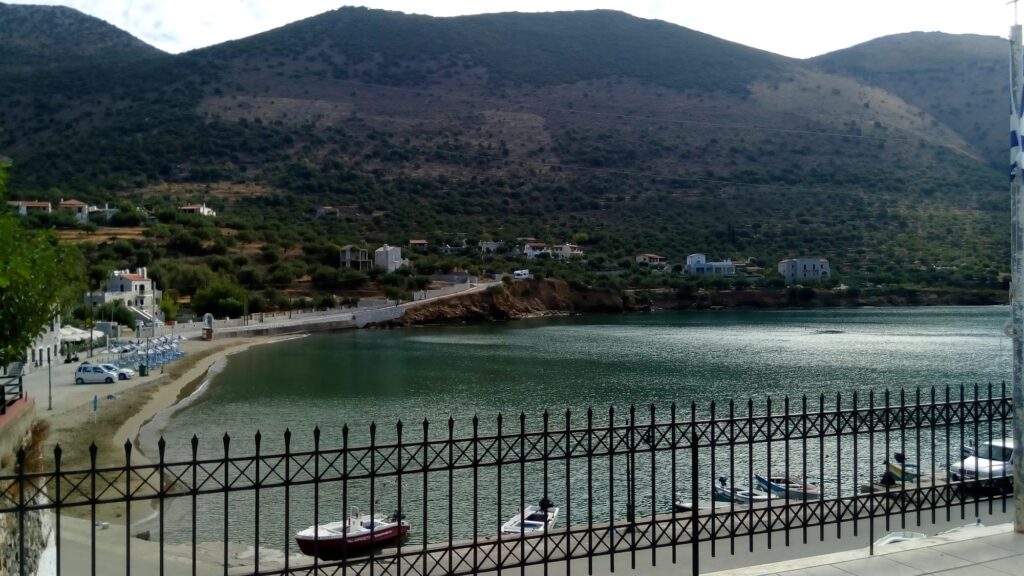
Kotronas is named from kotrona — the Greek word for boulder. The area has many large rocks, and the beaches in the bay are pebble or sand depending on the section. The village is the largest in Eastern Mani and serves as the municipal centre of the Eastern Mani municipality — the administrative hub of the less-visited coast that runs between Gytheio in the north and Cape Tainaron in the south.
Getting There: 41km From Gytheio (35–40 Minutes), 20 Minutes From Areopoli, Free Parking Along the Coastal Road
From Gytheio, drive south 41 kilometres through the Eastern Mani landscape toward Kotronas. The drive takes 35 to 40 minutes. From Areopoli — the capital of the Deep Mani on the western coast — the road across the peninsula takes approximately 20 minutes. Free parking is along the coastal road and near the village square.
The eastern Mani coast between Gytheio and Cape Tainaron is the less-travelled complement to the western Mani coast covered earlier in this series — quieter, with fewer facilities, and with the specific character of a region that remained more isolated than its western counterpart. We covered Mavrovouni Beach Gytheio Greece and Dexameni Beach Limeni Greece on the western approach; Kotronas is the eastern equivalent at a similar distance from Cape Tainaron.
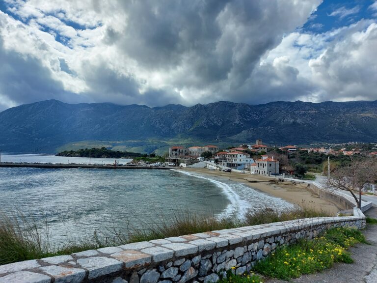
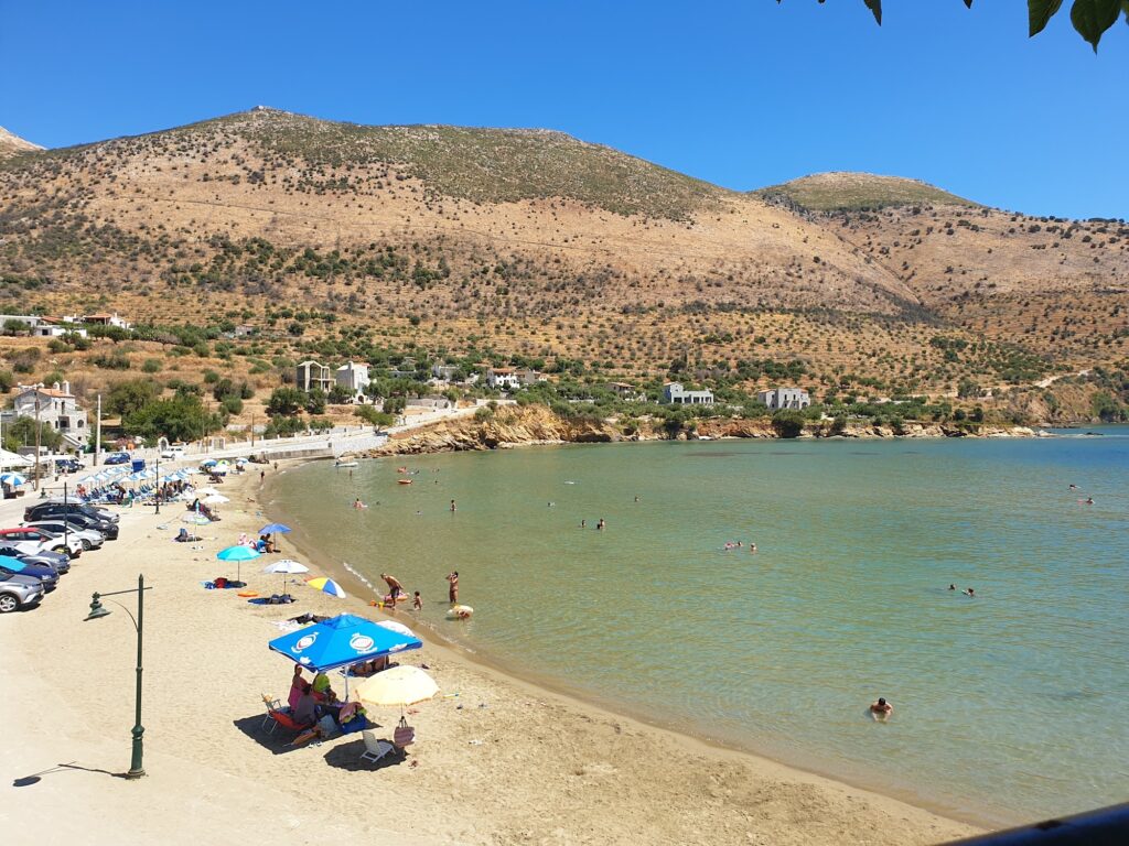
The Village Beach: Small Sandy Beach in the Heart of the Village, Shallow Crystal Water, Fig Trees on Skopa, Tavernas at the Quay
The central village beach is a small sandy beach directly in the settlement — the most accessible of the Kotronas beaches and the one that the village’s family character is built around. Shallow, crystal clear, calm. The quay has tavernas with fresh fish from the Laconian Gulf. The proximity of the village to the water is the specific social quality: Kotronas is a waterfront village where the distance between the square and the sea is measured in metres, not kilometres.
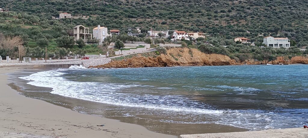
The Skopa Peninsula: 300-Metre Pebble Strip, Fig Trees, Double Beach, Hidden Sykia Cove, Ancient Citadel Ruins on the Western Slope
The narrow strip of land connecting Kotronas to the Skopa peninsula is 300 metres long, covered with large dark pebbles, and produces the “double beach” effect — sea on both sides of the causeway. Fig trees grow on the peninsula itself, providing shade rare on this coast. The chapel of Agios Nikolaos (thought to date to the 9th century) is on the peninsula — the same Agios Nikolaos that the village church is named after, built on the site of the ancient temple of Isoria Artemis, the deity whose cult began at Kotronas and spread to Sparta.
On the western slope of the Skopa peninsula, the remains of the ancient citadel fortifications are visible. The peninsula was chosen as the citadel site precisely because it was a natural observatory — the name Skopa means watchtower. At the far end of the peninsula is Sykia — a small, secret beach reachable only by path through the peninsula, the furthest-removed option for those wanting complete seclusion.
Agios Nikolaos on the Artemis Temple, and the Ypapanti Church With 19th-Century Frescoes
The church of Agios Nikolaos in the village is built on the foundations of the ancient temple of Isoria Artemis — the goddess whose worship at Kotronas predated the Spartan appropriation of the cult. The physical continuity of religious site from ancient Greek through Christian is documented in the foundation stones.
The Ypapanti church is a one-room vaulted church with frescoes from the second half of the 19th century, formally listed as a monument. The village has multiple churches concentrated in a small area, reflecting the Maniot tradition of clan-specific religious foundations.
Chalikia Vatta: The Snow-White Pebble Beach With Turquoise Water, No Shade, Bring Everything
Chalikia Vatta is a short drive west of Kotronas — large snow-white pebbles and turquoise waters, specifically recommended for snorkelling. No facilities, no shade whatsoever. The AllAboutPeloponnisos guide is blunt about the preparation required: bring your own umbrella and supplies. The beach is pristine precisely because it has no development. It is the wild alternative to the organised village beach, reachable in a few minutes by car and used by visitors based at Kotronas.
Kotronas Beach in Eastern Mani is the largest village on the eastern Mani coast, built on the site of ancient Tefthroni — sunk by earthquake in the 3rd century AD, ruins found by fishermen and divers near the Skopa peninsula (obsidian, ceramics, burial jars), ancient capitals embedded in tower house walls. Small central sandy beach, shallow and clear. The Skopa peninsula connected by 300-metre dark pebble causeway (double beach, fig trees, Agios Nikolaos chapel on the ancient Artemis temple, ancient citadel ruins on the western slope, Sykia secret cove at the end). Chalikia Vatta snow-white pebble beach with turquoise water a short drive west (no shade, bring everything). Ypapanti church with 19th-century frescoes listed as a monument. 41km from Gytheio, 20 minutes from Areopoli.
Drive from Gytheio. Walk the 300-metre causeway to Skopa. Swim on both sides.

Map
Sorry, no records were found. Please adjust your search criteria and try again.
Sorry, unable to load the Maps API.