Vathi Beach Gytheio: 2.5km Blue Flag, Towers, Turtles


Profile
Vathi Beach (Vathi Ageranou), Gytheio: The 2.5km Blue Flag Sandy Shore Between Two Hills With Maniot Tower Houses, Where Caretta Turtles Nest and the Shipwreck Dimitrios Lies Around the Corner
Greece | Vathi | Gytheio Municipality, Laconia, Peloponnese
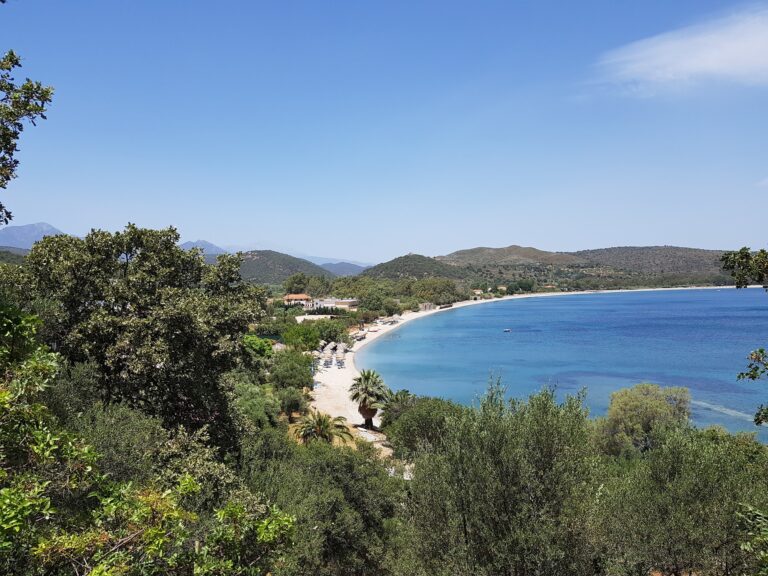
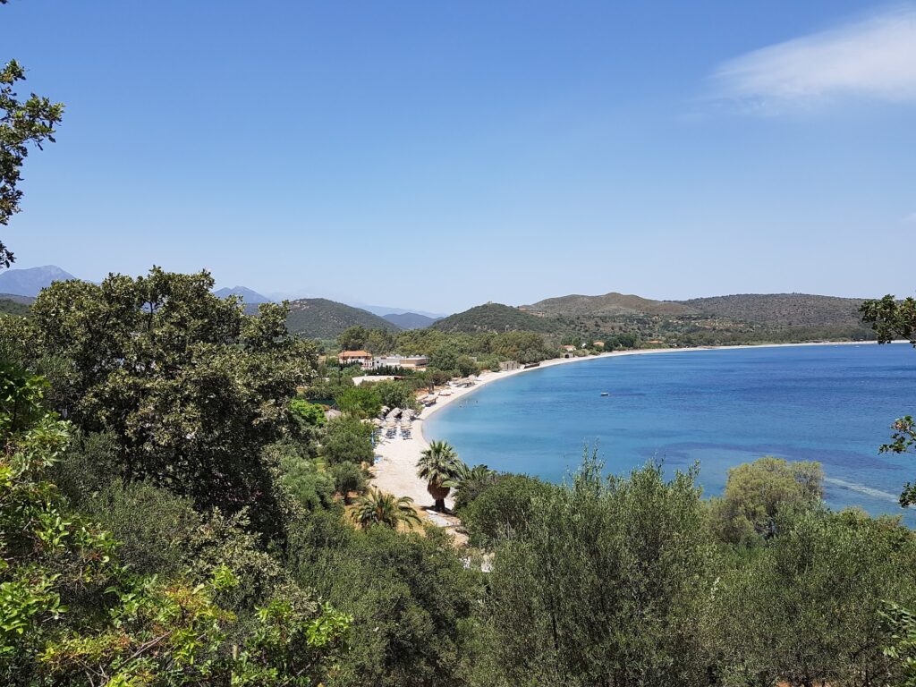
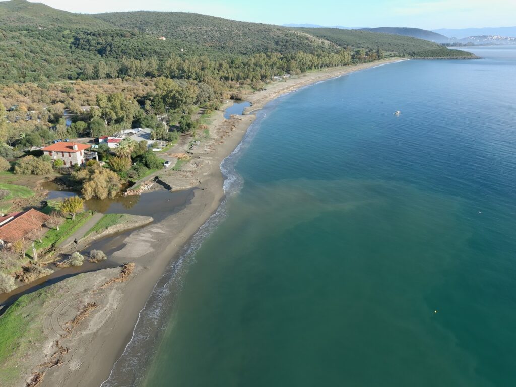
The hills on either side of Vathi bay have tower houses on them. The towers are the specific visual that lakonia.mobi uses to define the beach’s position in the landscape: the beach “lies between two hills dominated by towers, revealing the story of Mani to visitors.” Vathi is at the threshold — the last beach before the road turns south into the Deep Mani, where the tower house architecture and the arid limestone character become the dominant landscape. The tower houses on the hills above the sand are the border markers of two different worlds: the accessible, organised beach below and the clan architecture above.
The beach is 2,500 metres long — one of the longest sandy beaches in Laconia. Blue Flag awarded. Caretta caretta sea turtles nest here annually. Fine white sand with dense vegetation behind it. No sudden depth changes — the seabed descends gradually, making Vathi the family calibration of the Gytheio beach sequence: Mavrovouni (6km north, the windsurfer’s beach with the sharp drop-off) is for swimmers; Vathi is for everyone, including the non-swimmers, the toddlers, and the turtles.
The name Vathi means “deep” in Greek — though the beach is shallow, the bay itself gives the impression of enclosure, depth, and shelter. The Vathi Ageranou designation in the VisitPeloponnese guide locates it more precisely: “a fork in the road after Mavrovouni” leads to this beach, surrounded by trees.
Getting There: 12km South of Gytheio (15–20 Minutes), Fork Right After Mavrovouni on the Road South, Free Parking Behind the Beach
From Gytheio, drive south on the coastal road past Mavrovouni beach. After Mavrovouni, a fork in the road directs right toward Vathi. The total distance from Gytheio is approximately 12 kilometres, 15 to 20 minutes. Free parking is in the dedicated lots directly behind the beach.
We covered Mavrovouni Beach Gytheio Greece — the 6km Blue Flag windsurfing beach 2km south of Gytheio with the Marathonisi island where Paris and Helen spent their first night. Vathi is the next beach south on the same road to the Mani.
The Beach: 2.5km Fine White Sand, No Sudden Depth, Dense Vegetation, Caretta Nesting, Blue Flag, Dogs Allowed, Camping, Disability Access, Partly Organised
The full 2,500 metres of Vathi beach runs in a gentle crescent with fine white sand and dense trees and vegetation at the back — the tree canopy providing shade that most sandy beaches on this coast lack. The water is clear and warm. The seabed descends at a gradual rate with no sudden drops — the consistent characteristic that makes it the safest beach for young children in the Gytheio sequence.
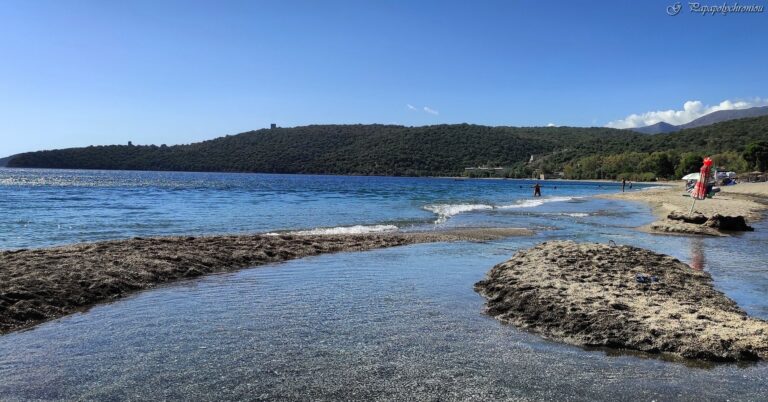
Caretta caretta turtles nest on Vathi — the sandy beach and the relatively undisturbed dune sections provide suitable substrate. Marked nesting sections in season follow the standard ARCHELON rules: no furniture after sunset, no lights, no staying at night.
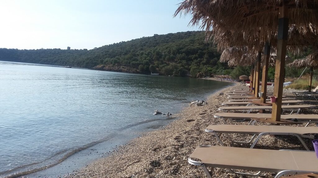
Dogs are allowed. Camping is available. Facilities for disabled visitors are noted. The partly organised sections have sunbeds, beach bars, and water sports operations; the unorganised sections stretch away from the facilities for visitors who prefer to lay towels on the open sand.
The Tower Houses on the Hills Above: The Mani Begins Here
The hills above Vathi bay carry the stone tower houses that announce the beginning of the Mani peninsula. Unlike the deep Mani south of Areopoli (covered in the Dexameni Beach Limeni Greece and Diros Beach Laconia Greece), where the tower architecture is pervasive, at Vathi it is visible on the skyline above a beach with families and sunbeds below. The juxtaposition is specific to this transitional geography — the Laconian coastal settlement giving way to the Maniot defensive landscape on the high ground.
The Dimitrios Shipwreck: Around the Corner at Valtaki-Glyfada
The Valtaki-Glyfada beach, a short distance around the headland from Vathi, has the rusting hull of the Dimitrios — a 67-metre merchant ship built in 1950 that ran aground during a severe storm on 4 December 1981. The ship broke loose from its moorings in Gytheio harbour during the storm, drifted offshore, and grounded at Valtaki where it has remained ever since. Its rust has become the specific colour of the beach attraction. Snorkelling around the hull is the activity that the Valtaki visitors come for; from Vathi, the drive to the wreck is a few minutes.
Vathi Beach (Vathi Ageranou) near Gytheio in Laconia is the 2.5km Blue Flag sandy shore between two tower-house hills at the entrance to the Mani — fine white sand, dense vegetation, gradual seabed (no sudden drops), Caretta nesting in marked sections, dogs allowed, camping, disability access, partly organised with beach bars and water sports, 12km south of Gytheio (fork right after Mavrovouni), the Dimitrios shipwreck at Valtaki-Glyfada a few minutes around the headland.
Drive south from Gytheio. Fork right after Mavrovouni. Look up at the towers on the hills.

Map
Sorry, no records were found. Please adjust your search criteria and try again.
Sorry, unable to load the Maps API.
Near by places:

