Dafnes Beach Patras: Gulf of Corinth Shore, Mountains


Profile
Dafnes Beach, Patras: The Gulf of Corinth Coastal Settlement Beach on the Northeast Achaia Shore, Where the Corinthian Mountains Are Visible Across the Water and the Rift Valley Beneath Widens by 10mm Every Year
Greece | Dafnes | Patras Municipality, Achaia, Western Greece
The Gulf of Corinth is not a stable body of water. The tectonic rift that formed it is active — the northern and southern shores are moving apart at approximately 10 millimetres per year, one of the fastest rates of crustal extension in Europe, comparable to parts of Iceland and the East African Rift. The mountains on the north shore — Aetolia-Acarnania and Phocis — are receding from the mountains on the Peloponnese south shore by a centimetre annually. Earthquakes along this rift have destroyed settlements at both ends of the gulf across recorded history; the most recent large earthquake in the area was the 1995 Aigio earthquake (magnitude 6.2) and the 2017 Akrata earthquake (magnitude 5.9). Bridges crossing the gulf — including the Rio-Antirrio bridge at the western end — are specifically engineered to accommodate seismic movement.
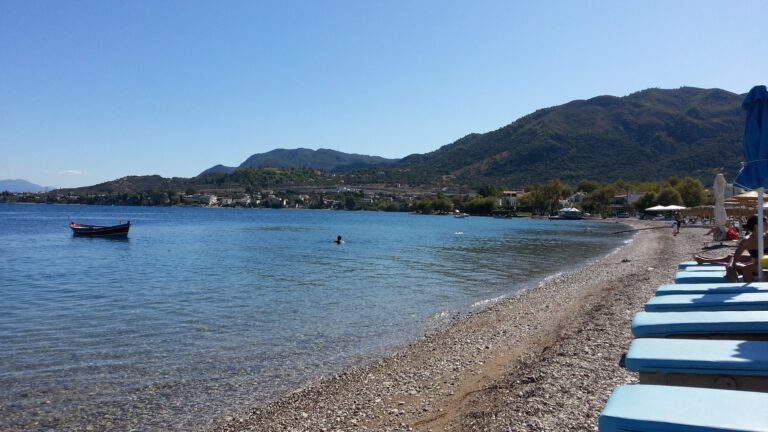
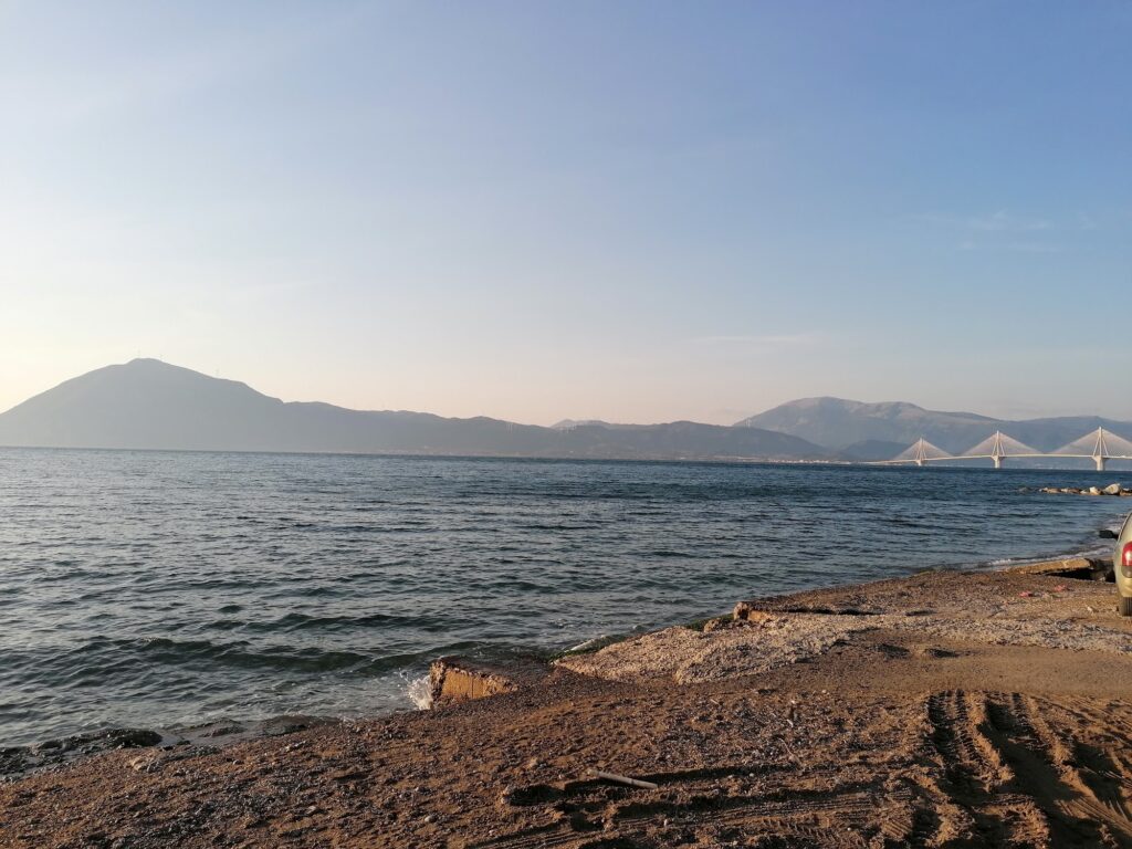
Swimming in the Gulf of Corinth at Dafnes beach is swimming in an inland sea created by one of the most geologically active rifts in Europe, with the mountains of the opposite shore in direct view across the water. The water is enclosed, the waves minimal, the temperature slightly cooler than the open Ionian Sea in summer due to the depth and the reduced solar warming of a body of water surrounded on all sides by land. The view is specific: the Corinthian mountain range on the northern horizon, visible in clarity across the 20-kilometre width of the gulf that separates the Peloponnese from mainland Greece.
Dafnes is in the sequence of northeast Patras coastal beaches that follows the Gulf of Corinth shore from the city outward toward Rio and Aigio: Kastelokampos first (closest to the city, 6km, covered in this series), then the settlements at Proastio, Dafnes, and Rio further along the coast. Each is a slightly more suburban, slightly more quiet alternative to the one before it, the urban pressure of Patras diminishing with distance.
Getting There: 15 Minutes Northeast From Patras Centre on the Old National Road or the Coastal Route, Proastiakos Train to Nearby Stations
From Patras city centre, drive northeast along the old national road (National Road 8A) toward Rio, Aigio, and Corinth. Dafnes is approximately 15 minutes from the city centre. The coastal route provides the most direct beach access; the road runs parallel to the shore with parking along the coastal strip.
The Proastiakos suburban railway that serves the Kastelokampos area continues northeast along the same coast — several stations serve the Rio area, which is close to Dafnes. From the nearest station, the beach is a short walk along the coastal road. The train connects the entire northeast Patras coastal strip to Patras Central Station within 15 to 25 minutes depending on the specific stop.
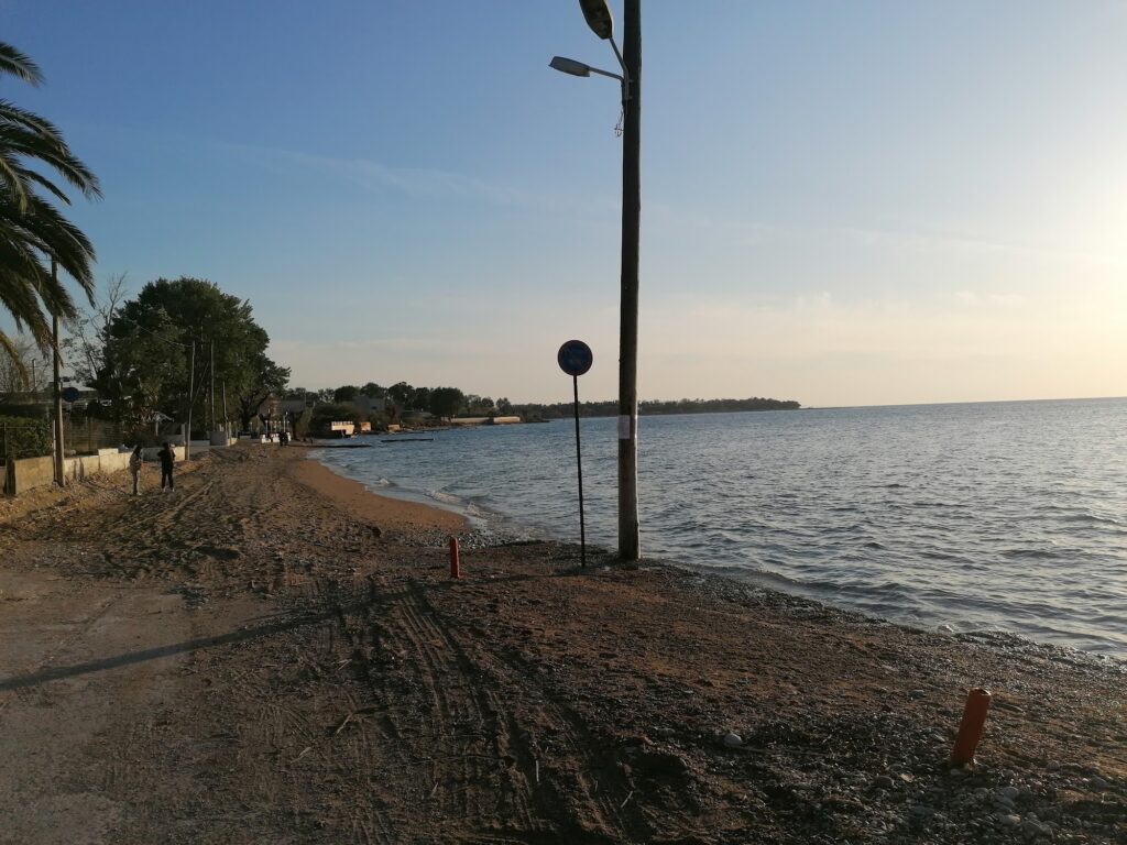
The Beach: Pebble and Sand, Gulf of Corinth Water, Clear and Cooler Than the Ionian, Mountains Across, Organised in Parts, Natural Shade From Trees
The Gulf of Corinth beaches on the northeast Achaia coast share a common character: pebble and shingle shore, clear water cooler than the open Ionian by several degrees in summer, minimal wave action, and the mountain panorama visible across the gulf on the northern horizon. Dafnes follows this pattern — mixed pebble and sand, the pebble entry calling for water shoes, the water clean and refreshing.
The seabed is pebbly at the water’s edge and transitions to sand at depth — the composition that produces clear, blue-green water without the sand turbidity that can affect sandy-bottomed beaches. The gulf’s enclosed geometry eliminates currents and wave action. The water deepens at a moderate pace rather than the gradual entry of a sandy lagoon, which is the honest parental note for families with very young children.
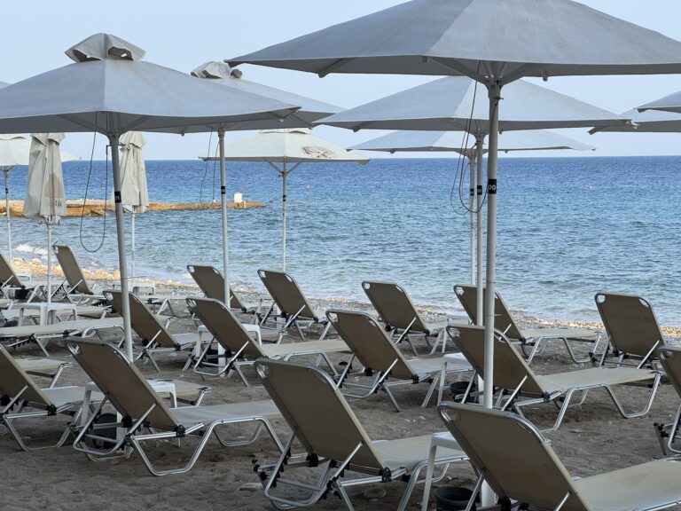
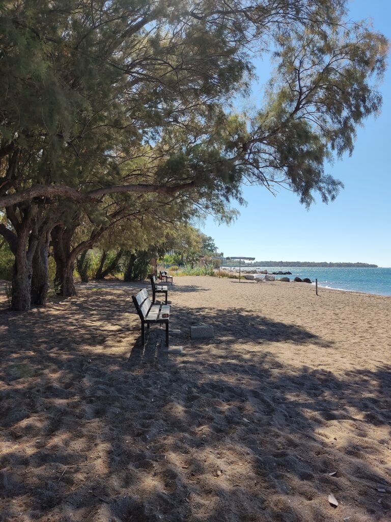
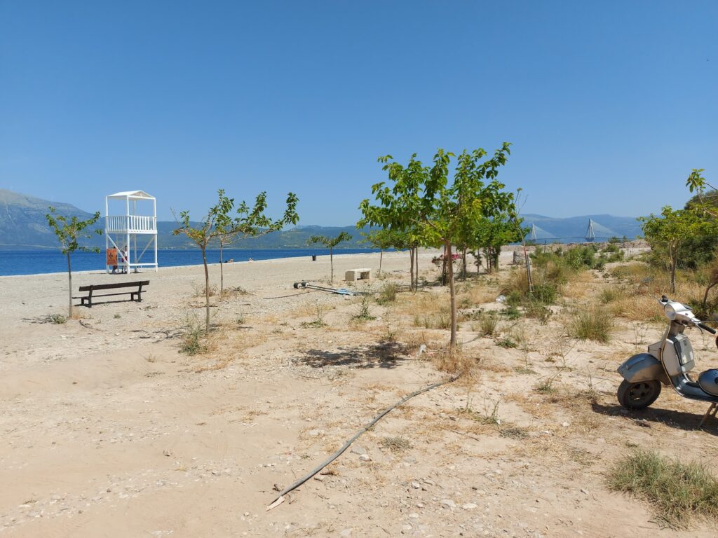
The beach is organised in parts — beach bars provide sunbeds and umbrellas on the consumption model in the main sections. Natural shade from trees exists further back from the water for visitors who prefer to avoid the bar sections. The Proastiakos connection and the cycling route from Patras make it accessible without a car.
The Gulf of Corinth Coast: The Patras to Corinth Beach Sequence
The coast northeast of Patras along the Gulf of Corinth is one of the longest continuous coastal routes in the Peloponnese — the road from Patras to Corinth (approximately 130 kilometres) follows the gulf shore almost uninterrupted, passing through the settlements of Rio, Aigio, Akrata, Diakofto, Kiato, and Corinth with their respective beaches. The Diakofto-Kalavrita rack railway — the narrow-gauge mountain railway that ascends 750 metres through the Vouraikos Gorge in 22 kilometres — departs from Diakofto, approximately 50 kilometres east.
The beaches along this coast become progressively more dramatic and less suburban with distance from Patras. Dafnes is in the suburban section — more accessible, more organised, more urban in character than Aigio or Akrata further east, but quieter than Kastelokampos which is 6 kilometres from the city centre.
The Achaia Clauss Winery: The Oldest Winery in Greece, 9km From Patras, Accessible by Bus
Achaia Clauss winery — founded in 1861 by the Bavarian merchant Gustav Clauss — is 9 kilometres from Patras city centre, the oldest commercial winery in Greece and the home of Mavrodaphne of Patras, the dark sweet wine made from the indigenous Mavrodaphne grape that Clauss is credited with developing. The winery buildings are in a specific Bavarian-influenced architectural style — towers, gardens, and a castle-like main building on a hillside above the gulf.
Bus #707 from Patras reaches the winery in approximately 1.5 hours. The winery tour and tasting, combined with the Dafnes beach day, is the specific Patras region combination that uses the city’s two most distinctive non-archaeological attractions — the wine heritage and the gulf beach — in the same day.
Kastelokampos and the Patras City Beaches: The Comparison
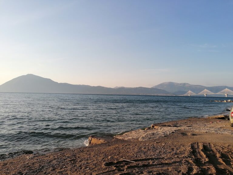
Kastelokampos Beach Patras Greece — the former EOT camping site turned municipal beach 6km north of the city, reachable by the Proastiakos train in 10 minutes (€1–2), with the Rio-Antirrio Bridge visible 3km north — is the closest fully-organised beach to Patras. Dafnes is slightly further northeast, quieter, less urban in character, and on the Gulf of Corinth side of the Rio strait where the water is enclosed rather than open to the Gulf of Patras.
The Rio-Antirrio Bridge is visible from both beaches — from Kastelokampos looking east, from Dafnes and Rio looking west. The bridge stands at the junction between the Gulf of Patras (open Ionian Sea extension) and the Gulf of Corinth (the enclosed rift sea to the east). Crossing it from one shore to the other is a 5-minute transit between two different bodies of water.
Dafnes Beach northeast of Patras on the Gulf of Corinth coast is the pebble-and-sand shore 15 minutes from the city — cooler and calmer than the open Ionian beaches, the Corinthian mountains visible directly across the 20-kilometre gulf, quieter than Kastelokampos and Rio to the southwest, organised beach bar sections with sunbeds on the consumption model, natural tree shade further back, the Proastiakos train connection along the same coast, the Gulf of Corinth rift widening 10mm every year beneath the water, and the Achaia Clauss winery (oldest in Greece, home of Mavrodaphne, founded 1861) 9km back toward Patras.
Drive northeast from Patras. Swim in the rift. Look at the mountains across the water.
Map
Sorry, no records were found. Please adjust your search criteria and try again.
Sorry, unable to load the Maps API.
Near by places: