Agios Vasileios Beach Patras: Train Station 2 Min Away

Profile
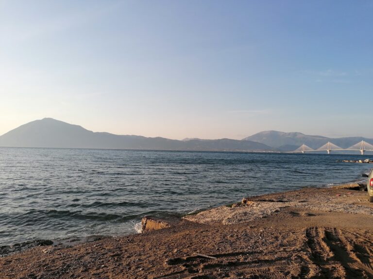
Agios Vasileios Beach, Patras: The 300m Gulf of Corinth Village Beach 3km Northeast of Rio, Served by the Proastiakos Suburban Railway, With Panachaiko Mountain Above and the Rio-Antirrio Bridge 4km West
Greece | Agios Vasileios | Rio Municipal Unit, Patras, Achaia, Western Greece
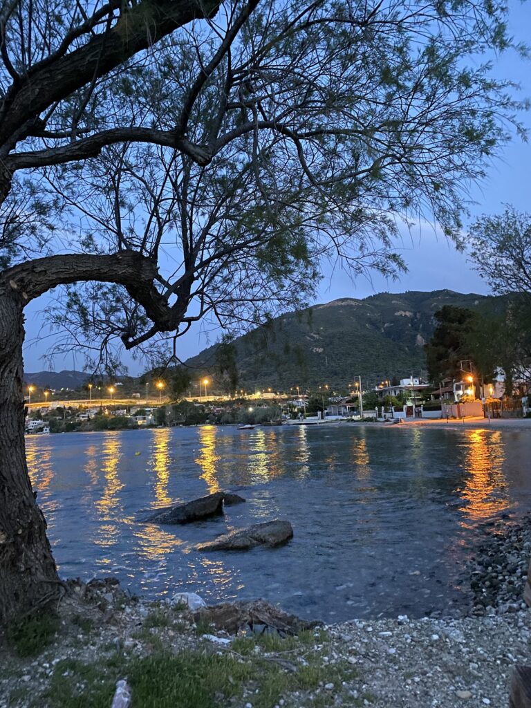
Panachaiko Mountain rises to 1,926 metres directly above Patras and the surrounding villages. From Agios Vasileios beach, the mountain is the specific backdrop that the source article’s description of “mountain panorama” refers to — not the distant silhouette that most coastal mountain views provide, but the full mass of Panachaikon descending from the summit through forest to the coastal ribbon where the village sits. On clear mornings, the mountain appears close enough to be a wall rather than a horizon. On the opposite side of the Gulf of Corinth, the mountains of Aetolia-Acarnania and Phocis — including the Vardousia range — complete the view.
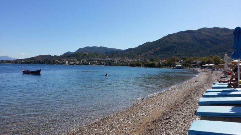
Agios Vasileios is a coastal village of 2,889 residents in the Rio municipal unit of Patras municipality, 3 kilometres northeast of Rio on the Gulf of Corinth. The village grew rapidly in the 1980s, when much of its current housing stock was built, and has continued expanding as a residential suburb of the growing Patras metropolitan area. The coastal road and the old National Road 8A (Patras–Corinth) pass south of the village; the beachfront is a separate strip between the village and the water.
The Proastiakos suburban railway connects Agios Vasileios directly to Patras Central Station — one of only two villages that the current Patras suburban rail service reaches (the other is Rio). The Wikipedia article on Patras is specific: “suburban trains connect Patras with the adjacent villages of Rio and Agios Vasileios.” The train is 2 minutes’ walk from the beach. This is the most direct public transport connection to any beach in the Patras metropolitan area — the specific practical advantage that distinguishes Agios Vasileios from Kastelokampos (bus and train to a nearby station then walk) and Dafnes (bus only).
Getting There: Proastiakos Train From Patras Central (Direct to Agios Vasileios Station, 2 Minutes’ Walk to Beach), or 15-Minute Drive on National Road 8A, Parking Along the Coastal Road
From Patras Central Station, the Proastiakos runs directly to Agios Vasileios station — the 15-kilometre journey takes approximately 20 minutes, with the station 2 minutes’ walk from the water. Trains run throughout the day; checking the current schedule before visiting is the standard advice for infrequent public transport.
By car, take the old National Road 8A northeast from Patras toward Corinth. After 13 kilometres, follow signs into Agios Vasileios village. Parking is along the coastal road and in nearby residential streets.
The Rio-Antirrio Bridge is 4 kilometres to the west — visible from the village. Nafpaktos is 15 minutes across the bridge, 23 kilometres northwest.
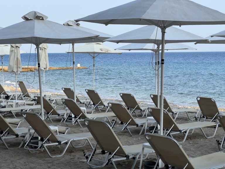
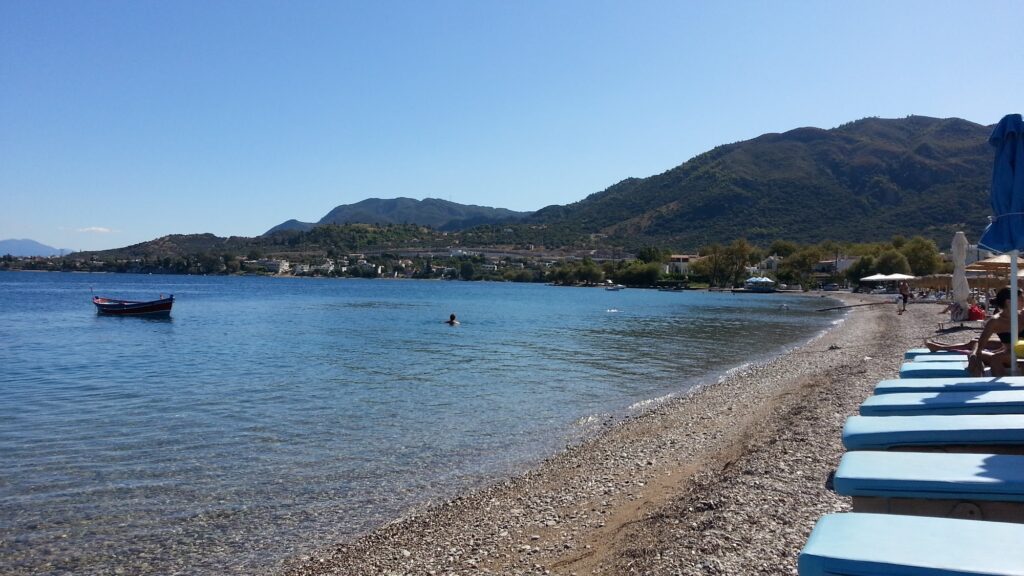
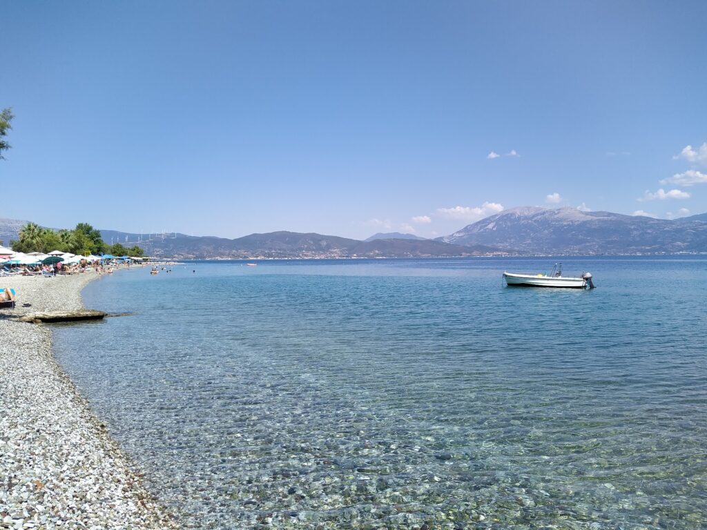
The Beach: 300m Fine Gravel, Gulf of Corinth Water, Cooler Than the Ionian, Organised Beach Bar, Depth Increases Steadily
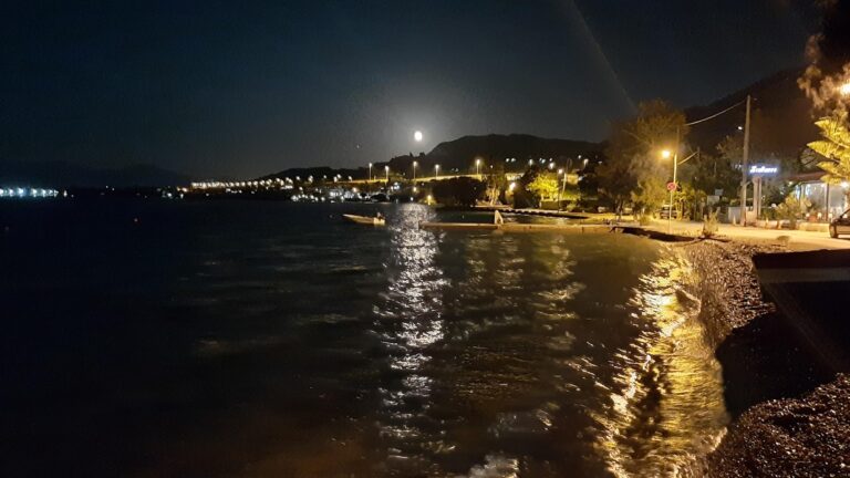
The beach is 300 metres long — compact rather than expansive — with fine gravel rather than sand. The Gulf of Corinth water here has the specific qualities of the enclosed rift sea: cooler than the open Ionian at the same time of year, calm with minimal wave action, clear, and with the mountain view in both directions. The depth increases steadily from entry rather than being ultra-shallow, which is the honest note for families with toddlers used to sandy lagoons — water shoes are comfortable for the gravel entry.
The beach bar provides sunbeds, umbrellas, and refreshments. The village promenade is immediately adjacent — tavernas, cafes, and restaurants within easy walking distance of the sand.
The Village Plateia and Promenade: Where the Evening Settles
Agios Vasileios has the specific character of a Patras suburb that functions as a coastal resort in summer — the village square (plateia) and the waterfront promenade are the social spaces. Fish tavernas (psarotavernes), grill houses (psitopolia), and cafes fill in the summer season with residents and visitors from Patras. The village is described by the local tourism source as having “beaches and hotels in the central part” — the infrastructure is orientated around the beach relationship that the village grew around in the 1980s.
The proximity to Rio — 3 kilometres west — means the restaurants and infrastructure of the larger town are also accessible. Rio itself is described as “a hub” combining mountain and sea, filled with clubs, bars, cafes, and fashionable restaurants, attracting visitors from Patras for its combination of gulf views and dining.
Panachaiko Mountain: The 1,926m Summit Above the Village
Panachaiko (also Mount Panachaikon) is the mountain that defines the landscape of Patras from every angle — seen from the ferry port, from the Rio-Antirrio Bridge, from the gulf, and most directly from the northeast coastal villages including Agios Vasileios. The summit at 1,926 metres is accessible by road to the Aroania plateau and then on foot. Panachaiko has ski facilities operating in winter when snowfall is sufficient.
The specific view from Agios Vasileios beach looking southeast is the full southern face of the mountain — the gradient from sea level to near-2000 metres in a horizontal distance of approximately 15 kilometres.
The Gulf of Corinth Context: The Rift, the Temperature, the View
The Gulf of Corinth between Agios Vasileios and the northern shore is approximately 20 kilometres wide at this point. The water is an enclosed inland sea created by the same geological rift that is widening at 10mm per year — the same fact introduced in the Dafnes Beach Patras Greece article. The temperature is cooler than the open Ionian at the same time of year, which the source article describes correctly as “a perfect refuge during peak heatwave” — the enclosed cooler water of the gulf is genuinely refreshing in the 38°C July afternoons when the Patras heatwave is at its peak.
The view from the beach looking north toward Nafpaktos and Central Greece — the mountains of Aetolia-Acarnania visible across the 20-kilometre gulf — is the specific panorama that makes the Gulf of Corinth beaches different from the open-sea beaches elsewhere in the series.
Agios Vasileios Beach at Patras is the 300-metre fine gravel Gulf of Corinth beach 3km northeast of Rio — served by the Proastiakos suburban railway from Patras Central (direct, station 2 minutes from water), Panachaiko mountain (1,926m) as the southeast backdrop, Rio-Antirrio Bridge 4km west, the Rio Venetian Castle 3km west, Gulf of Corinth water cooler than the Ionian (refreshing in heatwave), village promenade with tavernas and grill houses, parking along the coastal road, and Nafpaktos 15 minutes across the bridge.
Take the Proastiakos from Patras Central. Get off at Agios Vasileios. Walk 2 minutes to the water.

Map
Sorry, no records were found. Please adjust your search criteria and try again.
Sorry, unable to load the Maps API.
Near by places: