Baia dei Saraceni Varigotti: The Port That Silted Up
Profile
Baia dei Saraceni, Varigotti: The Port That Silted Up in 1341 and Never Recovered
Italy | Varigotti | Finale Ligure, Savona, Liguria
The port that gave the Baia dei Saraceni its earliest strategic importance stopped functioning in 1341, when it silted up completely during the first war between Finale and Genoa — the Genoese apparently accelerating the process specifically to deny the harbour to their opponents. Before that, the bay had served as the main maritime base for a settlement that carries a longer history than its popular nickname suggests. The earliest documented residents were Roman, known as Varicottis in late antiquity. The Byzantines fortified the headland at Punta Crena with a castrum to protect the natural harbour below, and it was those Byzantine fortifications that the Lombard king Rothari destroyed in 643 AD, driving out the garrison and effectively ending the settlement’s role as a defended port. The Lombards had no fleet and no use for a harbour, so they withdrew, leaving the bay intermittently available to whoever passed through — which, during the following centuries of Saracen raiding along the Ligurian coast, included the people whose name eventually attached permanently to the place.
The white architecture of Varigotti’s Borgo Saraceno, the row of flat-roofed houses that gives the village its distinctly un-Ligurian appearance, is often attributed directly to North African or Arab influence, and the visual case for that reading is easy to make standing in front of the houses. One architectural historian has argued differently — that the cubic structures with their domed terraces belong to an older pan-Mediterranean tradition rather than to specifically Arab settlement — but the debate has not dislodged the popular association, and the name Saracens remains attached to both the village and its bay regardless of which reading holds up under closer scrutiny.
Getting to Baia dei Saraceni Varigotti: The A10, Three Kilometres From Finale Ligure
The most direct car route takes the A10 motorway to the Finale Ligure exit, then follows the SS1 Via Aurelia east for roughly three kilometres to Varigotti. Paid parking sits along the SS1 facing the bay, and the warning from anyone who knows the beach well is consistent: arrive early, in July and August certainly before nine in the morning, because the spaces fill rapidly and the alternative is parking on the village outskirts and walking back. Coming from the east on the A10, the Spotorno exit puts you slightly closer.
By train, Finale Ligure Marina station is the stop, served by the Genoa–Ventimiglia regional line at roughly hourly intervals. From Genoa Brignole or Principe the journey runs around an hour and twenty minutes. TPL Linea 40 connects the station to Varigotti in ten to fifteen minutes, running along the Via Aurelia. The walk from Finalmarina is around forty to fifty minutes along the coast road, or an hour by the Sentiero del Pellegrino, the pilgrim path that climbs above the cliff line and descends into Varigotti from the west — a considerably more demanding approach but one that passes above the Free Castelletto Beach Finale Ligure Italy and the Capo San Donato tower before arriving at the top of Punta Crena with a full view of the bay below.
Baia dei Saraceni Varigotti: White Pebble, Fine Sand, Caribbean Water in the Right Light
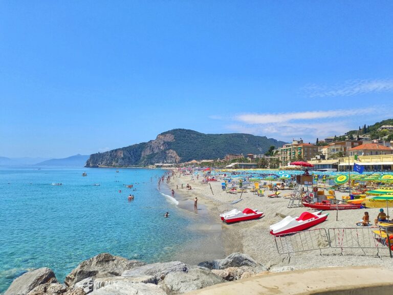
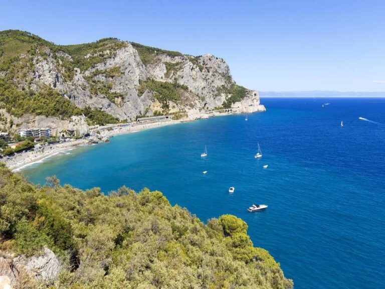
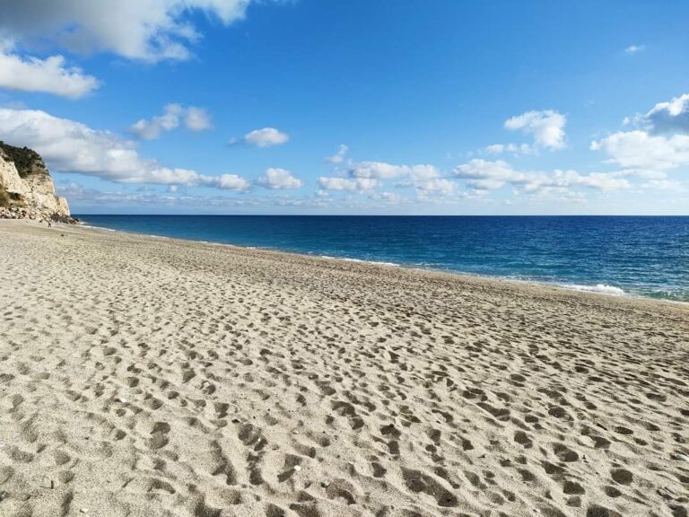
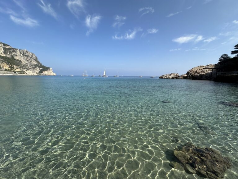
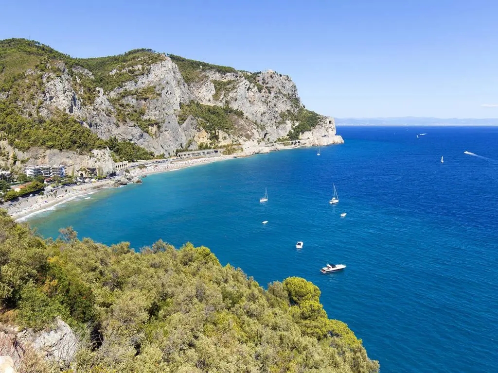
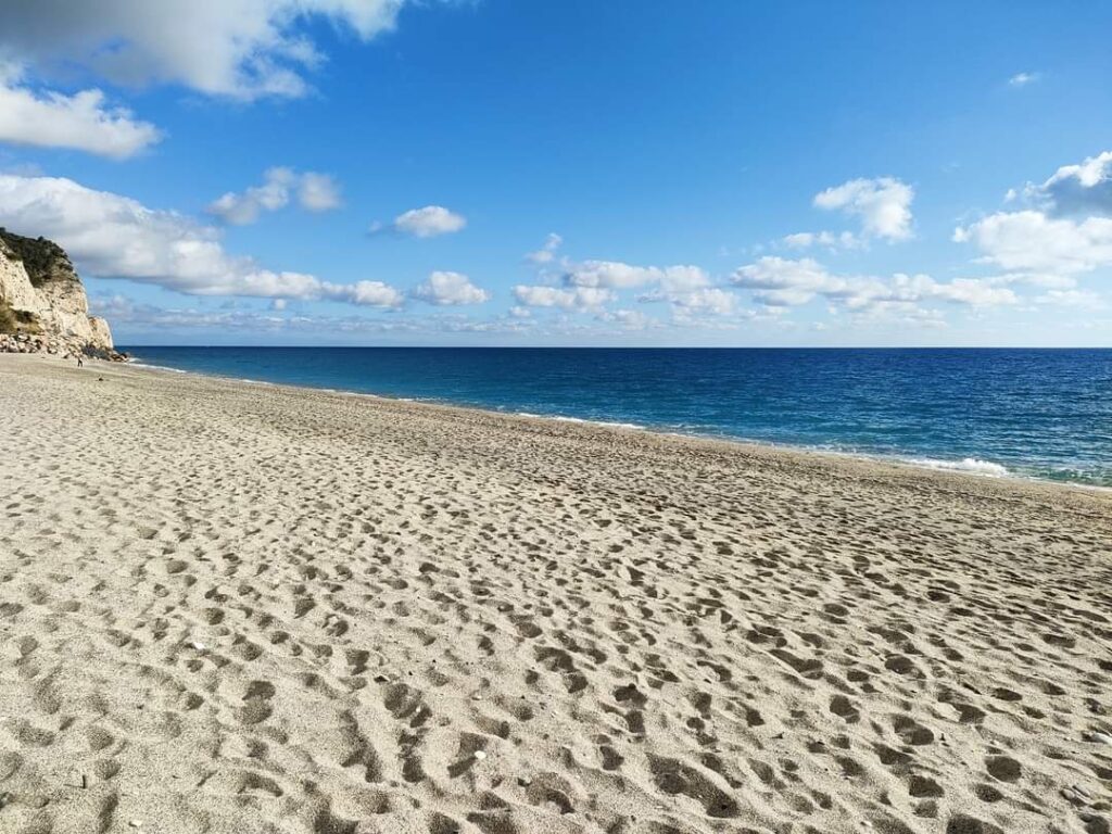
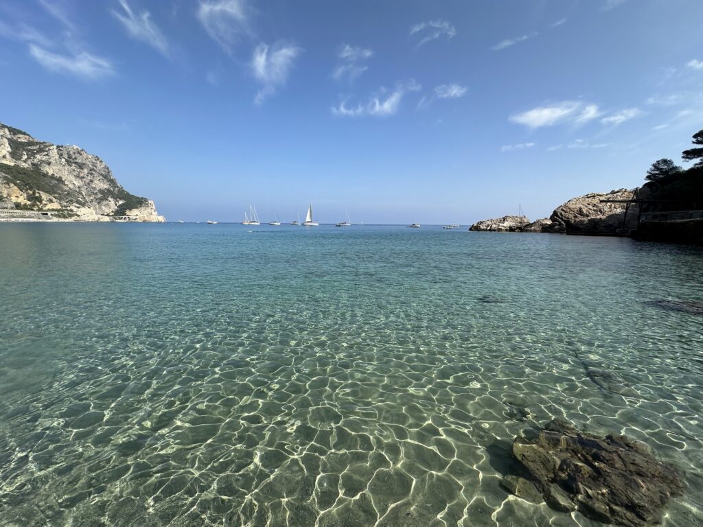
The beach is described consistently and with some consistency of hyperbole as the finest in Liguria, sometimes compared to Caribbean conditions in the right light at the right time of year. The specific visual conditions that drive the comparison are real: the combination of a white pebble and fine sand floor, exceptionally clear water, and the limestone cliff wall rising behind the beach produces colour gradations — pale turquoise into emerald over the rocky seabed — that are more vivid than the typical Ligurian coastal palette. The Manie plateau above the bay shelters it from cold northerly winds, giving it a milder microclimate than many beaches along this stretch of coast, which contributes to the length of its usable season.
Part of the beach is entirely free public access, with no entry charge or minimum spend; part is managed by private bathing establishments with sunbed and umbrella rental. The free section runs along a stretch that gets very crowded at peak times — the beach is one of the largest public beaches in Liguria by area, which means even at capacity there is more space than at smaller free beaches along the same coast, but the specific quality of solitude associated with less famous beaches is not what this place offers. The practical advice from regular visitors is to use the less accessible coves at the eastern end of the bay, where the rocks make the approach slightly more demanding and the density of sunbathers drops accordingly.
Freshwater rinse showers sit near the main path exit. The harbour authority for Finale Ligure specifically fines boats that anchor within a set distance from the coastline, protecting the swimming zone from passing maritime traffic in a way that is less formally organised on many other Ligurian beaches.
Punta Crena, the San Lorenzo Church, and the Tower Above the Bay
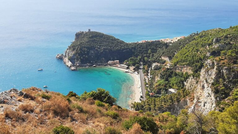
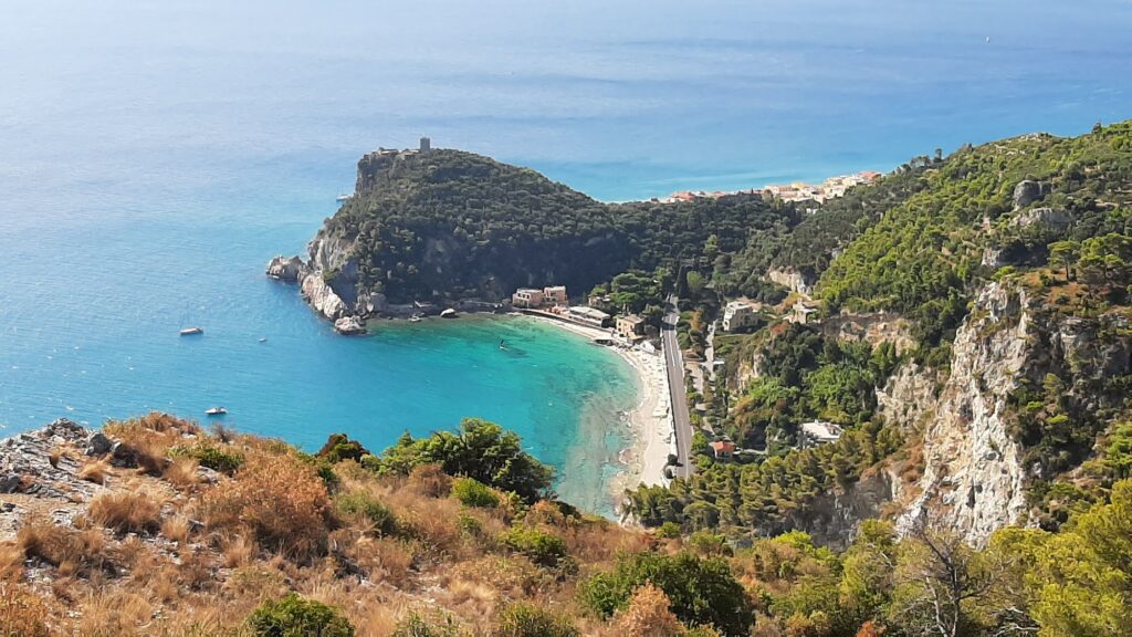
The Punta Crena promontory separates the Baia dei Saraceni from the main Varigotti village beach to the west, and the fifteen-minute climb to its summit is one of the better decisions available to anyone spending a day at the bay. The path passes through centuries-old olive groves before reaching the church of San Lorenzo Vecchio, a small Romanesque building documented from 1127, when Cistercian monks from the Lérins abbey — the monastic islands opposite Cannes — took possession of the site. The interior retains visible elements from both the medieval structure and the Byzantine age, the two periods superimposed on each other in the stone without obvious mediation.
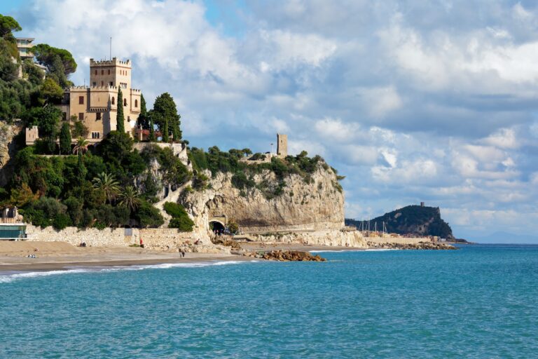
Beside the church stands the Torre di Varigotti, also known as the Saracen Tower, built in the second half of the 16th century to monitor the sea between Noli and Finale. The current structure dates to the early 19th century on the site of earlier watchtowers, and the remnants of the medieval castle destroyed by Genoa in 1341 are visible nearby. The view from the tower takes in the whole bay, the arc of white houses along the main Varigotti shore, and the Capo Noli headland to the east where the Sentiero del Pellegrino continues its coastal traverse.
What the Borgo Saraceno Looks Like Up Close
Walking through Varigotti’s pedestrianised centre, the architectural contrast with other Ligurian villages is immediately readable. Instead of the multi-storey coloured facades typical of Ligurian port towns, the Borgo Saraceno runs a row of low, white, flat-roofed houses directly on the beach, their cubic forms interrupted by external staircases and terraces. The historic cemetery on the hillside behind the main church looks directly over the sea, which gives it a specific visual quality that the village’s better-known photographic subjects do not quite capture.
The Sentiero del Pellegrino leaves from the western end of the village and climbs toward Noli across Capo Noli, a two-to-three-hour walk with views that open continuously above the sea. It is demanding in places and requires appropriate footwear; the approach toward Finale Ligure in the opposite direction, through the coastline above Free Castelletto Beach Finale Ligure Italy, is the shorter alternative for anyone wanting a section of the path without committing to the full route.
Baia dei Saraceni Varigotti and the Wider Coast
Spiaggia Libera Attrezzata Finale Ligure Italy, the main equipped free beach in Finalmarina, lies three kilometres west along the Via Aurelia and offers a different character — more accessible, more organised, with the wooden walkways and specialised chairs of a formally designated accessible beach, compared to the rougher approach of the Baia dei Saraceni. Further west along the same coast, Baia Salata Borgo Prino Imperia Italy represents another stretch of the Riviera di Ponente with its own distinct historical layering, the road between the two passing through a coast that varies considerably across short distances.
The bay looks different in May or June than it does in August. In the shoulder months, the beach holds its population without strain, the parking is manageable, and the water in the morning light before the day starts has the specific quality that makes the Caribbean comparisons at least understandable, even if they need some charity to hold. The limestone cliff wall catches the early sun before the rest of the bay does, and the ruined tower on Punta Crena is visible from the water at that hour in a way that the midday heat flattens into background. The port that silted up in 1341 is still the bay. The Byzantine castrum is still somewhere on the headland. The name stuck and the water stayed clear.
Map
Sorry, no records were found. Please adjust your search criteria and try again.
Sorry, unable to load the Maps API.
Near by places: