Agios Ilias Beach Elis: Greece's Second Railway Ran Here
Profile
Agios Ilias Beach Elis Greece: The Second Railway in the Country Was Built to Export Raisins Through This Coast
Greece | Agios Ilias | Pyrgos, Elis, Western Peloponnese
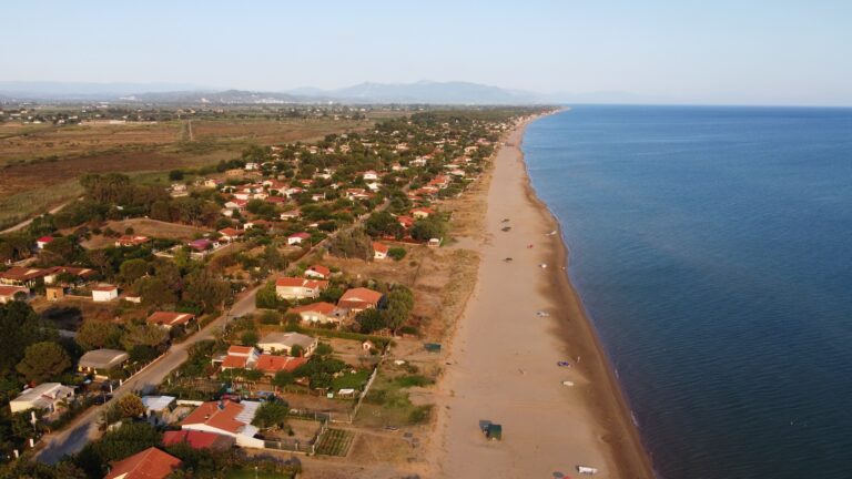
The Pyrgos-Katakolo railway, completed in November 1882, was the second line ever built in Greece — the first was Athens-Piraeus — and it was constructed not for passengers but for raisins. French vineyards had been devastated by phylloxera, demand for Greek raisins had surged to fill the gap, and the olive and vine plain of Elis needed a faster route to the Ionian coast than any cart could manage. Twelve and a half kilometres of track ran from Pyrgos down to the sea at Katakolo, and for a few productive decades, the economics worked. The 1896 crisis in raisin production strained the line, but it continued operating until the mid-20th century, eventually absorbed into the wider Peloponnese network. What remains is a coastal landscape that still reflects the agricultural logic that drove the railway’s construction: silver-green olive groves running almost to the shore, the fertile plain of Elis visible inland, and a beach at Agios Ilias that sits in the same natural position those raisin exporters would have known as they waited at Katakolo for the boats.
Katakolo itself has a name that arrived through an insult. The story runs that Zakynthos and Kefalonia used to exile their undesirables to this headland, sending them off with the phrase “άι κατά κώλου” — a vulgar dismissal that meant roughly “get away” — and the settlement gradually adopted a corruption of that phrase as its permanent identity. Whether the story is historically accurate or simply a good story repeated often enough to become local truth is less important than what it suggests: a place at the edge of something, neither fully part of the island world offshore nor fully integrated into the Peloponnesian interior.
Getting to Agios Ilias Beach Elis Greece: West From Pyrgos, South From Katakolo
The drive from Pyrgos covers approximately 13 kilometres heading west toward the coast, the road passing through the olive orchards and agricultural plain that defines this part of Elis before reaching the coastal strip south of Katakolo. The journey takes around 15 minutes under normal conditions. From Katakolo itself, the beach lies roughly 10 kilometres south along the coastal road — a short drive or scooter ride that follows the same Ionian shoreline the entire way.
Cruise ship passengers disembarking at Katakolo form a recognisable part of the beach’s summer constituency: Agios Ilias appears on multiple shore excursion itineraries as a beach stop, combined with visits to Ancient Olympia further inland, and the beach’s proximity to the port makes it the most convenient Ionian swimming option for passengers whose time ashore is limited. For anyone travelling independently from Athens or Patras, the A5 motorway through Elis puts the beach within a manageable drive, and Pyrgos functions as the natural base from which the whole western Peloponnesian coast is accessible.
Agios Ilias Beach Elis Greece: Golden Sand, Tamarisk and Pine, Zakynthos on the Horizon
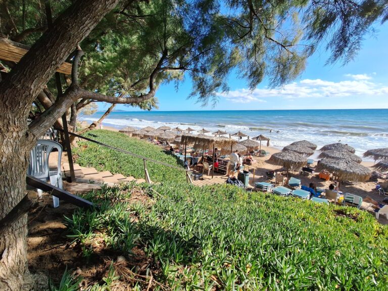
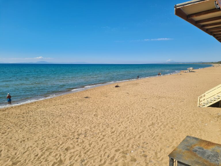
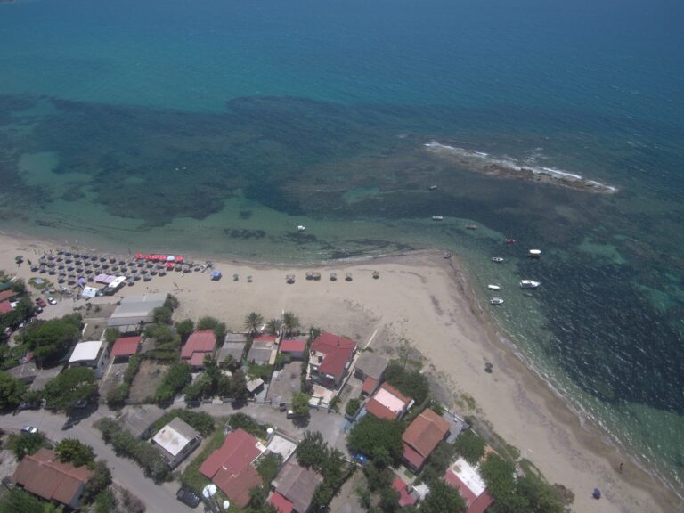
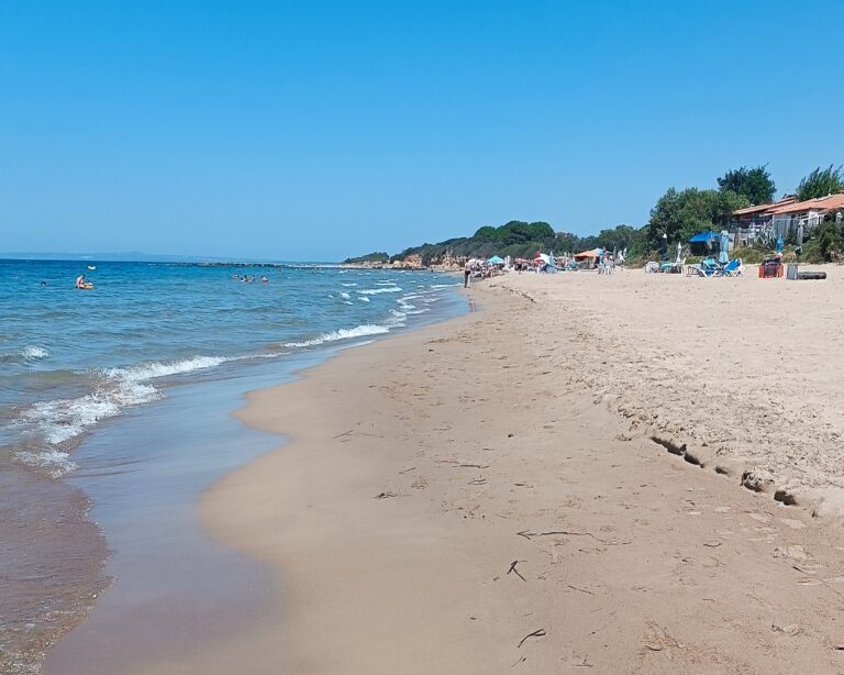
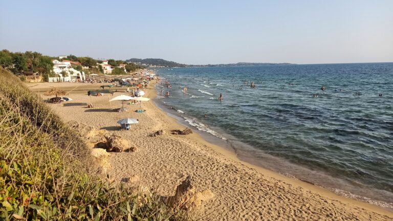
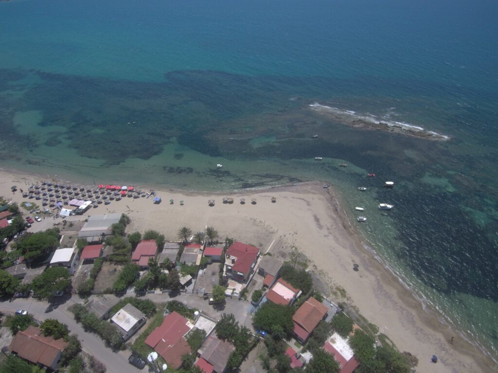
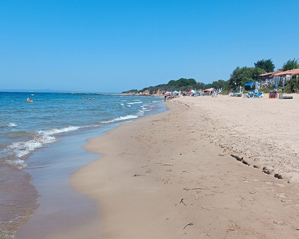
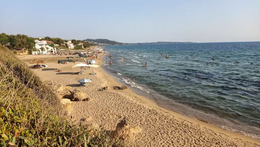
The beach runs as a long stretch of fine golden sand, shallow-shelving and well-suited for families, with tamarisk and pine trees fringing the back of the beach and providing intermittent shade without blocking the sea view. The sand continues south in what the Discover Greece regional description calls “that astounding beach whose golden dunes stretch all the way to Kyparissia” — a continuous coastal strip that runs considerably further than Agios Ilias alone represents, though this beach is the most accessible section of it from Katakolo and Pyrgos.
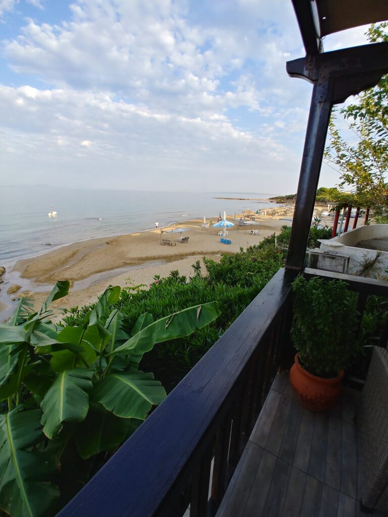
Zakynthos is visible on the horizon on clear days, the island’s profile sitting above the water to the west. The Ionian sunset from this coast takes on the specific quality of facing an open sea with islands in the foreground rather than the enclosed gulf character of the Corinthian coast — the light falls across a wider, less contained horizon, and the evening on the beach here has a specific quality that the eastern-facing beaches of the mainland cannot replicate.
Sunbeds and umbrellas are available through the beach bars working organised sections, and the coastal promenade connects directly to tavernas serving the fresh catch from the Ionian fishing grounds visible offshore. Ladenia — the flat, olive-oil-drenched bread specific to western Peloponnese cooking — appears alongside the seafood on the menus here, one of the regional specifics that distinguishes the food on this coast from the broader Greek beach bar repertoire.
Pontikokastro, the Mercouri Estate, and the Wider Territory Around the Beach
The Pontikokastro castle above Katakolo, roughly 2.5 kilometres north of the beach road, was built during the Byzantine period by Villehardouin and rebuilt by the Franks in the 13th century on the ruins of an earlier citadel from the ancient site of Feia. Only fragments of the fortifications remain, but the promontory itself gives views across both the Gulf of Kyparissia and the open Ionian, with Zakynthos and Kefalonia both visible on clear days. The combination of medieval fortress and ancient site beneath it, all accessible in under an hour from the beach, is the kind of layered historical access that Elis provides more readily than its relative obscurity in standard tourist itineraries might suggest.
The Mercouri Estate, one of the oldest wineries in Greece with 150 years of continuous production near Korakochori, grows its vines at sea level close to these beaches — an unusual practice that gives the estate’s Refosco and local varieties a specific coastal quality. The estate includes a small agricultural museum and offers tastings; the combination of winery and beach has become a predictable element of the shore excursion circuit from Katakolo, though the winery rewards a slower visit than the cruise timetable typically permits.
Ancient Olympia, where the Olympic Games began in 776 BC and where the Temple of Zeus and the famous statue of Hermes by Praxiteles still draw scholars and visitors, lies 20 kilometres east of Pyrgos. The site and the beach exist at opposite ends of the same day for most visitors, and the particular quality of swimming in the Ionian after a morning among the ancient athletics grounds — the specific transition from stone and history to salt water and open horizon — belongs to the logic of this coast rather than being a forced combination.
The Caretta Caretta Coast and the Longer Ionian Strip
The golden sand coast that begins at Agios Ilias and runs south toward Kyparissia is among the most significant nesting grounds for the Caretta caretta loggerhead sea turtle in the Mediterranean. The beach at Kalo Nero at the mouth of the Neda River, south along this same coastal strip, is identified as the second-most important nesting ground in Greece after Zakynthos — a designation that reflects the quality and length of this undeveloped sand coast, which has remained relatively free of intensive tourism infrastructure compared to the more famous beaches elsewhere in Greece.
The tamarisk shade at the back of the beach, the shallow warm entry into the water, and Zakynthos on the horizon are the three things that stay with you after a day at Agios Ilias. The raisin railway that made this coast economically significant in the 1880s is gone; the olive groves that made it agriculturally productive are still producing. The beach is the same coastal edge it always was.
Map
Sorry, no records were found. Please adjust your search criteria and try again.
Sorry, unable to load the Maps API.
Near by places: