Gribovo Beach Nafpaktos: Plane Trees, Lepanto, the Bridge


Profile
Gribovo Beach, Nafpaktos: The Blue Flag Shore Below the Venetian Castle Whose Name Comes From a Slavic Word for Water, Where Cervantes Lost His Left Hand 5km Offshore and the Plane Trees Are a Hundred Years Old
Greece | Nafpaktos | Aetolia-Acarnania, Western Greece
On 7 October 1571, the largest naval battle in the history of Europe was fought 5 kilometres offshore from where Gribovo beach now sits. The combined Christian fleet of Spain, Venice, the Papacy, Malta, Genoa, and Savoy — 207 galleys and 6 large galleasses carrying 30,000 soldiers — met the Ottoman fleet in the Gulf of Nafpaktos. The battle lasted four hours. Twenty thousand Ottoman soldiers were killed. It was the first major military defeat of the Ottoman Empire by a European force and is considered one of the decisive moments in European history. Miguel de Cervantes, 24 years old at the time, was serving on a Venetian galley. He was wounded three times, losing the use of his left hand permanently. He later wrote that the battle “was the most magnificent moment that the past or the present times have known, or that the future will see.” His statue now stands at the Venetian harbour in Nafpaktos, looking out toward the gulf where his hand was lost.
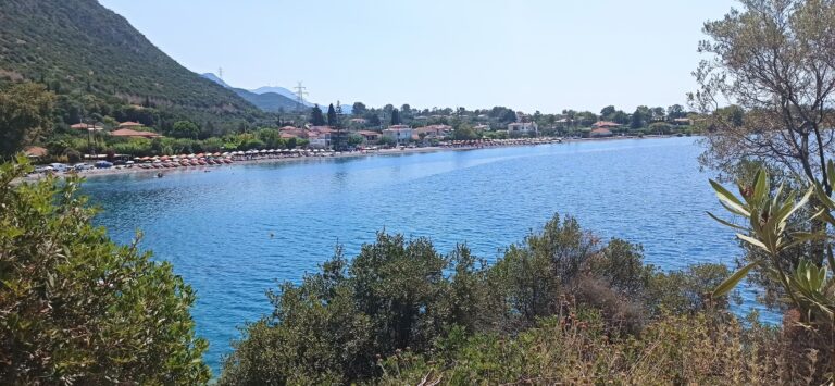
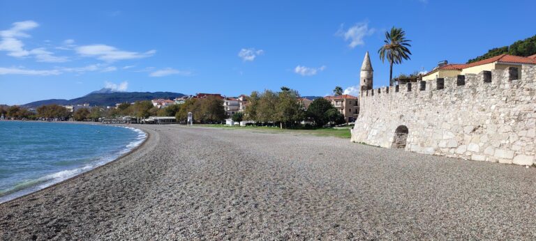
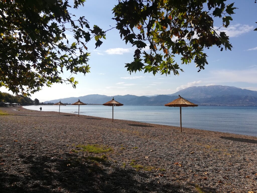
The name Gribovo is of Slavic origin, meaning “a place with lots of water” — a name that predates the modern resort infrastructure by many centuries and reflects the specific source-rich geography of the eastern side of Nafpaktos. The beach is on the east side of the famous Venetian harbour, flanked by hundred-year-old plane trees whose branches reach almost to the water’s edge. The trees are the defining visual quality of Gribovo — shade without umbrellas, a natural canopy that changes the entire midday atmosphere of the beach. The beach and the trees together, with the medieval castle visible on the hill above and the Rio-Antirrio Bridge — the longest cable-stayed bridge in Europe — visible in the distance to the east, make Gribovo one of the most contextually layered beaches in this series.
Getting There: 5–10 Minutes Walk East From the Venetian Harbour, 2.5 Hours From Athens via Rio-Antirrio Bridge, KTEL Bus From Athens to Nafpaktos
From Athens, take the national road toward Patras, cross the Rio-Antirrio Bridge (toll-paying; the bridge opened in 2004 and is 2,252 metres long, the longest cable-stayed bridge in Europe), and follow signs for Nafpaktos. The drive takes approximately 2.5 hours. The bridge itself is the visual landmark that appears on the horizon from Gribovo beach looking east — crossing it from Patras to the western mainland is the specific arrival experience.
From Nafpaktos harbour, Gribovo is 5 to 10 minutes’ walk east along the pedestrianised coastal road. The road is closed to cars in summer and functions as a promenade connecting the Venetian harbour, Gribovo, and the eastern beach of Psani.
By KTEL bus from Athens (Kifissos station), the journey takes approximately 3 hours with a stop at Nafpaktos bus station. From the station, the beach is a 15-minute walk or a short taxi ride.
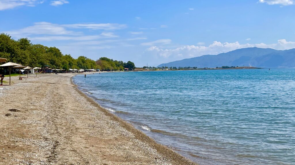
The Beach: Blue Flag, Golden Sand and Pebbles, Centenarian Plane Trees, Pedestrian Summer Road, Lifeguards, Clear Corinthian Gulf Water
Gribovo is one of two Blue Flag beaches on either side of the Nafpaktos Venetian harbour — Psani is the kilometre-long beach to the west, and Gribovo is to the east. Both have the plane trees; both are pedestrianised in summer; both have the same clean water standard. The distinction between them is character rather than quality: Psani faces west toward the open gulf and gets the north wind from the front; Gribovo, slightly more enclosed on the eastern side, is more sheltered and warmer on days when the north wind blows. The hotel at Lepanto specifically notes that Psani is the better option when the north wind blows from the back, while Gribovo suits most conditions.
The plane trees are not decorative additions — they are a century old and their canopy is genuinely substantial. Sitting under them on the beach in midday heat is a qualitatively different experience from sitting under a fabric umbrella. The tree shade is natural, the ground beneath is cooler, and the dappled light through the branches has the specific quality that distinguishes the tree-shaded Corinthian Gulf beaches from the open exposed beaches that most of the series covers.
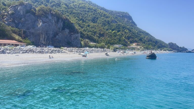
The water is clear and the depth increases at a moderate rate — not the ultra-shallow family lagoon of Tolo or the gradual sandy entry of Monolithi, but comfortable for swimming and consistent with the Blue Flag standard that the beach has held for years.
The Venetian Harbour: The Most Photographed Place in Western Greece, Cervantes, Botsaris Tower
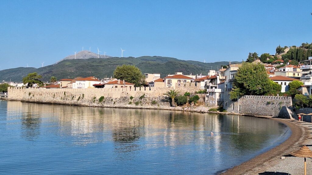
The Venetian harbour of Nafpaktos is the town’s defining image — a small circular harbour enclosed by medieval stone walls and towers, a lighthouse at the entrance, colourful fishing boats inside. It is the most photographed place in western Greece and the starting point for understanding the town’s history. The harbour was built by the Venetians in the 15th century and expanded through the centuries of alternating Venetian, Ottoman, and finally Greek administration.
At the western arm of the harbour stands the statue of Miguel de Cervantes — erected by a Spanish sculptor to commemorate the writer’s participation in the Battle of Lepanto. The Tower of Botsaris in the old town houses a permanent museum dedicated to the battle, with copies of maps, paintings, and documentation of the 1571 engagement. The Fetihe Tzami — the Victory Mosque built by Sultan Bayezid II after his 1499 victory over the Venetians, now a cultural exhibition space — is a 10-minute walk from the harbour.
The Venetian Castle and the 2.5km Wall
The Venetian Castle above Nafpaktos is reached by walking up through the old town. The fortification walls extend 2.5 kilometres around the hillside, descending to the harbour and the sea. The walls are intact across much of their length and the walk along them provides the elevated view of Gribovo beach, the harbour, the gulf, and the Rio-Antirrio Bridge that contextualises the whole geography. The castle is free and open, accessible on foot from the town centre in approximately 20 minutes.
The Rio-Antirrio Bridge: Visible From the Beach, the Engineering Context
The Rio-Antirrio Bridge — officially the Charilaos Trikoupis Bridge — connects the Peloponnese at Rio to the mainland at Antirrio, 5 kilometres east of Nafpaktos. Opened in August 2004 in time for the Athens Olympics, it is 2,252 metres long and the longest cable-stayed bridge in Europe. It crosses one of the most seismically active areas in Europe — the design accounts for tectonic movement, soft seabed, and regular earthquakes. The engineering solution involved cable-stayed pylons anchored on steel legs that can slide slightly on the seabed rather than being fixed — one of the most technically complex bridge structures built in the 20th century.
From Gribovo beach looking east, the four orange cable-stayed pylons of the bridge are visible on the horizon. At night they are lit, and the illuminated bridge across the gulf entrance is the specific evening view from the promenade.
For visitors who want a different beach day experience in the same region, Vathiavali Beach Palairos Greece is approximately 90 minutes northwest by car — the most beautiful beach in Aetolia-Acarnania, accessible only by road since recently. Monolithi Beach Preveza Greece — the longest sandy beach in the EU — is approximately 2 hours north via Agrinion and Arta.
The Classic Promenade: Psani to the Harbour to Gribovo
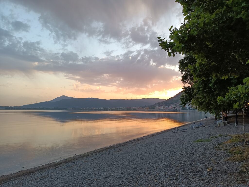
The walk from Psani beach through the Venetian harbour to Gribovo and back is one of the most classic evening walks in Nafpaktos — a 3-kilometre circuit that covers the full seafront character of the town: the fish tavernas on the promenade, the harbour boats, the statue of Cervantes, the lighthouse, the castle visible above, and the plane trees at both ends. In summer when the coastal road is pedestrianised, the circuit is free of traffic for its entire length. The Nafpaktos evening in July or August is specifically described as one of the best urban seaside experiences in western Greece.
Gribovo Beach at Nafpaktos in Aetolia-Acarnania is the Blue Flag shore east of the Venetian harbour — the name means “place of water” in Slavic, the centennial plane trees provide shade without umbrellas, Cervantes lost his left hand 5 kilometres offshore in 1571, the Venetian Castle with 2.5km of walls is above, the Rio-Antirrio Bridge (longest cable-stayed in Europe, 2,252m) is visible to the east, the classic promenade walk from Psani through the harbour to Gribovo is the town’s evening programme, and the summer pedestrianised coastal road makes the entire circuit car-free.
Walk east from the harbour. Sit under the plane trees. Look east at the bridge pylons.
Map
Sorry, no records were found. Please adjust your search criteria and try again.
Sorry, unable to load the Maps API.
Near by places: