Great Sand Beach Marmari: A Venturi Effect Shapes It


Profile
Great Sand Beach, Marmari: A Venturi Effect Between Two Coastlines Gave This Sand Its Shifting Shape
Greece | Marmari | Southern Evia
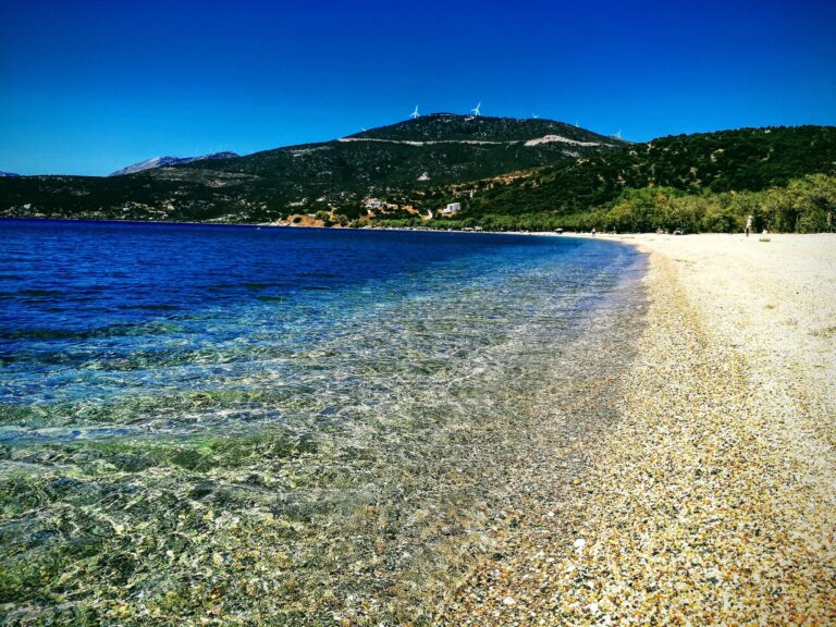
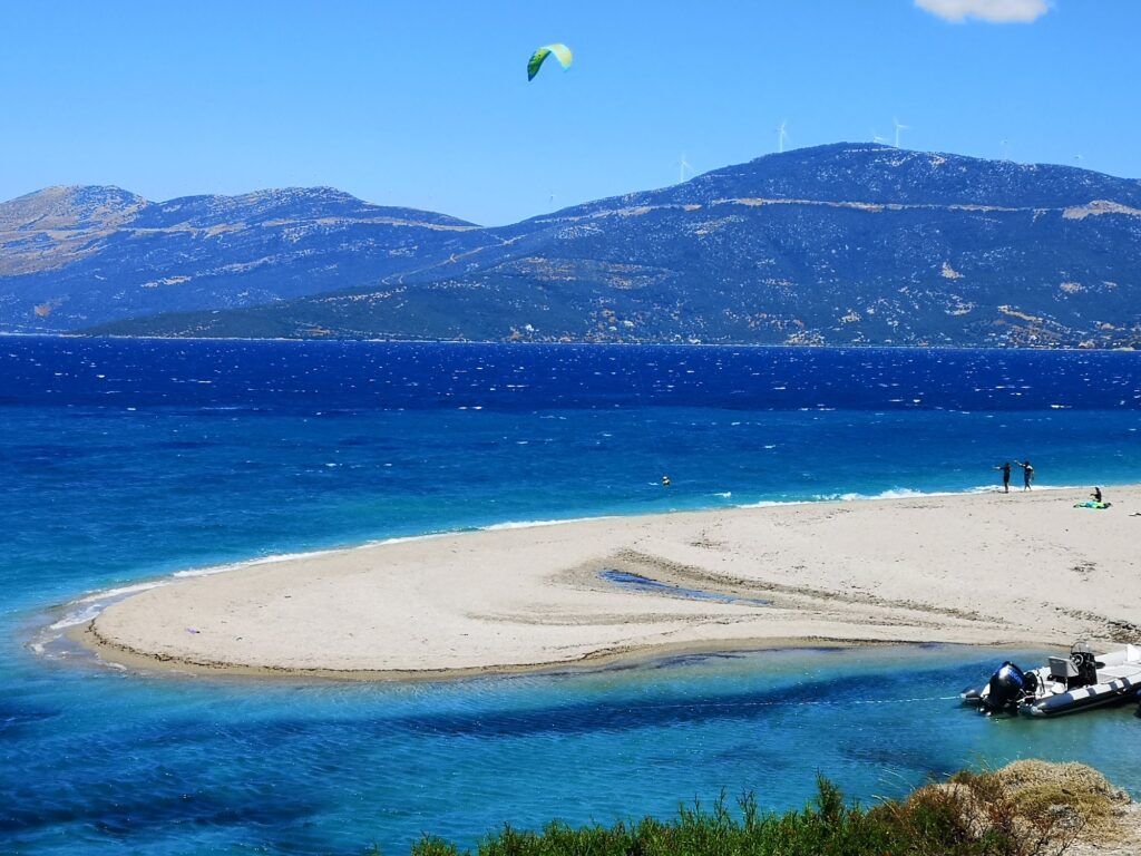
The constantly shifting shape of Great Sand Beach, also called Megali Ammos, has a specific physical explanation rather than a poetic one. The mountains surrounding Marmari, combined with the narrow channel between Evia and the Petalioi islands, create what is technically known as a Venturi effect — a phenomenon in which wind passing through a constricted space accelerates significantly. The sea here stays calm only when the wind blows from the south, or when there is no wind at all; when the wind comes from the north, conditions can turn genuinely aggressive, with currents strong enough that swimming far from shore is specifically discouraged, particularly for young children.
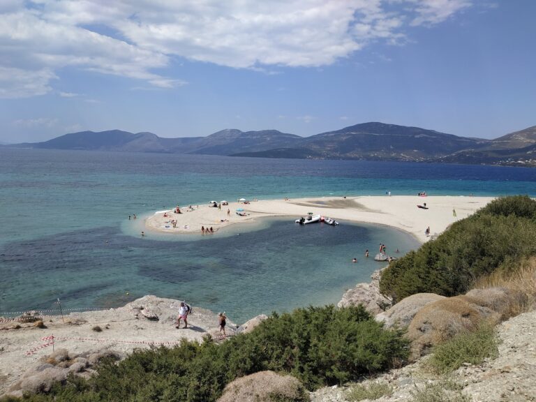
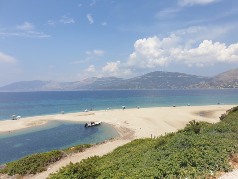
I should correct a detail I initially misread in describing the beach’s scale. The name Megali Ammos translates as Big Sand, but according to a detailed local account, that description refers to the beach’s width rather than its length — the beach itself measures only around 250 metres end to end, modest by most standards, while its width can exceed 100 metres at points, constantly reshaped by the same currents and winds responsible for the Venturi effect. The resulting form has been likened, not entirely flatteringly, to a tongue extending into the sea, or, in an aerial time-lapse, to the shape of a dog licking a bone — an image I would not have arrived at myself, but one that captures the beach’s genuinely strange, ever-changing silhouette better than any single still photograph could.
In 2020, this exact beach featured in an advertising campaign by the Greek Ministry of Tourism, built around the message that a Greek summer offers more than simply sun and sea. The campaign’s aerial footage was striking enough that some viewers publicly disputed whether the beach shown was genuinely in Greece at all, suggesting it might instead be a location in Croatia — a controversy I find revealing less about the footage’s accuracy and more about how unfamiliar this kind of shifting sand formation is within the popular image of a Greek beach.
Getting There: One Hour by Ferry From Rafina, or 2.5 Kilometres South of Marmari
The most direct route from Athens uses the car ferry from Rafina to Marmari, a crossing of approximately one hour, costing around nine euros per passenger and twenty-one euros per car. From Marmari itself, the beach is roughly 2.5 kilometres south, reachable by a fifteen-minute walk along the coastal road or a short drive, with the final stretch of road continuing on a dirt track in generally good condition. From Karystos, the drive covers approximately twelve kilometres and takes around fifteen minutes.
A second, longer overland route runs via Chalkida, approximately 112 kilometres from Marmari, useful primarily for those who have missed the last ferry crossing of the day. A third option uses the Agia Marina to Nea Styra ferry, followed by a twenty-seven-kilometre drive south to Marmari.
The Beach: Medium-Grain Sand, Few Pebbles, Almost No Facilities, World-Class Wind
The sand itself is of medium grain with very few pebbles, the seabed sandy and the water clear and fairly deep close to shore. Aside from a single beach bar offering a handful of tables and sunbeds, Great Sand Beach has essentially no facilities, and is not, by its own reputation, a typical destination for casual sunbathing. The view extends across the Petalioi islets toward the mouth of the South Euboean Gulf, with Mount Hymettus on the Attica mainland visible across the water at sunset, and Chersonisi, the second-largest islet in the Petalioi complex, sitting directly opposite.
The wind here is the genuine draw. Conditions hold steady through the summer, and during the Etesian winds of August, can exceed fifty miles per hour, making this one of the more demanding and rewarding windsurfing and kitesurfing locations in Greece, with dedicated schools, including the Royal Sand Marmari Surf Club, operating directly on site.
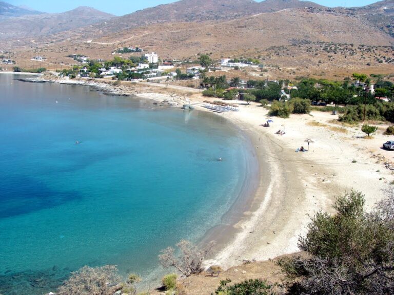
The Petalioi Islands: The “Seychelles of Greece,” Reachable by Boat
Offshore from Marmari, the cluster of roughly ten small islands known as the Petalioi are sometimes described as the Seychelles of Greece, their interiors privately owned and largely inaccessible, but their beaches public and reachable by small boat or kayak from Marmari’s harbour. Pine forest, turquoise water, and a sense of genuine remoteness despite the short crossing make them a natural extension of a day spent at Great Sand Beach, for visitors willing to arrange the additional boat trip.
Great Sand Beach at Marmari, also known as Megali Ammos, owes its constantly shifting shape to a Venturi effect created by the surrounding mountains and the narrow channel toward the Petalioi islands — a beach only 250 metres long but considerably wider at points, reshaped continually by wind and current, and the subject of a disputed 2020 tourism advertisement some viewers mistook for a location in Croatia. Medium-grain sand, almost no facilities beyond a single beach bar, and winds strong enough during August’s Etesian season to exceed fifty miles per hour, making this one of Greece’s recognised windsurfing and kitesurfing destinations. One hour by ferry from Rafina, then 2.5 kilometres south of Marmari, with the Petalioi islands reachable by boat for those extending the visit. For the wider northern stretch of this same island, I have covered Pefki Beach Evia Greece and Nisiotissa Beach Neos Pyrgos Evia Greece.
Take the ferry from Rafina. Check the wind direction before assuming a calm swim. Bring your own everything — there is almost nothing to rent here.


Map
Sorry, no records were found. Please adjust your search criteria and try again.
Sorry, unable to load the Maps API.
Near by places: