Lygaria, Agia Pelagia: Named for a Monastery


Profile
Lygaria, Agia Pelagia: A Beach Named for a Monastery Named for a Plant
Greece | Lygaria | Agia Pelagia, Heraklion, Crete
Lygaria doesn’t take its name directly from the osier shrub that grows abundantly in the area, the way most short descriptions put it — it actually comes from a monastery, Panagia Ligariani, said to date back to around 1610, whose own name derives from that same plant. The monastery itself is gone now, but the small church of Panagia still stands roughly 250 metres from the cliff edge, a quiet survivor of the building that gave the whole bay its name.
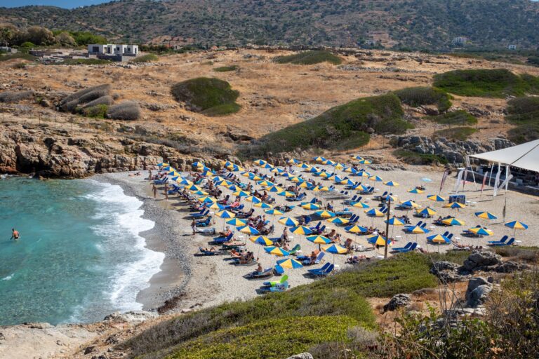
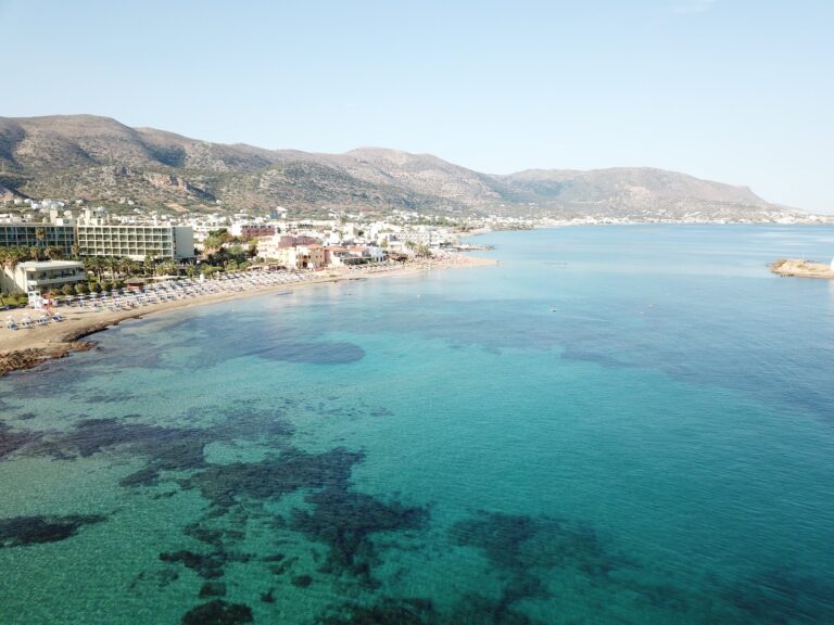
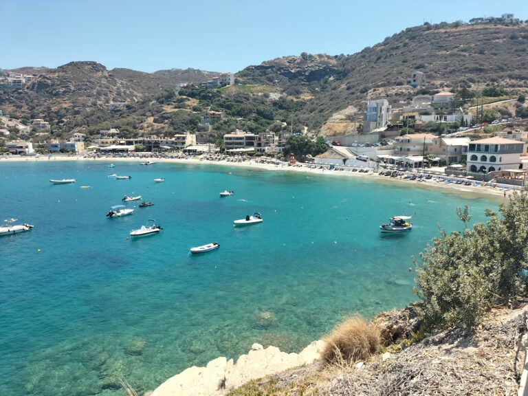
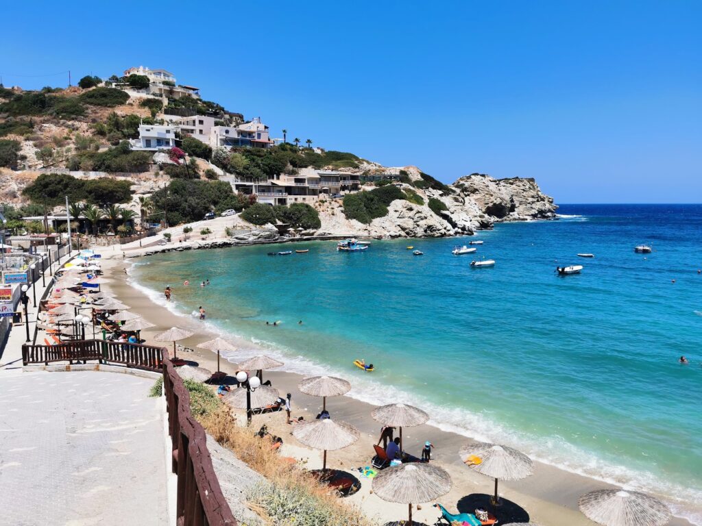
The bay was once used as an anchorage for ships, and small boats still bob on the water today, giving the whole scene a genuinely pretty, slightly old-fashioned look that several accounts specifically single out. The beach runs about 420 metres, the second-longest organised stretch of sand in the wider Agia Pelagia district, with steep rock enclosing the bay almost entirely and sheltering it well from the northwest winds that trouble more exposed beaches nearby.
I want to mention a genuinely interesting detail about the geography here, since it’s the kind of thing worth knowing before assuming the whole beach is equally good. The eastern part of Lygaria is less protected from waves and tends to collect more debris; the western side stays cleaner, calmer, and flatter, with smooth rocks close to shore rather than the patchier sand-and-rock mix found elsewhere along the bay. I’d head west if given the choice, particularly after a windy stretch of weather.
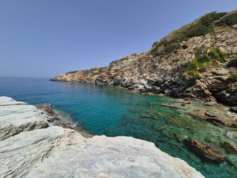
A path climbing from the western end of the beach leads up to the top of the cape protecting Lygaria, and just beyond it sits a small, genuinely hidden cove called Parasfougario — sand and pebble, exposed to wind, and reachable only by a twenty-to-twenty-five-minute swim from either Lygaria or Agia Pelagia, or by a private stone stairway from a cliffside house that’s technically off-limits to the public. I didn’t make the swim myself, but I appreciated knowing it was there, a genuinely secret stretch of sand that most visitors to this stretch of coast will never see.
Getting There: 20 to 25 Minutes Northwest of Heraklion
I followed the New National Road (E75) west toward Rethymno, taking the Lygaria/Mades exit and following the winding descent down toward the bay — the same exit I’d used reaching Mades Made Beach Agia Pelagia Crete Greece, the small neighbouring cove I covered elsewhere in this series, since the two share the same turn-off before diverging on the way down. The drive from Heraklion took me about twenty-five minutes including the descent.
The KTEL bus departs Heraklion’s central station and drops passengers at the main village junction, a journey of roughly thirty minutes. A free public parking area sits at the western end of the beach, and I’d genuinely arrive before half past ten on a weekend — this is a beach locals from Heraklion treat as their own, and the limited parking fills accordingly.
The Beach: Coarse Sand, Calm Deep Water, Full Facilities
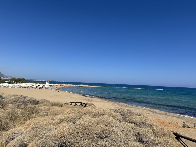
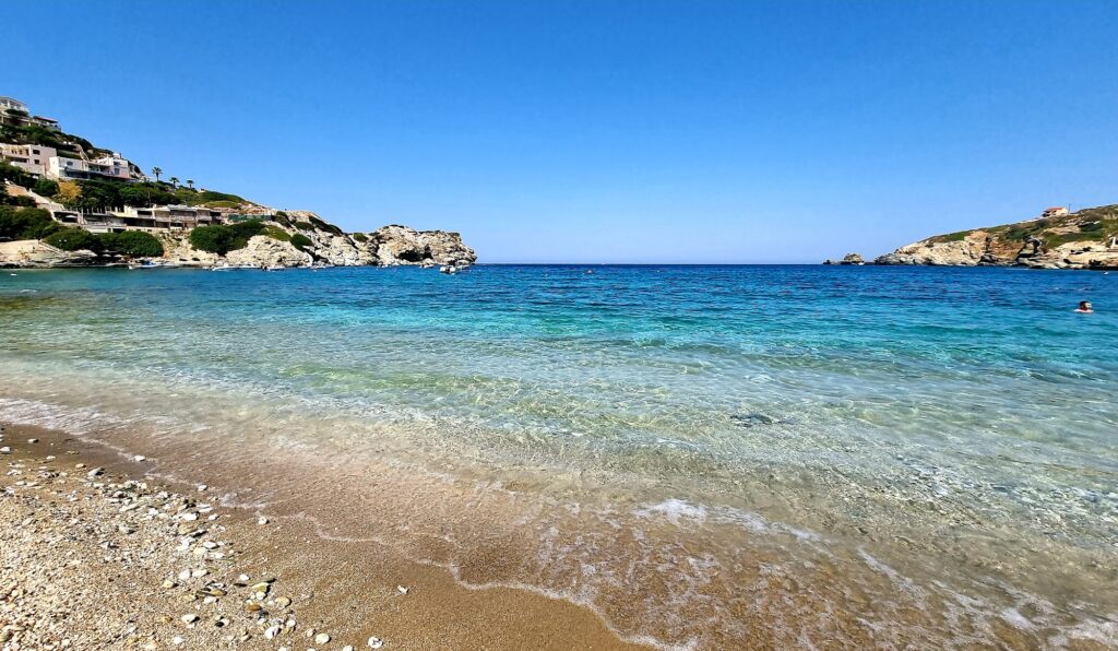
The shore is coarse sand mixed with small pebbles, the water turning a vivid turquoise on a clear day, deep but mostly calm thanks to the steep rock sheltering the whole bay. Organised sections offer sunbeds and umbrellas with plenty of space between them, and the beach is genuinely accessible for visitors with limited mobility, a detail worth knowing given how many smaller coves on this stretch of coast can’t say the same.
A professional diving school operates directly on the beach, taking advantage of the rocky, marine-life-rich edges of the bay for both lessons and excursions, and tavernas line the shore serving fresh seafood, including mussels, alongside the wider range of traditional Cretan dishes I’d expect at any well-established beach resort. A lifeguard is on duty during peak hours, and public restrooms and showers cover the practical side.
Lygaria, just east of Agia Pelagia, takes its name from a 1610 monastery, Panagia Ligariani, itself named for the osier shrub still growing locally — a beach named, in effect, twice removed from the plant most descriptions credit directly. The bay shelters well from the northwest wind, running 420 metres of coarse sand with calmer, cleaner water toward the west end than the east. A hidden, technically inaccessible cove, Parasfougario, sits just beyond the cape at the beach’s western edge, reachable only by a long swim. Sunbeds, a diving school, tavernas, and accessible facilities round out a beach that’s genuinely popular with locals from Heraklion, twenty-one kilometres and twenty to twenty-five minutes away.
Take the Lygaria/Mades exit off the E75. Head to the western end of the beach for calmer, cleaner water. Climb the path to the cape if you want the view, even if Parasfougario itself stays out of reach.


Map
Sorry, no records were found. Please adjust your search criteria and try again.
Sorry, unable to load the Maps API.
Near by places: