Daskalio Beach Keratea: Where a Fleet Once Anchored


Profile
Daskalio Beach, Keratea: The Harbour That Received an Enemy Fleet in 411 BC
Greece | Daskalio | Lavreotiki Municipality, East Attica
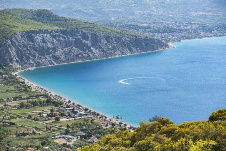
The bay at Daskalio has a documented identity considerably older than its current life as a small seaside settlement. Nineteenth-century classical geographers, working from references in Strabo, Pausanias, and inscriptions catalogued by earlier scholars, identify this harbour with the ancient deme of Potamos, on the Lavreotiki coast between Thorikos to the north and Prasiae to the south — a place celebrated in antiquity, according to those same sources, as containing the legendary tomb of Ion, the mythological ancestor of the Ionian Greeks. More strikingly still, Thucydides records that this exact harbour received the Peloponnesian fleet in 411 BC, during the long war between Athens and Sparta — meaning the calm water where I waded in is, by the reading of multiple classical scholars, the same anchorage an enemy fleet used during one of antiquity’s most consequential conflicts.
The wider Lavreotiki region carries its own substantial weight in Athenian history. The ancient mining district here, centred on Lavrio and Thorikos, financed the rise of Athenian naval power through slave-operated silver and lead extraction beginning in the 480s BC; on Themistocles’s urging, the revenue funded the expansion of the Athenian fleet to two hundred ships, the same fleet that would later prove decisive against the Persians. More than 250 ancient ore-washing facilities have been identified across the district by archaeologists, and the entire area was recognised in 2023 as a UNESCO Global Geopark.
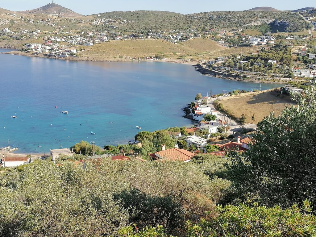
Daskalio itself today is a genuinely small settlement, with a population under 150 according to the most recent census, sitting just south of the neighbouring settlement of Kakia Thalassa among a string of small coastal communities — Kalopigado, Vgethi, Porto Ennia — that have developed along this stretch between Lavrio and Porto Rafti. The white houses with their blooming gardens climb the hillside in a way several accounts compare to a Cycladic island town, the comparison earned by genuine topography rather than marketing language.
Getting There: 45 Kilometres From Athens, via Markopoulo and Lavrio Avenue
The drive from central Athens follows the Attiki Odos toward Markopoulo, continuing onto Lavrio Avenue and following signs for Keratea, then Daskalio, the road tracing the rolling Attica countryside before descending to the coast. The full journey takes forty-five to fifty-five minutes.
The orange KTEL Attikis bus departs from the Nomismatokopio Metro station toward Keratea, from which a local connection or short taxi covers the remaining distance to the shore. Parking exists along the coastal road, though arriving before ten in the morning on a summer weekend is worth doing to secure space near the water.
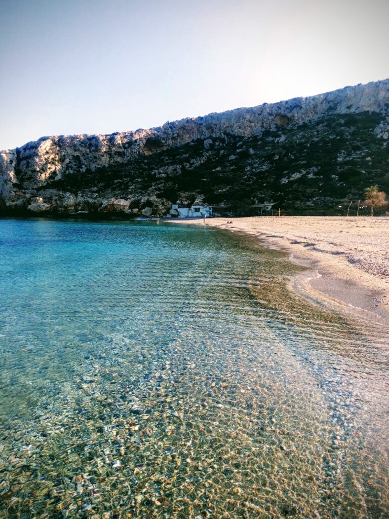
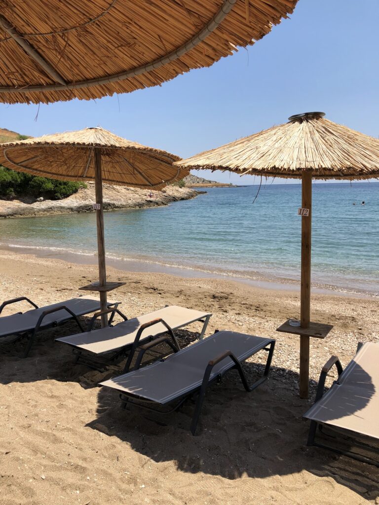
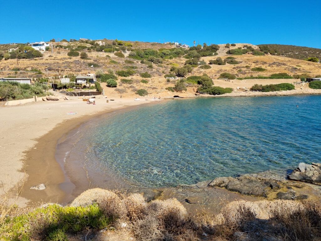
The Beach: Three Small Harbours, One Blue Flag, One Unorganised
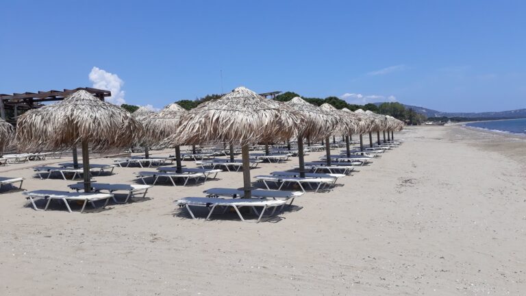
Daskalio actually consists of three small ports, each functioning as its own beach. The first holds Blue Flag certification as of 2023, and both the first and second are organised with beach bars and rental sunbeds established in recent years. The third, Limanaki, is the smallest of the three and the only one left genuinely unorganised, a quieter alternative for anyone preferring it that way.
All three share fine sand and the same striking blue-green water, embraced by rock formations that several visitors specifically favour for laying a towel away from the organised crowd. The wider area is affected by northern winds, which can raise a genuine swell, so checking conditions before settling on a swim is sensible rather than excessive caution.
Daskalio Beach, near Keratea in the Lavreotiki municipality, occupies a harbour identified by classical geographers with the ancient deme of Potamos, celebrated in antiquity as the burial place of the hero Ion and recorded by Thucydides as the anchorage of the Peloponnesian fleet in 411 BC. The wider region’s ancient silver mines funded the Athenian fleet that helped defeat the Persians, and the district now holds UNESCO Global Geopark status. The settlement itself is small, under 150 residents, its white houses climbing the hillside in a genuinely Cycladic-looking arrangement, with three small harbour beaches — two organised, one left wild — and Blue Flag certification on the first. Forty-five kilometres from Athens via Markopoulo and Lavrio Avenue.
Drive via Markopoulo and Lavrio Avenue. Choose the organised harbours for convenience, Limanaki for quiet. Stand in the water and consider that this exact anchorage once held an enemy fleet during the Peloponnesian War.
Map
Sorry, no records were found. Please adjust your search criteria and try again.
Sorry, unable to load the Maps API.
Near by places: