
Kavos Beach Lichada Evia: Where the Islands Broke Off
Profile
Kavos Beach Lichada Evia Greece: The Islands Visible from the Shore Were Part of This Peninsula Until 426 BC
Greece | Kavos | Lichada, North Evia
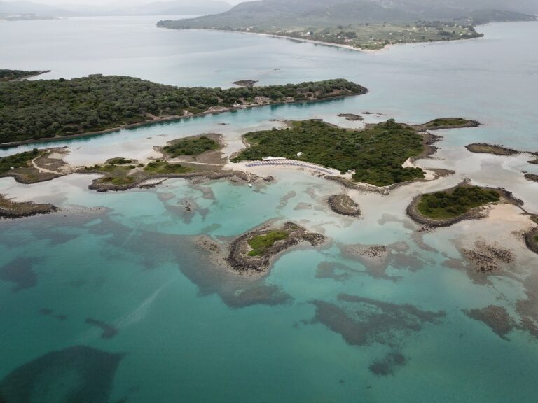
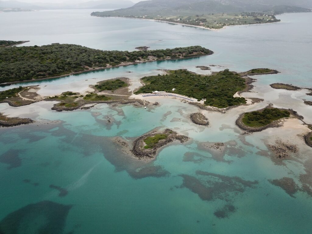
The islands visible from Kavos Beach were not always islands. Until 426 BC, the land between the tip of the Lichada peninsula and what are now the Lichadonisia was connected — the same promontory, the same ground. An earthquake that year caused the connecting section to sink, leaving behind seven separate islands in water that had previously been dry land. Standing on the beach and looking out at Manolia, Megali Strongyli, and the other islets arranged in the middle distance, this is not a poetic observation but a geological one. The distance between the beach and the nearest island is roughly what it was before the earthquake, only now it is sea rather than ground, and the crossing takes five to ten minutes by boat rather than a walk.
The mythology surrounding the place runs in the same direction. Lichas was the servant of Heracles who unwittingly brought him the poisoned robe — Deianira, believing it a love charm, had sent it with him thinking it would rekindle her husband’s affections. When Heracles donned the garment and the poison began to burn, he seized Lichas in his agony and hurled him into the sea. Poseidon transformed the scattered remains of the servant into islands, and both those islands and the peninsula he fell from carry his name: Lichadonisia and Lichada. The island identified as the head of Lichas in the old accounts is Strongyli, the round one. The mythology and the geology arrive at the same point from different directions, which is unusual even for Greek sites.
Getting to Kavos Beach Lichada Evia Greece: End of the Road, 30km from Aidipsos
Kavos is, as the source descriptions put it, the literal end of the road on this part of the island — the coastal route from Aidipsos southwest through Agios Georgios and Lichada terminates at the beach settlement rather than continuing further. The drive from Loutra Aidipsou covers approximately 30 kilometres and takes around 35 to 40 minutes, the road following the coastline for much of the approach before winding through the hills of the Lichada peninsula on the final descent. The descent itself reveals the peninsula, the beach, and the islands simultaneously in a view that is more effective for being unexpected after the forested mountain section.
The road sign for Lichada and Agios Georgios appears before Aidipsos proper when coming from Neos Pirgos to the south — the turn is clearly marked, and the coastal road that follows it keeps the sea to the left. Parking is available in informal lots behind the beach tavernas. The settlement is small enough that arriving before midday is sufficient for finding a space in most of the season, though the peak summer weekends that draw boat-trip visitors from Athens compress that window somewhat.
For those approaching from the mainland opposite, the ferry route between Arkitsa and Aidipsos puts the drive at a manageable day-trip distance from Athens, the entire journey including the crossing running around two and a half to three hours.
Kavos Beach Lichada Evia Greece: Long, Shallow, Tree-Lined, the Boat Departure Point
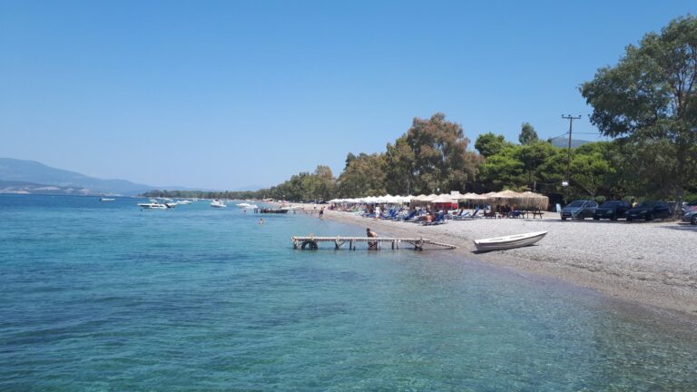
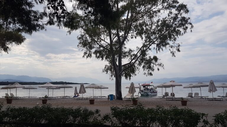
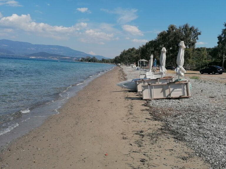
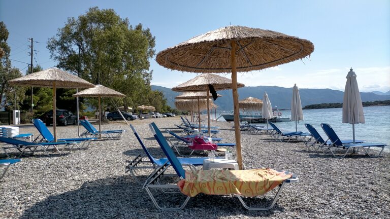
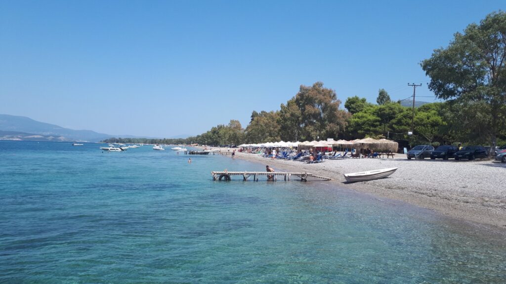
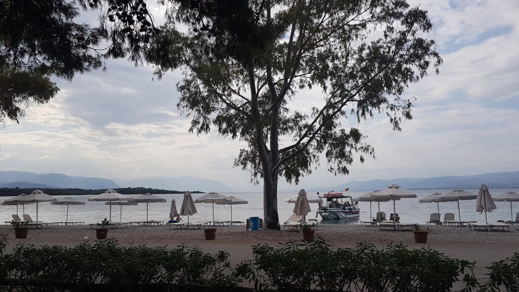
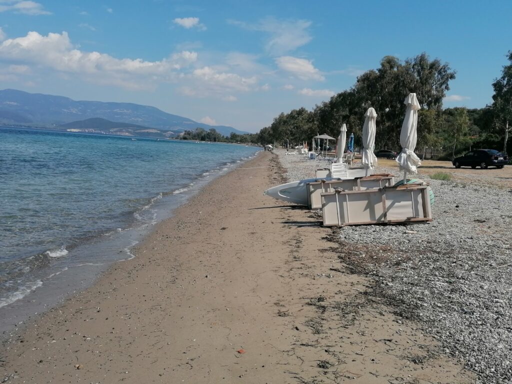
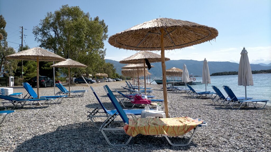
The beach runs as a long, narrow strip of mixed sand and smooth pebbles along the western face of the peninsula, the water shallow over a sandy floor and calm through most of the season given the shelter provided by the land on three sides. The unusual feature that photographs of Kavos show and descriptions mention consistently is the trees growing directly on the beach itself — mature trees with roots in the pebbles and shade canopy over the waterline — which gives the beach a character distinct from the usual separation of shoreline and treeline. Natural shade on the actual beach, rather than behind it, is genuinely rare on this scale.
Sunbeds and umbrellas are available through the beach tavernas managing sections of the shore, and the tavernas themselves serve fresh seafood caught in the gulf — the fishing villages of the Lichada peninsula, including Lichada and Agios Georgios a short distance along the road, have sustained small-scale fisheries in these waters for the depth of recorded history. The water at Kavos sits at the point where the North Euboean Gulf meets the Maliakos Gulf, and the currents that flow through that junction are part of what keeps the bay clear and well-oxygenated through the summer.
The boat departure point for the Lichadonisia operates from the beach itself. The taxi boat — known to local accounts as ta ida ola — can be called by phone and comes to pick up passengers directly from the shore. The fare runs around seven euros per person for the return crossing, children under ten free. The trip to the nearest organised island, Manolia, takes five to ten minutes. This makes Kavos one of the most convenient departure points for the islands, competing only with Agios Georgios and the Kammena Vourla crossing from the mainland opposite.
The Lichadonisia From Kavos Beach: What to Expect on the Islands
The seven islands — Manolia, Megali Strongyli, Mikri Strongyli, Steno, Vagia, Voria, and Limani — are uninhabited now, though demographic records from 1928 show 70 people living on them, mainly fishermen. The last residents left during the 1960s and by the 1981 census only five people remained. The ruins of the old settlement survive on Manolia, the largest island, at its southern end.
Manolia is the only island with organised facilities: a beach bar, sunbeds and umbrellas, fresh fish and souvlaki available. The underwater terrain around all the islands is noted consistently for the sunken ships resting on the seabed — the Lichadonisia were the suggested location for the Battle of the Echinades in 322 BC, one of the naval engagements of the Lamian War, and the seabed around them reflects centuries of maritime traffic through a channel that the earthquake of 426 BC reconfigured. Free-divers come specifically for the wreck sites. The glass-bottom boats operated by some of the tour operators make the seabed visible during the crossing itself, without requiring diving at all.
The Lichada Peninsula Beyond the Beach
The wider Lichada peninsula rewards time beyond the beach and the island crossing. The deserted village of Paleohori, reached by walking paths uphill from the current settlement, is among the oldest inhabited sites on the peninsula, its abandonment leaving stone buildings at a point above the coast where the views down to the Lichadonisia and across to the mainland opposite carry the specific quality of looking at something that used to be joined. The Post-Byzantine chapel of Prophet Elias sits above it, and the lighthouse at Cape Kavos at the peninsula’s actual tip is accessible by road.
The Sanctuary of Zeus Keaneos is believed by some archaeologists to have stood at Cape Keaneon, now occupied by the chapel of Agios Konstantinos and Eleni — ancient building materials were visibly reused in that chapel’s construction. The whole mountain area from Lichada through to Gialtra is noted for hiking and 4×4 routes through pine forest, a different use of the same landscape that the beach operates within.
Amarynthos Beach Evia Greece and Paralia Saranti Beach Boeotia Greece both sit within the wider regional circuit for anyone covering the Gulf of Evia and the Corinthian Gulf coast in the same trip — each represents a different character of the same mainland-coast geography that Kavos belongs to at its northern end.
The boat number is 6977628080 or 6972808181 — call from the beach and the boat comes to you. The organised island is Manolia. The ruins of the old settlement are at its southern end, and the walk around the island to reach them from the beach bar takes long enough to be worth timing for the early morning before the day-trip crowds arrive from Kammena Vourla. The return crossing back to Kavos gives the clearest view of the peninsula’s tip and the lighthouse standing at the end of a landmass that was considerably larger before the ground beneath it sank.
Map
Sorry, no records were found. Please adjust your search criteria and try again.
Sorry, unable to load the Maps API.