Pounta Zeza, Lavrio: An Ancient Strait Lies Offshore

Profile
Pounta Zeza, Lavrio: An Ancient Strait Named in a 363 BC Inscription Lies Just Offshore
Greece | Lavrio | Lavreotiki Municipality, East Attica
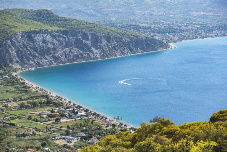
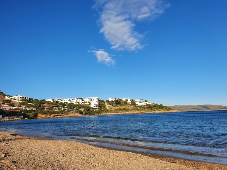
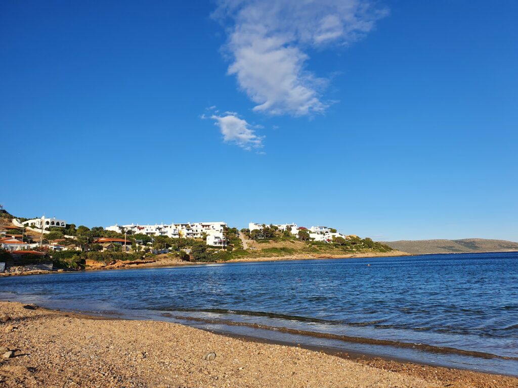
I put on a mask at Pounta Zeza mostly out of curiosity, not really expecting to find much, and came up having actually swum over stonework that historians connect to a named place in a 2,400-year-old inscription. The submerged settlement here is identified with the ancient “Strait of Salaminia,” a location referenced directly in inscriptions from the Athenian Agora dating to 363 BC. The likely explanation is straightforward once you know it: the settlement originally extended across the hill behind today’s beach, sloping gently down toward the sea, and over the centuries the coastline simply moved, taking part of the ancient town with it. What’s left now sits partly submerged just offshore, close enough to reach with nothing more than a snorkel and a bit of patience.
This whole stretch of coast carries that kind of weight without making much fuss about it. Lavrio, a short drive away, was ancient Laurium, whose silver mines genuinely funded much of Athens’s rise as a naval power — the same wealth, more or less, that built the fleet at Salamis. I find it strange and a little wonderful that a beach this relaxed, with teenagers gathering at the beach bar for souvlaki and coffee, sits directly above ground this consequential.
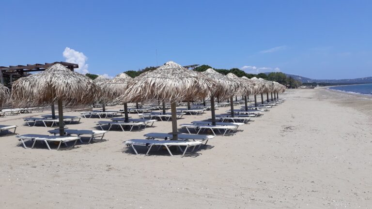
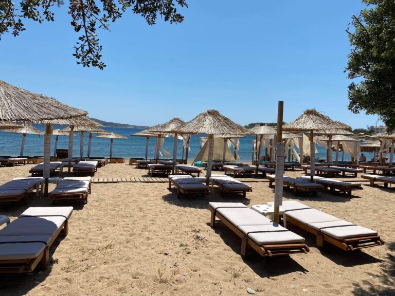
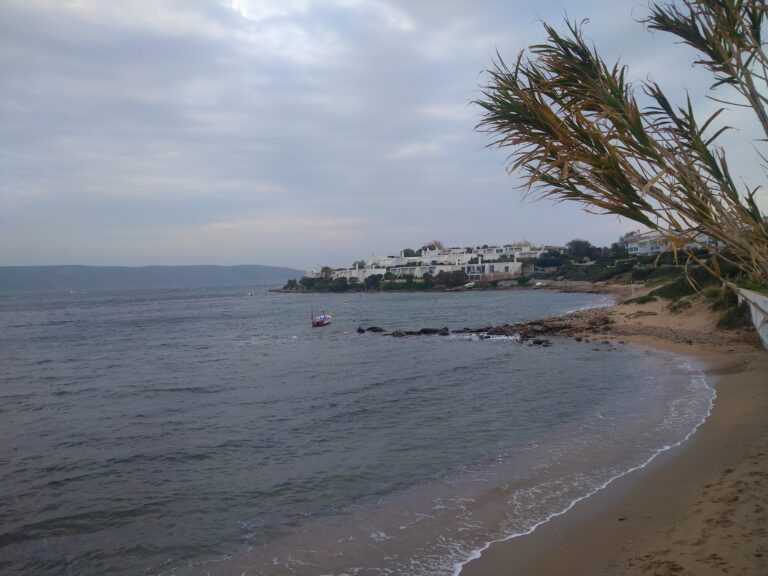
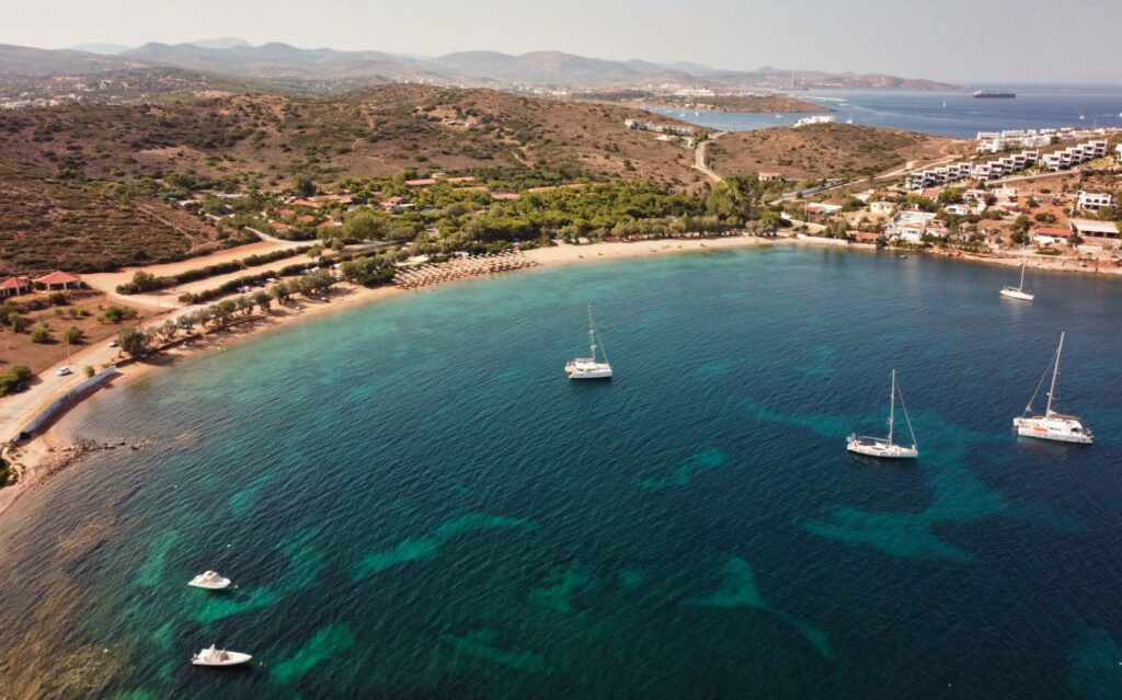
The beach also goes by a second name, Panormos, and I’ve seen both used interchangeably depending on which sign or which local you ask. Either way, what’s actually there is a wide, sandy stretch backed by a proper cluster of trees — enough to throw real shade over a decent patch of sand rather than the token tamarisk scattered along some other beaches I’ve covered. Most of it stays unorganised: no rows of rented sunbeds dominating the shore, just open sand and shade, with a smaller organised section if you’d rather pay for an umbrella than carry your own.
Getting There: 60 to 70 Minutes From Athens, Just Before Lavrio
I drove the Athens–Sounio coastal road for the scenery, which genuinely earns its reputation as one of the better drives in Attica, though the faster Attiki Odos route toward Lavrio works just as well if you’re short on time. Pounta Zeza sits right before you reach Lavrio itself, signposted clearly enough from either the coastal road or the Lavrio town approach.
Parking is informal but plentiful in the space behind the beach and its tree cover, and I never had any trouble finding a spot even arriving in the middle of a summer afternoon. The KTEL Attikis bus on the Sounio coastal route stops here directly — just ask the driver for Pounta Zeza.
The Beach: Sand and a Few Pebbles, Shallow and Gentle, Genuinely Shaded
The shore mixes fine sand with a scattering of smooth pebbles right at the waterline, and the seabed slopes so gently that I watched small children wading out a long way before the water reached their waists. The bay’s shape, curving in like a horseshoe, keeps the water calm even when the wind picks up elsewhere along this stretch of coast — I’d still check conditions before assuming total shelter, but it held up better than I expected on a breezier afternoon.
The beach holds Blue Flag certification, and the water was clear enough for the snorkelling I’d come specifically to try, the visibility good enough to make out shapes on the seabed without much effort. A beach bar anchors the social side of the place, and I noticed a younger crowd gathering there through the afternoon and into the evening — this felt less like a quiet family retreat and more like a casual, slightly lively local hangout, sunset drinks included.
Asimaki and Charakas, a Short Drive Either Way
Pounta Zeza sits within easy reach of two other beaches along this same stretch toward Sounio — Asimaki Beach Lavrio Sounio Attica Greece, facing the island of Makronissos, and Charakas Beach Keratea Attica Greece, facing the protected island of Patroklos. I’d treat all three as natural stops on the same drive rather than a single destination, each with its own character but close enough together that hopping between them costs very little extra time.
Pounta Zeza, also called Panormos, sits just before Lavrio on the Sounio coastal road, above a submerged ancient settlement identified with the Strait of Salaminia, referenced directly in a 363 BC inscription from the Athenian Agora. Sand and a few pebbles, a gentle shallow entry, genuine tree shade, Blue Flag water, and a beach bar that draws a younger, livelier crowd than some of the quieter beaches nearby. Sixty to seventy minutes from Athens, with Asimaki and Charakas both close enough for the same day out.
Drive the Sounio coastal road for the views, or the Attiki Odos if you’re pressed for time. Bring a mask if you want to look for the submerged remains. Stay for sunset at the beach bar if that’s more your pace than an early departure.


Map
Sorry, no records were found. Please adjust your search criteria and try again.
Sorry, unable to load the Maps API.
Near by places: