Akrata Beach Achaia: Year-Round Swimming, Rivers, Lake

Profile
Akrata Beach, Achaia: The 2.5km Gulf of Corinth Shore Between the Tholopotamos and Krathis Rivers, Where the Water Never Falls Below 15°C and Lake Tsivlou Was Created by a Landslide at 700 Metres Above
Greece | Akrata | Aigialeia Municipality, Achaia, Peloponnese
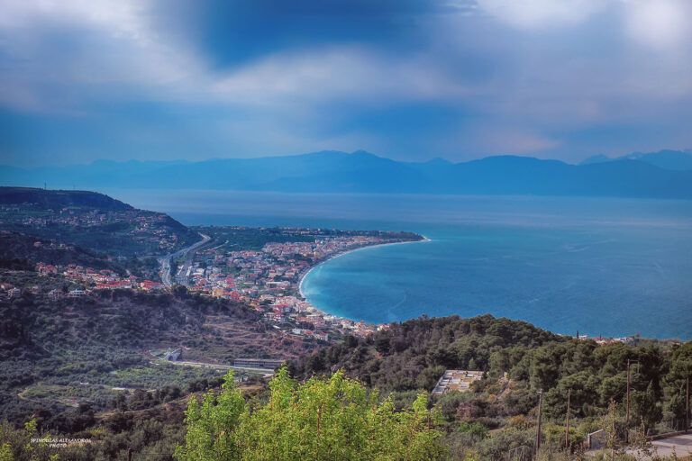
The Krathis river flows from Mount Chelmos — the mountain that carries the Styx, the river of the underworld. The Styx waterfall near the summit at 2,355 metres is where Thetis held Achilles by the heel, and where the gods swore their most binding oaths. The water flows down through the gorge, through the forests above Kalavryta (the rack railway town covered in the Eleonas Beach), and reaches the Gulf of Corinth at Akrata, where it forms the eastern boundary of the town’s 2.5-kilometre beach. The Tholopotamos river forms the western boundary of the same beach. Akrata sits between two rivers flowing from the high Peloponnese mountains to the sea.
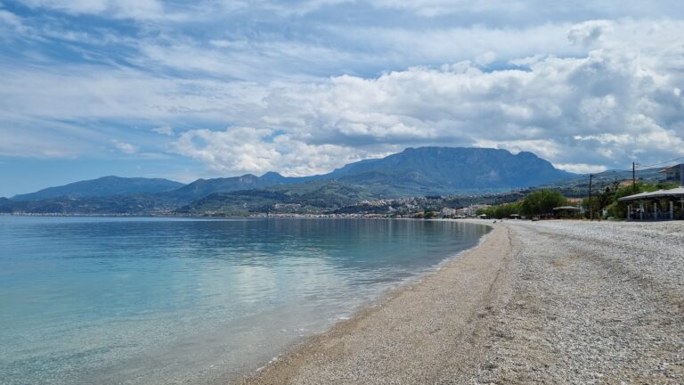
The beach at Akrata is swimmable year-round. The Gulf of Corinth water temperature at Akrata never drops below 15°C — confirmed by the Aigeira.org water temperature data — and ranges from 21°C to 28°C in summer, dropping to 15–20°C in the shoulder seasons. The “year-round swimming” quality is specific and unusual for a northern Peloponnese Gulf beach, reflecting both the enclosed gulf’s thermal retention and the southward-facing exposure of this stretch of coast.
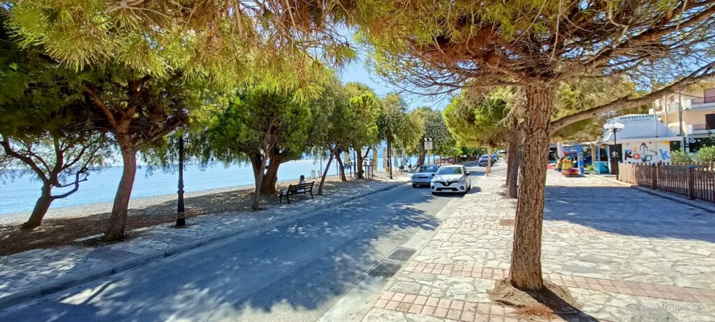
Akrata is a seaside settlement on the route from Athens to Patras — the A8 motorway and the Hellenic Train (formerly Proastiakos) both pass through the area on the northern Peloponnese coastal corridor. The town has grown as a favourite of Athenians who initially came for the clean beaches and stayed for the green mountain environment immediately above. Entire apartments are rented for the summer by families who use Akrata as a coastal base for the surrounding mountains and villages.
Getting There: 150km From Athens (1h45 Via A8), Hellenic Train Stop on the Athens–Patras Line, 70km From Patras
From Athens, take the A8 (Olympia Odos) motorway toward Patras. After Corinth and Kiato, continue along the northern Peloponnese coast. Akrata is 150 kilometres from Athens, approximately 1 hour 45 minutes. From Patras, the distance is 70 kilometres eastward on the same motorway, approximately 50 minutes.
By Hellenic Train, the line from Athens toward Patras stops at Akrata — the same line that stops at Diakopto (20km east, the rack railway departure point) and Aigio (28km west). The train journey from Athens takes approximately 2 hours.
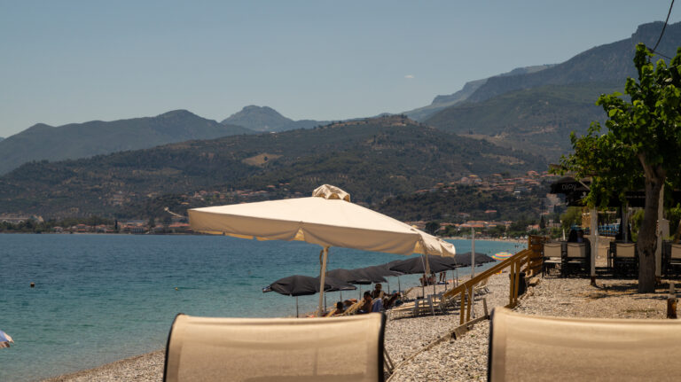
The Beach: 2.5km Between Two Rivers, Pebble, Clear Gulf Water, Showers Evenly Spaced, Organised With Cafes and Beach Bars, Lifeguards in Season
The beach stretches 2.5 kilometres from the Tholopotamos river on the west to the Krathis on the east — the rivers defining the natural coastal cell. The surface is pebble with some sand mix. The Aigeira.org description is characteristically precise: “a pebble beach with evenly spaced showers along the way and a variety of beach bars and tavernas.” The organised sections with sunbeds and umbrellas cover the central portions; free sections exist at both ends near the rivers.
The settlement of Aigeira (ancient Aegira) is adjacent to Akrata along the same coastal strip — the two coastal villages are practically continuous.
Ancient Aegira: The Theatre, the City of Aeges, the Monastery of Agia Triada
Akrata and the adjacent Aigeira occupy the site of ancient Aegira — one of the twelve cities of ancient Achaia. The remains of the ancient theatre are visible. The ancient city of Aeges — a related settlement — was destroyed around 281 BC. The post-Byzantine Monastery of Agia Triada is in the suburbs of Akrata, a functioning monastery on the hillside above the coastal settlement. Ancient Felloi — mentioned by Pausanias in his Achaika — was 20 kilometres inland at Seliana, where traces have been discovered.
Lake Tsivlou: Created by a Landslide Over 100 Years Ago, 700 Metres, Surrounded by Forest
Lake Tsivlou is approximately 25 kilometres south of Akrata at 700 metres altitude in the Achaia mountains. The lake was created over 100 years ago when a landslide blocked the Krathis river valley — a natural dam that accumulated water and created a lake where previously there was none. The lake is surrounded by forest, visually striking, and accessible by mountain road from Akrata. The day programme that the Akrata tourism guide recommends: beach in the morning, Lake Tsivlou and the mountain road in the afternoon.
Zarouchla: The Mountain Gastronomy Village
Zarouchla — approximately 30 kilometres south of Akrata in the high Achaia mountains — is the village known throughout the region for its traditional cooking. The specific combination of the Akrata beach day and the Zarouchla evening meal follows the coastal-to-mountain axis that characterises the best Achaia day circuits.
The Northern Peloponnese Coast Circuit: Akrata’s Position Between Diakopto and Aigio
The coastal strip from Corinth to Patras along the northern Peloponnese is one of the most continuous coastal resort sequences in Greece: Kiato, Xylokastro, Dervenakia, Sikyona, Aigio, Akrata, Diakopto, Aigio again westward — each town with its beach, its mountain backdrop, and its railway station. Eleonas Beach Diakopto Greece — the 2km olive grove shore 20km east where the Odontotos rack railway departs for the Vouraikos Gorge to Kalavryta since 1896 — is the nearest series beach to the east. Kastelokampos Beach Patras Greece — the former EOT camping site on the Gulf of Patras approach to the city — is the western end of the same coastal chain.
Akrata Beach in Achaia is the 2.5km Gulf of Corinth pebble shore between the Tholopotamos and Krathis rivers (the latter flowing from Mount Chelmos where the Styx originates above) — swimmable year-round (minimum 15°C), Hellenic Train stop, 150km from Athens (1h45), 70km from Patras, organised sections with showers at regular intervals, Ancient Aegira theatre ruins adjacent, the post-Byzantine Monastery of Agia Triada on the hillside, Lake Tsivlou (landslide-created lake at 700m altitude) 25km south, Zarouchla gastronomy village 30km south, the Diakopto rack railway 20km east.
Take the train from Athens. Swim year-round. Drive south to Lake Tsivlou in the afternoon.


Map
Sorry, no records were found. Please adjust your search criteria and try again.
Sorry, unable to load the Maps API.