Nestinarka Beach Tsarevo: Named After Fire-Walkers


Profile
Nestinarka Beach, Tsarevo, Bulgaria: The 600m Vasiliko Bay Named After Fire-Walkers, 3km From Town on the Coastal Promenade, With Surfing Conditions and an Old Campsite Behind
Bulgaria | Vasiliko | Tsarevo Municipality, Burgas Province
Nestinarstvo — the ancient Strandzha tradition of dancing barefoot on hot coals — is still practised in villages 20 kilometres inland. The beach takes its name from this ritual, which is the specific thing worth knowing because it explains why the name is unusual and why the whole stretch of coast south of Tsarevo carries a particular resonance with anyone who knows the Strandzha cultural tradition. The fire-walkers don’t come from Tsarevo, but the landscape that produced them begins just beyond the beach.
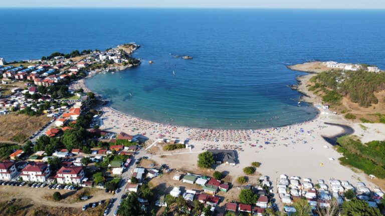
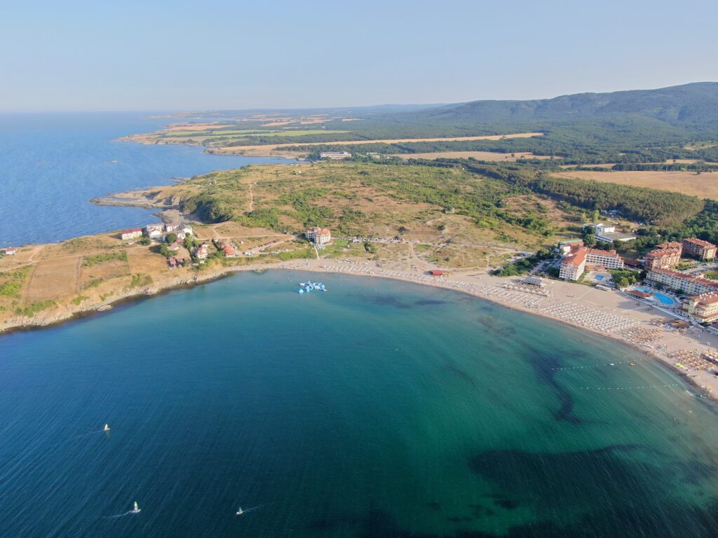
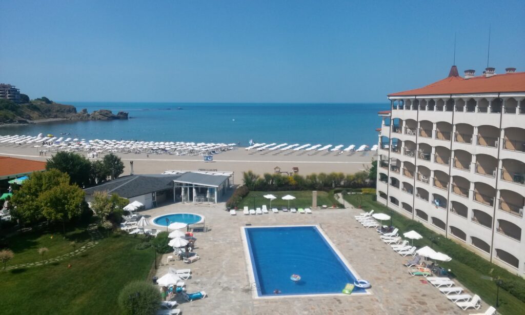
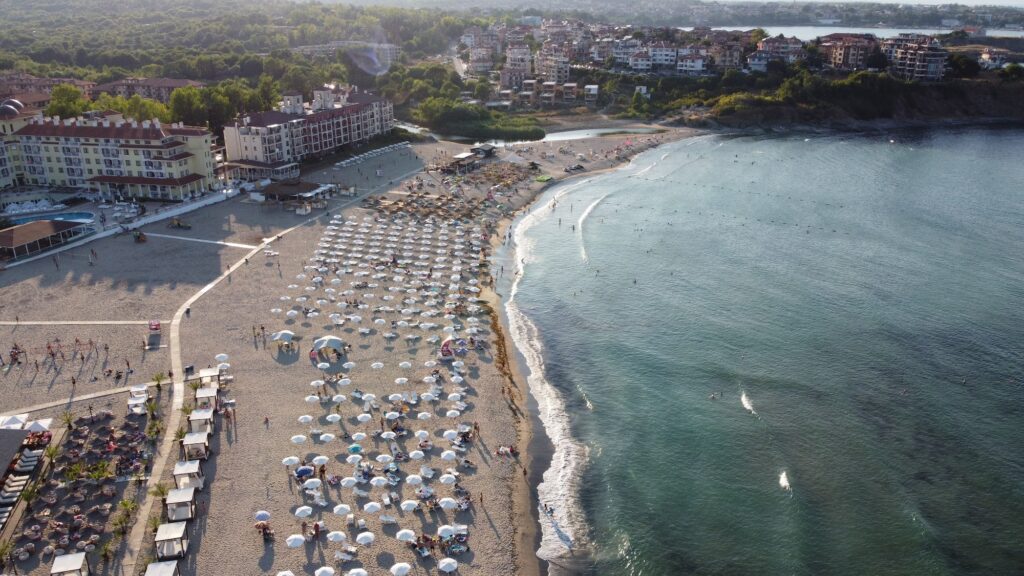
Nestinarka is the largest beach near Tsarevo: 600 metres long and 90 metres wide, located in the Vasiliko neighbourhood in the southern part of the town, approximately 3 kilometres from the town centre by the coastal promenade. The Vasiliko district is the old part of Tsarevo — the town was actually called Vasiliko until 1934, when it was renamed Tsarevo (from the Greek vasilevs, meaning king or tsar). The name change kept the meaning while swapping the language. The old neighbourhood name stayed.
Behind the beach, a campsite called Camping Nestinarka operated for decades and still has remnants — bungalows and small holiday resorts scattered among the trees further back from the sand, not always obvious but present if you look.
Getting There: 3km From Tsarevo Centre Along the Coastal Promenade, Or by Tourist Train, Car to Parking Behind the Sand
The coastal promenade between Tsarevo and the Vasiliko neighbourhood connects the two directly. It’s a flat, paved walk that follows the shoreline south from the town centre — 3 kilometres, roughly 35 minutes on foot, and pleasant enough that plenty of visitors walk both ways rather than taking a taxi back. The tourist train that runs during summer connects the central town square to the Nestinarka bay regularly, which is the easier option if you’ve spent the afternoon on the beach and don’t feel like the walk home.
By car, follow signs into Tsarevo and continue south toward the Vasiliko zone. Paid and free parking areas sit directly behind the beach. The town is 60 kilometres from Burgas on the E87, and intercity buses stop at the central Tsarevo terminal — from there, a taxi to the beach costs next to nothing.
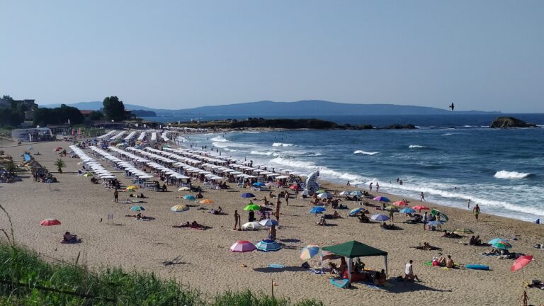
The Beach: 600m, 90m Wide, Sand With No Rocks, Surf Conditions Possible, Campsite Remnants Behind
The seabed is covered with sand and there are no rocks to interfere with a pleasant swim — a specific quality worth noting because some of the other Tsarevo area beaches have rocky sections that change the entry experience. At Nestinarka the bottom is clean sand throughout, the depth builds gradually, and the shallow shelf is long enough for small children to wade comfortably.
The conditions here are different from Arapya, which sits 4 kilometres to the north. Arapya’s horseshoe bay geometry suppresses most wave action. Nestinarka is more open, and in the right wind conditions produces surf worth bodyboarding or surfing — something the Tsarevo tourism description flags specifically: adventure lovers would choose Nestinarka for surfing. It isn’t a dedicated surf beach in the way that Central Beach Lozenets Bulgaria hosts the national championship, but on the right day there’s enough swell for anyone with a board.
Lifeguards cover the beach from early morning through the afternoon. Sunbeds and umbrellas are available, water sports including jet skiing and water skiing operate from the beach, and there are restaurants and bars behind the sand.
The Vasiliko Old Quarter and Cape Castro
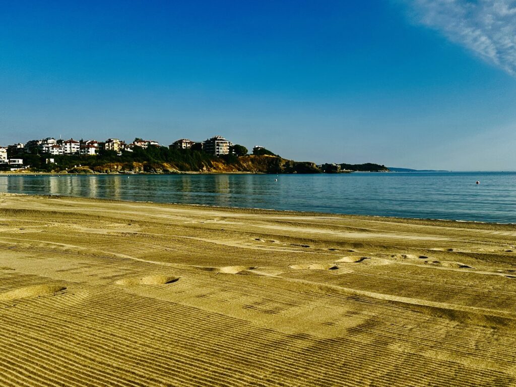
The Church of the Assumption of the Blessed Virgin Mary on Cape Castro is 91 metres from the beach — a figure that tells you everything about how close the historical district is. The small church sits on the cape at the southern end of the Vasiliko neighbourhood, overlooking the water, and is worth the five-minute walk whether or not churches are normally on your itinerary. The view back north toward Tsarevo from the cape is the specific angle that reveals how the town sits across three small peninsulas and four bays — a geography that isn’t obvious from beach level.
The Vasiliko district has traditional Bulgarian architecture — older houses with wooden balconies and stone walls — that survived the 20th-century construction era better than the newer town centre did. Walking through it to reach the beach is worth doing at least once.
The Strandzha Connections: Fire-Walking Villages, National Park Trails
The villages where nestinarstvo is still practised — Bulgari and Balgari — are 20 to 25 kilometres west in the Strandzha mountains. The ritual takes place on the feast of Saints Constantine and Helena (June 3rd). If the timing lines up, it’s worth the drive. If it doesn’t, the Strandzha Nature Park visitor centre in Malko Tarnovo or the Tsarevo museum both have documentation.
Strandzha Nature Park itself begins effectively at the edge of town. The trails from Tsarevo into the park connect the coast to the oak and beech forest interior — the same landscape that the ancient fire-walking tradition emerged from.
Veleka River Mouth: The Extraordinary Beach 15km South
Veleka Beach near Sinemorets — 1,000 metres long where the Veleka River meets the sea in an extraordinary lagoon setting — is 15 kilometres south of Nestinarka on the coast road. For anyone based in the Tsarevo area, Veleka Beach Sinemorets Bulgaria is the half-day excursion that the car makes possible. The lagoon, the dunes, the river mouth, and the near-empty sand are a complete contrast to Nestinarka’s more organised character.
Nestinarka Beach in Tsarevo is the 600-metre Vasiliko bay named after the Strandzha fire-walking tradition — 3 kilometres from town on the coastal promenade, the largest beach near Tsarevo, sand throughout with no rocks, surfing and bodyboarding possible in the right conditions, the Church of the Assumption on Cape Castro 91 metres from the sand, old campsite remnants behind in the trees, and the fire-walking villages 25 kilometres west in the mountains.
Walk south from the town centre along the promenade. The church on the cape tells you when you’ve arrived.
Map
Sorry, no records were found. Please adjust your search criteria and try again.
Sorry, unable to load the Maps API.
Near by places: