Mylokopi Beach Loutraki: Twin Bay, Best Dive in Corinthia

Profile
Mylokopi Beach, Loutraki: The Twin Bay Formed by an Ancient Earthquake, Called the Voidokilia of the Corinthian Gulf, 15km From Loutraki and Not Accessible Without a 4WD or a Forest Walk
Greece | Perachora Peninsula | Loutraki-Perachora, Corinthia, Peloponnese
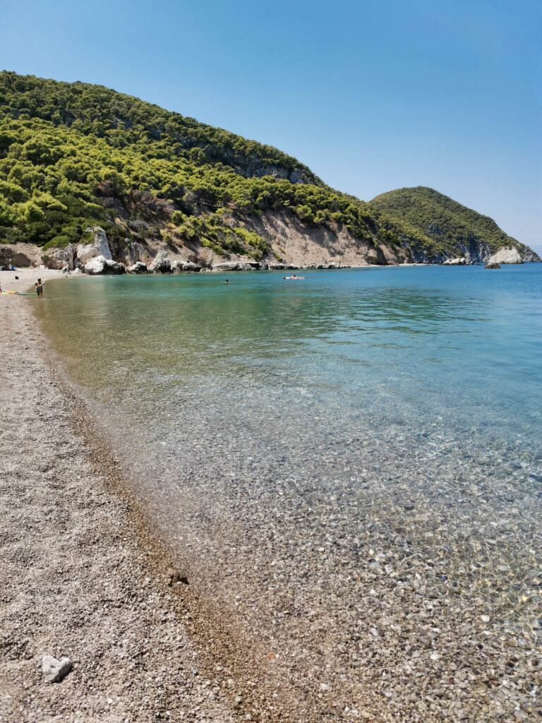
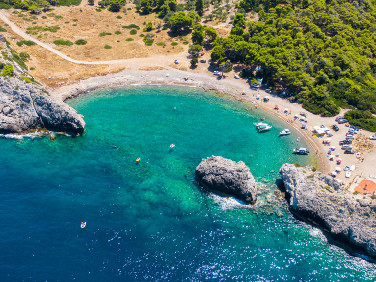
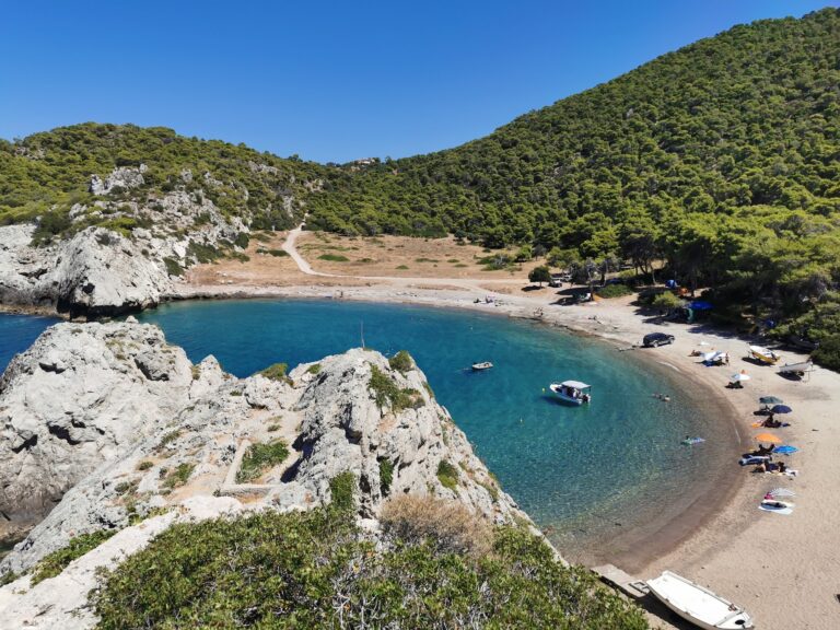
An earthquake created Mylokopi. The double bay on the northern coast of the Perachora peninsula was formed by ancient seismic activity — the same geological forces that have made the Corinthian Gulf one of the most seismically active rifts in Europe expressed themselves here in a specific geomorphological event: a limestone headland was split or a coastal section subsided, creating the two adjacent coves separated by a narrow neck of land that now define Mylokopi’s geography. Small Mylokopi has fine golden sand. Large Mylokopi has the dramatic consequence of the tectonic event — cracked limestone slabs, broken rock formations, the physical record of the earthquake written in the seabed and the shoreline.
The comparison that the Loutraki tourism community uses is to Voidokilia — the famous double-bay beach in Messenia on the southwest Peloponnese coast, where a symmetrical sandy arc is considered one of the most beautiful beaches in Greece. “The Voidokilia of Loutraki” is the shorthand, acknowledging both the geographical similarity (two bays, shared headland) and the quality claim (comparable beauty, accessible from a major southern Greek city). Voidokilia draws visitors from across Greece and Europe; Mylokopi draws visitors from Athens who know the Corinthian coast.
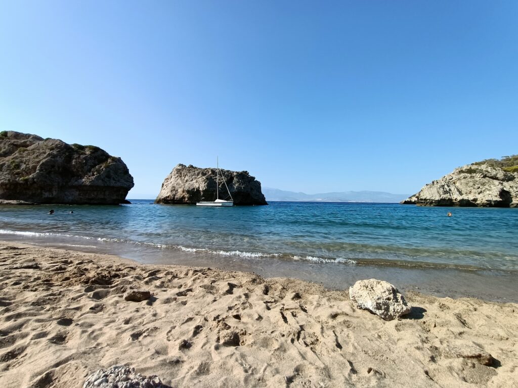
Mylokopi is the best beach in Corinthia for scuba diving. The particular morphology of the seabed — the tectonic plates, the underwater canyons, the reef formations created by the ancient earthquake — combined with the clarity of the Corinthian Gulf water in this sheltered corner produces the specific conditions that free divers and yacht owners seek. Changing seabed colours visible from the surface are the visual quality that makes the underwater topography distinctive.
Getting There: 15km From Loutraki, 15 Minutes From Perachora Village, 4WD for the Final Road, or Park at the Top and Walk — 1h30 From Athens
From Loutraki, follow the road toward Perachora village. The provincial road Loutraki–Perachora leads northwest along the peninsula. Before reaching Perachora village, signs for Mylokopi or follow the road past Perachora toward the coast. The final section of the approach road is a dirt track — not accessible by standard car according to the EnjoyCorinthia guide (which states “not accessible by conventional vehicles”). A 4WD is the specific requirement; visitors without one park at the top and walk on forest paths through the pine trees. The walk is described as long — the forest path descent adds 20 minutes to the journey.
From Athens, the drive takes approximately 1 hour 30 minutes — 90 kilometres via the A8 Motorway (also called the Moreas) to Loutraki, then the provincial road to Perachora and Mylokopi.
The Two Bays: Small Mylokopi (Sandy) and Large Mylokopi (Tectonic Rock Formations)
The twin bays share the same entrance but have different characters. Small Mylokopi is sandy — fine golden sand, the beach that families with young children gravitate toward for the comfortable entry and the shallow water. Large Mylokopi is defined by the dramatic tectonic plates and broken limestone slabs — the earthquake geology expressed as a swimming surface, and the specific landscape that free divers prefer for the rock formations and the clear deep water between the slabs.
Both bays face north into the Corinthian Gulf. The pine trees of the Geraneia Mountains come down almost to the waterline. There is no commercial infrastructure of any kind on either bay — no sunbeds, umbrellas, cafes, showers, or changing facilities. Everything needed for a day must arrive with the visitor.
The Diving and Snorkelling: The Best Seabed in Corinthia
The VisitPeloponnese guide states directly: “Mylokopi is worth a special mention as the wonderful changing colours of the seabed mean it’s the best beach in Corinthia for scuba diving.” The changing colours reflect the transition from sandy seabed to the darker rock formations, the varying depths created by the tectonic topography, and the specific transparency of the Corinthian Gulf water in this sheltered bay. Free divers and snorkellers specifically seek out Large Mylokopi for the formations. Mask and fins are the essential equipment for any visit that extends to the water.
The Heraion of Perachora: The 8th Century BC Sanctuary of Hera on Cape Melagavi
Perachora village — 15 minutes’ drive from Mylokopi — is the base for the Heraion of Perachora, the ancient sanctuary of Hera at Cape Melagavi, the northwesternmost point of the Perachora peninsula. The sanctuary dates to the 8th century BC and includes two temples, a stoa, and the remains of the port facilities that served the sanctuary’s visitors. The Melagavi Lighthouse stands at the tip of the cape — a working lighthouse at the site of the ancient sanctuary, one of the more specific archaeological landscapes in the region.
The three-day Loutraki programme from the AllAboutPeloponnisos.com guide is the specific recommendation: Mylokopi on day one, Heraion and Melagavi Lighthouse on day two, Loutraki Thermal Spa on day three.
Lake Vouliagmeni: The Coastal Lagoon 16km From Loutraki
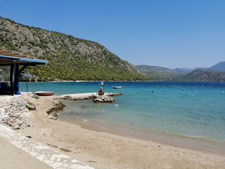
Lake Vouliagmeni — not to be confused with the famous Vouliagmeni near Athens — is a coastal lagoon 16 kilometres northwest of Loutraki, near Perachora. It has a narrow channel connecting it to the Corinthian Gulf and a sandy beach. The tavernas at Lake Vouliagmeni are the dining destination for visitors who spend the day at Mylokopi — the nearest restaurant options to the beach.
Loutraki: The Thermal Spa City, the Ancient Diolkos, the Casino
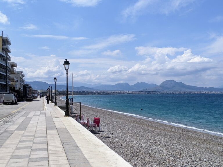
Loutraki is the nearest substantial town — 15 kilometres from Mylokopi. Its famous thermal springs were known in antiquity and treated Roman general Sulla in 86 BC, making the healing waters one of the oldest documented spa traditions in Europe. The Diolkos — the ancient 6th-century BC ship trackway built by the Corinthian tyrant Periandros to haul boats overland between the Saronic and Corinthian gulfs — passed through the area near modern Loutraki. The Casino Loutraki is the largest casino in Greece and one of the largest in Europe. The town’s coastal promenade is accessible and family-friendly.
For beach comparison within the same area, Porto Germeno Beach Greece — the four unorganised pebble beaches below the Aigosthena fortress with the tallest surviving ancient Greek tower — is on the same Gulf of Corinth coast, approximately 35 kilometres further east toward Athens.
Mylokopi Beach near Loutraki is the twin bay formed by ancient earthquake — Small Mylokopi sandy (families, shallow), Large Mylokopi with tectonic rock formations (free divers, snorkellers, the best scuba beach in Corinthia), called the “Voidokilia of Loutraki“, 15 kilometres from Loutraki on the Perachora peninsula (15 minutes from Perachora village), not accessible by conventional vehicles (4WD required for the final road or park at the top and walk the pine forest path), no amenities (bring everything), sunset from the bay specifically praised, the Heraion of Perachora and Melagavi Lighthouse 15 minutes away, Lake Vouliagmeni lagoon for dining, 1 hour 30 minutes from Athens.
Take the A8 from Athens to Loutraki. Drive the peninsula. Use a 4WD or walk the pine path.


Map
Sorry, no records were found. Please adjust your search criteria and try again.
Sorry, unable to load the Maps API.
Near by places: