Moutsouna Beach Naxos: Historic Emery Port With Pylons


Profile
Moutsouna Beach, Naxos: The Port Where 340,000 Tonnes of the World’s Second Hardest Mineral Were Loaded Between 1929 and 1982, With the Cable Railway Pylons Still Standing Above the Bay
Greece | Moutsouna | Naxos, Cyclades
Emery is the second hardest mineral after diamond. Naxos is the only place in Europe with natural emery deposits of high quality and one of very few globally. The emery mines in the mountains above the east coast of Naxos have been worked since the Bronze Age — ancient tools made from Naxos emery have been found across the Aegean. In the early 20th century, the question of how to get the emery from the mountain mines to the loading ships without losing the weeks of donkey transport that the process had required was solved in the most ambitious way the technology of the time permitted.
The Enaerios — the aerial cable railway — was built between 1926 and 1929 and began operation in 1930. It stretched for 8,720 metres from the mine at Stavrolagada to the port of Moutsouna, supported by 72 iron pylons between 5 and 43 metres high. It carried 170 wagons, required between 42 and 68 workers to operate, and transported approximately 340,000 tonnes of emery between 1929 and 1982. It was one of the most ambitious infrastructure projects ever built on a Cycladic island and is described as among the finest industrial monuments in Greece.
It closed when artificial emery — cheaper to produce, functionally equivalent — eliminated the market for the natural product. The mines followed. The port that had served them became a fishing village and eventually a tourist destination.
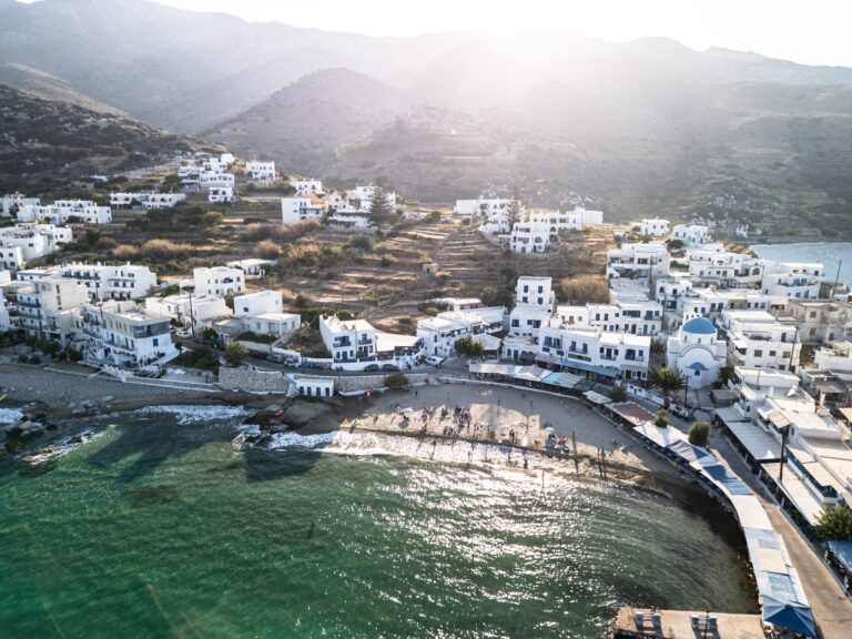
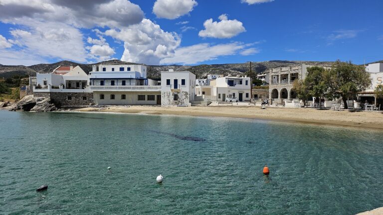
The cable railway pylons still stand above the bay. Looking up from the beach at Moutsouna, the iron towers are visible on the hillside — the 43-metre ones are the height of a 14-floor building. The loading station at the port is visible from the beach. The wagons that once carried the emery down the mountain are now partially preserved as industrial monuments at Stavrolagada.
Getting There: 39km From Naxos Town via Apeiranthos, 1 Hour by Car, Steep Winding Road After Apeiranthos, Limited Bus in Season
From Naxos Town (Chora), the drive takes approximately one hour on a 39-kilometre route that goes inland through Chalki, Filoti, and Apeiranthos before descending the steep winding mountain road to the coast. The mountain road section after Apeiranthos requires attention — it is paved but narrow, steep, and winding. A car or scooter is the practical transport option; a scooter requires experience and comfort with mountain road conditions.
A limited KTEL bus service runs from Naxos Town to Moutsouna in peak season, passing through the mountain villages. The service is infrequent — checking the current schedule before depending on it is essential.
Free parking is at the harbour entrance.
Apeiranthos: The Marble Village, the Distinct Dialect, and the Four Local Museums
The drive to Moutsouna passes through Apeiranthos — one of the most distinctive villages in the Cyclades. The houses and streets are entirely built from marble quarried locally; the marble pavement, the marble-fronted buildings, and the marble fountain are the specific architectural identity. The village population has a significant proportion of Cretan origin, descended from refugees who came in the 17th century, and the local dialect is considered a distinct variation of Greek by linguists — differentiated from standard Modern Greek in ways that reflect the isolated mountain village history.
Apeiranthos has four small museums covering geology, folklore, archaeology, and natural history — an extraordinary concentration for a village of approximately 600 permanent residents. The combination of the village visit and the descent to Moutsouna is the specific east Naxos mountain-to-sea programme that most visitors who make the drive do in the same half-day.
The Beach: Two Small Sandy Coves, Unorganised, Clear Water, The Small Cyclades on the Horizon
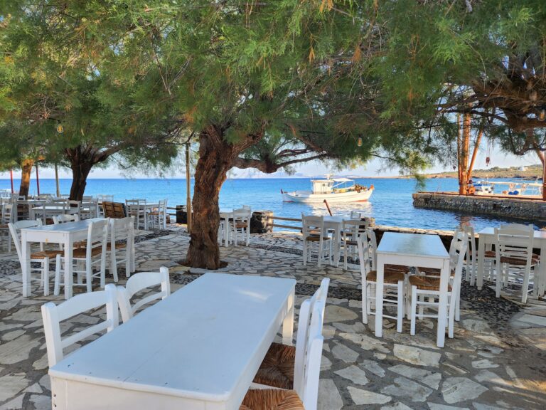
The beach at Moutsouna is divided into two small sandy coves — described variously as Ai Giannis and Tigani in different sources. Both have fine sand and clear water. The beach is not organised — no sunbeds for hire, no umbrellas. The proximity to the village tavernas provides the practical infrastructure. The waters are shallow and calm, the east coast position providing natural shelter from the westerly winds that dominate the main Naxos tourist beaches.
Looking east from the beach, the Small Cyclades are on the horizon — Koufonisia, Donousa, Schinoussa, and Iraklia, the four small inhabited islands between Naxos and Amorgos. The boats from Naxos Town that serve the Small Cyclades pass through these waters.
The Emery Loading Station: Still Visible, Designated Industrial Monument
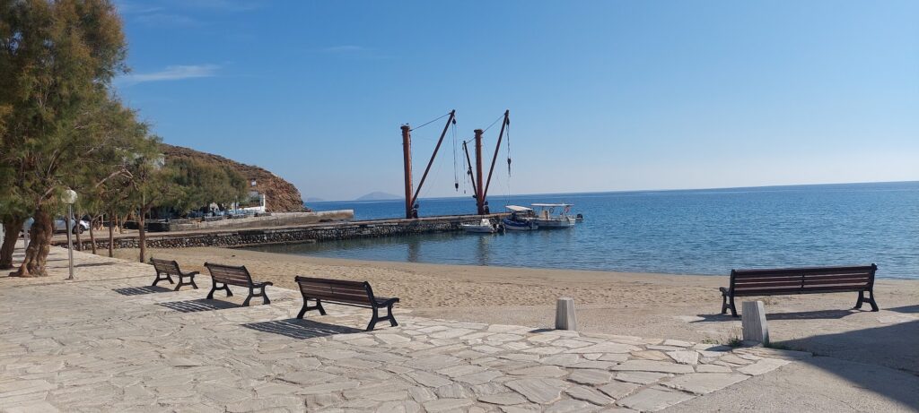
The loading station at the Moutsouna port — the structure where the emery arrived by aerial cable from the mountain and was weighed and loaded onto cargo ships — is still standing at the harbour. The defunct crane that the source article mentions is this structure. The iron pylons on the hillside above — the most visible part of the industrial monument from the beach — form the backdrop to the bay in a way that is unusual for any beach in Greece: industrial infrastructure from the 1920s and 1930s, preserved in place, visible from the water.
The full extent of the Enaerios can be understood by driving part of the road from Apeiranthos toward Moutsouna — the pylons appear along the hillside route, and the scale of the engineering becomes apparent. Several individual pylons are up to 43 metres — these are substantial structures in terrain that had no road when they were built.
Psili Ammos and Kleidos: The Beaches South of Moutsouna
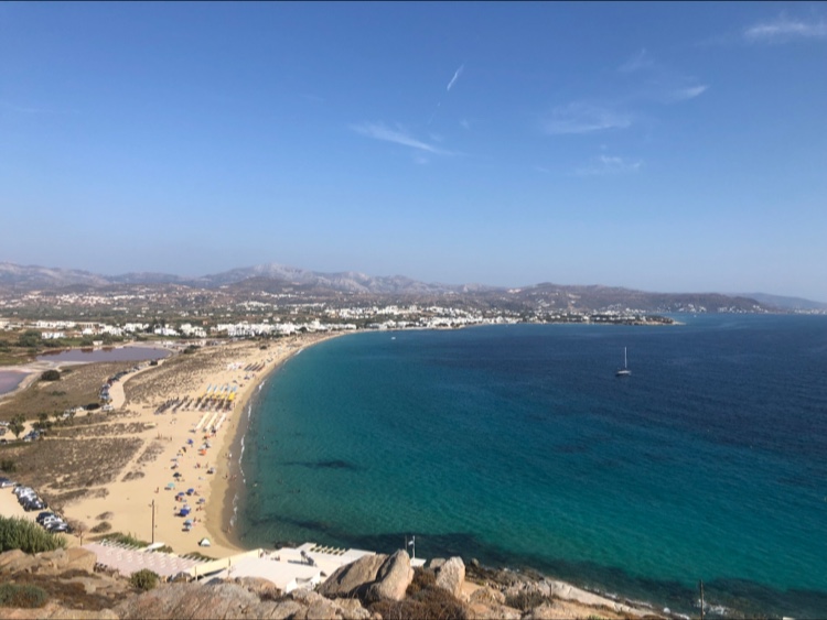
The east coast road south of Moutsouna leads to further beaches. Psili Ammos is approximately 8 kilometres south — a fine sand beach that is one of the better beaches on the east coast of Naxos and reaches a temperature of over 30°C in summer due to the relatively sheltered position. Kleidos beach is 12 kilometres south. Both are accessed from the same road, and both have the relative quietness of east Naxos beaches compared to the tourist-developed west coast.
Naxos: The Largest Cycladic Island, the Portara, Mount Zeus
Naxos is the largest island in the Cyclades by surface area — 429 square kilometres — and the most self-sufficient. It produces its own potatoes, citrus, olives, cattle, sheep, marble, and emery. The famous Portara — the massive marble doorway of an unfinished temple to Apollo or Dionysos on the islet of Palatia at Naxos Town — is the island’s most recognisable landmark. Mount Zeus (Zas) at 1,001 metres is the highest peak in the Cyclades.
Naxos Town is one of the most complete tourist destinations in the Cyclades — a functioning small city with a Venetian castle, a medieval old town, beaches immediately adjacent, and ferry connections to the full Cycladic network. The combination of Naxos Town as a base and the mountain-to-sea day circuit through Apeiranthos to Moutsouna is the specific Naxos programme that uses the island’s size as an asset.
Moutsouna Beach on Naxos is the historic emery port on the east coast — the aerial cable railway (Enaerios) pylons still standing above the bay (built 1926–29, 72 pylons, 340,000 tonnes of emery transported between 1929 and 1982, now a designated industrial monument), two small unorganised sandy coves, clear water, the Small Cyclades on the horizon, the loading station at the port still visible, Apeiranthos marble village and its four museums 11km up the mountain road, Psili Ammos 8km south and Kleidos 12km south along the east coast, 39km from Naxos Town by car (1 hour), limited bus in season.
Drive from Naxos Town through Apeiranthos. Stop for the marble streets and the museums. Descend to the bay. Look up at the pylons from the beach.


Map
Sorry, no records were found. Please adjust your search criteria and try again.
Sorry, unable to load the Maps API.
Near by places: