Agiokampos Beach Larissa: Thessaly's 12km Blue Flag Shore


Profile
Agiokampos–Sotiritsa–Velika Beach, Larissa, Thessaly: The 12km Blue Flag Coastline at the Foot of Mount Kissavos, the Most Popular Beach in Thessaly, With Hungarian and Czech Visitors, a Sunken German Ship, and Canyoning in the Gorge of Calypso
Greece | Agiokampos | Larissa Prefecture, Thessaly
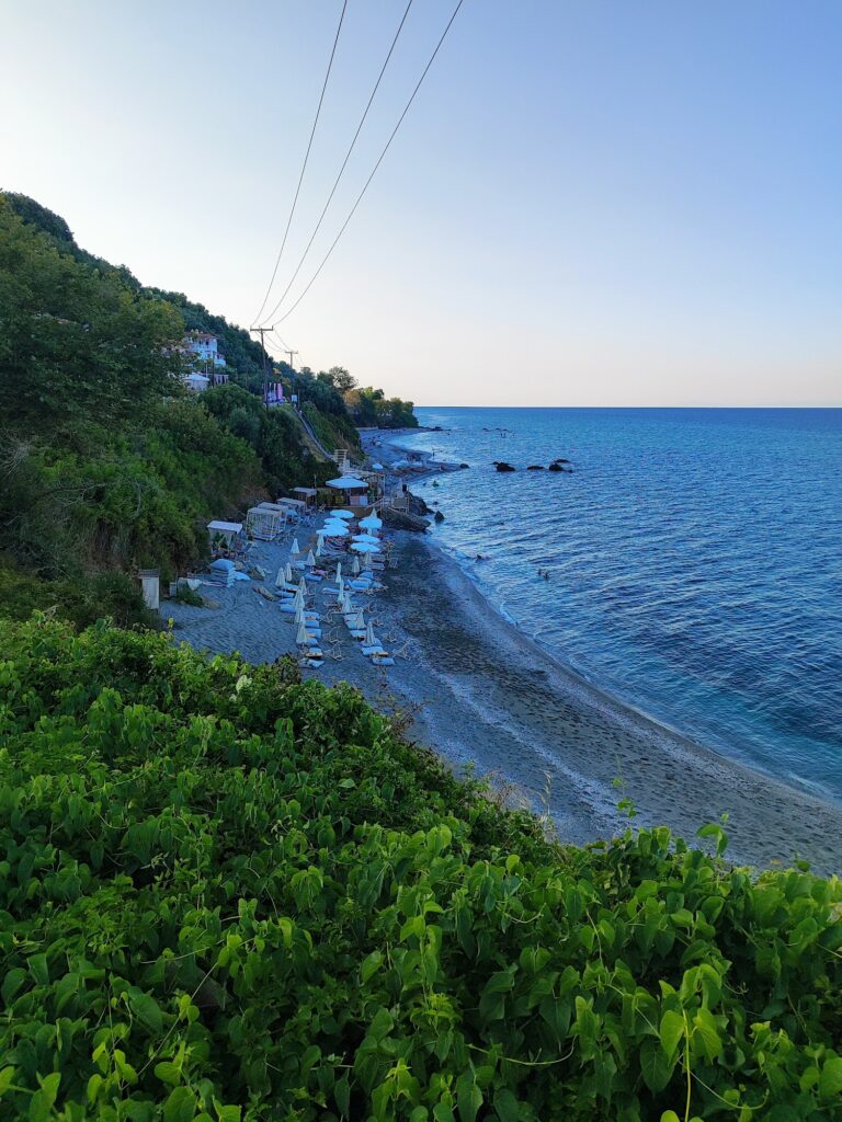
Larissa is the largest city in Thessaly and the fifth most populous in Greece. It is an inland city — 45 kilometres from the sea. When summer arrives and the flat Thessalian plain turns brutal in the heat, the residents of Larissa drive the 45 kilometres east to the coastline below Mount Kissavos (also called Mount Ossa), the mountain whose name gave Pieria its mythology: it is the mountain the Titans stacked on top of Olympus in their war against the Olympian gods. The beaches they are driving to — Agiokampos, Sotiritsa, and Velika — form a single continuous coastline of approximately 12 kilometres, all Blue Flag awarded, backed by the green slopes of Kissavos descending almost to the water.
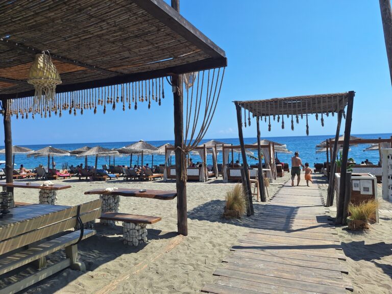
This is the most popular beach in Thessaly. It draws visitors from throughout central Greece — and internationally from Hungary and the Czech Republic specifically, reflecting the package-tourism relationships that developed between central European markets and this specific stretch of the Aegean coast. On summer weekends the coastal road has traffic; on summer weekdays it is manageable. The villages have the infrastructure of a resort that grew up around domestic and regional tourism: beach bars, tavernas, hotels, rooms to rent, two campings at Agiokampos, and the specific nightlife character that Agiokampos has compared to the quieter Sotiritsa in the middle.
Getting There: 45km From Larissa via Agia, Paved Road, KTEL Bus in Season, Sunday Traffic Warning
From Larissa city centre, drive east toward Agia village and continue to the coast — approximately 45 kilometres, 40 to 50 minutes. The road is well-paved throughout. Sunday summer traffic is the specific practical caution: the beaches are the weekend escape for a large city, and the approach road can back up on busy Sundays in July and August. Setting off early solves the problem.
The KTEL bus connects Larissa with Agiokampos, Sotiritsa, and Velika in season. The journey takes slightly longer than driving.
From Thessaloniki, the drive south on the E75 takes approximately 1.5 hours; exit for the coast roads toward the Kissavos foothills.
Free parking is available along the entire coastal road.
The Three Beaches: Agiokampos (Most Organised), Sotiritsa (Quieter Middle), Velika (Where Kissavos Meets the Sea)
The 12-kilometre coastal road runs from the port of Agiokampos in the north through Kato Sotiritsa in the middle to Velika in the south. Each section has a distinct character despite forming a single beach.
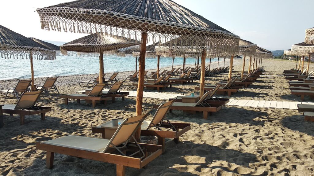
Agiokampos is the most developed and most visited section — most of the beach bars, tavernas, shops, and organised beach infrastructure is concentrated here. The port at Agiokampos has the fishing fleet, the camping site, and the boat tour operations. It is the busiest and most energetic section.
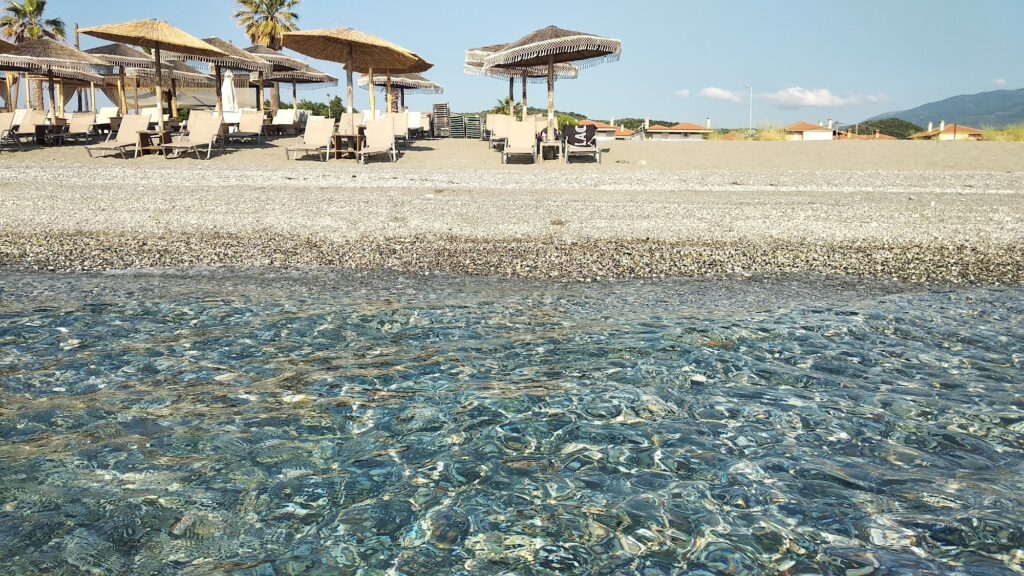
Kato Sotiritsa sits between the two, quieter than Agiokampos with fewer beach bars and a calmer atmosphere. The beach itself is sandy with small pebbles — more relaxed for families who find Agiokampos too busy.
Velika is where Mount Kissavos most visibly enters the picture — the green slopes come closest to the water here, providing the specific visual that distinguishes the Larissa coast from the open, flat-backed beaches of the north. After Velika, the coastal landscape changes further south into the hillier terrain toward Paliouria and Koutsoupia.
Mount Kissavos: The Green Mountain That Descends to the Sea
Mount Kissavos (Ossa) — 1,978 metres — runs parallel to the coast and its lower slopes reach almost to the shoreline at several points along the Larissa coast. The effect is a cooler, greener backdrop than the flat exposed beaches elsewhere in Thessaly, and natural shade from the vegetation at the transition zone between the mountain and the sea.
In mythology, Kissavos is one of the two mountains the Titans stacked on top of Olympus in their attempt to climb to the realm of the Olympian gods. Olympus (2,919m) and Kissavos (1,978m) face each other across the Tempi Valley corridor, and the Kissavos coastline is the seaward edge of this mythological territory.
Papakosta Beach: 4km South of Agiokampos, Unorganised, 1km Long, Oak and Arbutus Forest
The Akti Papakosta beach is 4 kilometres south of Agiokampos toward Rakopotamos — 1 kilometre long, unorganised, surrounded by a forest of oaks and arbutus trees that provides natural shade right to the beach edge. It is described consistently as beautiful and quiet. No facilities, no sunbeds — the forest shade is the alternative.
For visitors based at Agiokampos who want a completely different beach experience within 10 minutes’ drive, Papakosta is the natural option.
Mylos Glymeni: The Southernmost Beach of the Larissa Coast, Where a WWII German Ship Sank Carrying Alleged Gold
Mylos Glymeni is the southernmost beach of Larissa Prefecture, near the boundary with Magnesia Prefecture. It is unorganised, accessible by a dirt road from Sklithro, characterised by large stones and pebbles carved by waves. The area is described as ideal for snorkelling and diving because of shipwrecks in the vicinity — including, according to local accounts, a German warship that sank here carrying gold. The stories of underwater gold in shipwrecks are common across the Aegean, and whether the Mylos Glymeni claim has historical basis is uncertain — but the diving community in the area treats it as a specific site of interest.
Boat Tours and the Gorge of Calypso
From Agiokampos port, boat tours run along the coastline to hidden coves and sea caves accessible only by water. Trekking Hellas operates canyoning trips in the Gorge of Calypso nearby — a specific adventure activity connected to the Kissavos mountain terrain above the beach. The combination of beach, boat trip, and canyon trekking from a single base makes Agiokampos more diverse as a destination than the standard beach description suggests.
The Larissa-Coast Connection: Thessaly’s Inland Capital and Its Aegean Escape
Larissa is one of the oldest continuously inhabited cities in Europe — archaeological evidence suggests occupation since the early Bronze Age (approximately 2600 BC). The city’s mythology connects it to Larissos, son of Pelasgos, who gave the city its name approximately 4,000 years ago. The beaches of Agiokampos, Sotiritsa, and Velika are the specifically Larissian coast — the place the city goes to the sea.
Gritsa Beach Litochoro Greece is the next organised beach north, 8 kilometres above where the Kissavos coast meets the Pieria coast at Kastri. Psarolakas Beach Platamonas Greece is further north in Pieria, below the Crusader castle. The full coastal sequence from Platamonas south through Litochoro, Kastri, Agiokampos, Sotiritsa, Velika, and beyond forms the base of two mythological mountains end to end.
Agiokampos–Sotiritsa–Velika Beach in Larissa, Thessaly is the 12-kilometre Blue Flag coastline 45 kilometres from Larissa city at the foot of Mount Kissavos — the most popular beach in Thessaly, particularly visited by Hungarian and Czech tourists alongside domestic visitors, Agiokampos the most organised and lively section (port, boat tours, campings, beach bars, nightlife), Sotiritsa the quieter middle, Velika where Kissavos comes closest to the water, Sunday traffic warning (go early), Papakosta unorganised forest-shaded beach 4km south, Mylos Glymeni the far south end with shipwrecks, canyoning in the Gorge of Calypso, and free parking along the coastal road.
Drive from Larissa early on a Sunday. Start at Agiokampos port. Walk south.

Map
Sorry, no records were found. Please adjust your search criteria and try again.
Sorry, unable to load the Maps API.