Alonaki Beach Preveza: Calm Cove With Islet to Jump From


Profile
Alonaki Beach (Fanariou), Preveza: The Sandy-and-Pebble Cove 24km From Parga Where the Cliffs Stay Calm When Ammoudia Gets a Sandstorm, and a Small Rock in the Middle of the Bay Is Good for Jumping
Greece | Fanari Area | Preveza Regional Unit, Epirus
When the wind picks up on the Epirus coast and Ammoudia beach at the mouth of the Acheron turns to grit and spray, the coves behind the limestone headlands stay still. Alonaki is one of them. The cliffs that rim its semicircular bay deflect the wind entirely on days that make the open beaches uncomfortable — a specific quality noted by visitors who have experienced both beaches on the same afternoon, arriving at Alonaki after Ammoudia proved impossible. The price is the access road.
The Acheron river — one of the rivers of the Greek underworld in ancient cosmology, the river that the dead crossed to reach Hades — flows into the Ionian at Ammoudia, a few kilometres north of Alonaki. The ancient Necromanteion (oracle of the dead) is near the river, a site where the ancient Greeks believed they could communicate with the dead through rituals in an underground chamber. The river’s mythology saturates this part of Epirus — the beaches, the village names, and the tourist activities (kayaking on the Acheron, boating to its mouth) all reflect the specific identity of a river whose name entered the global imagination through Homer’s Odyssey.
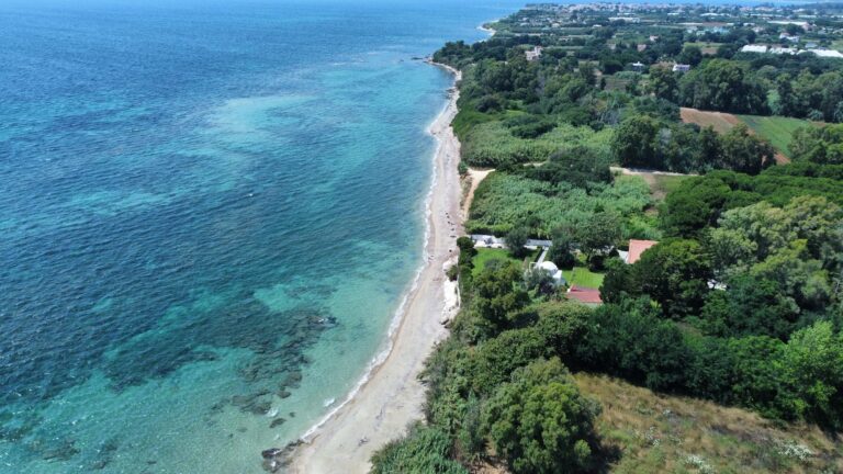
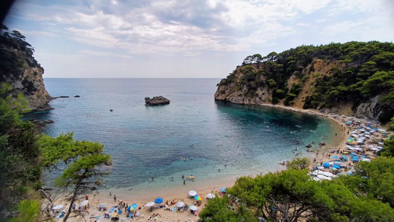
Alonaki beach is one of the most beautiful small coves on the Epirus coast, described consistently in those exact terms across independent sources. It is 24 kilometres from Parga and 30 kilometres from Preveza — equidistant between the two main towns of the region. The beach has a mix of fine sand and small pebbles. A small rocky islet sits in the middle of the bay, approximately 20 metres from the shore. Visitors swim to it and jump from the rocks into the clear water — the specific physical activity that the islet makes possible and that photographs of the beach always show.
Getting There: E55 From Preveza Toward Igoumenitsa, Turn Left After the Acheron Bridge, Valanidorrachi Village, Narrow and Dirt Road, Park Under the Pines
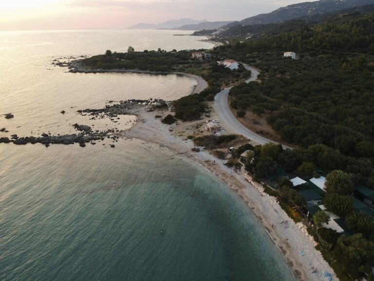
The access road is the primary honest consideration for Alonaki. From the E55 national road between Preveza and Igoumenitsa, turn left after crossing the Acheron River bridge. Follow signs for Alonaki or Fanari. The road passes through the village of Valanidorrachi and then continues for approximately 4 kilometres through pine forest on a narrow and partly dirt road. The final section is specifically described by multiple sources as rough. A standard car manages in dry conditions; the ride is “quite long and harsh” in one independent description. The view through the forest as the road descends toward the sea compensates for the road quality.
Parking is under the pine trees near the beach entrance. From the parking area, a staircase leads down through the trees to the sand — the final descent is on steps. The combination of the rough road, the narrow track through Valanidorrachi, and the staircase at the end makes Alonaki genuinely inaccessible for motorhomes, large campervans, and pushchairs.
From Parga, the drive is 24 kilometres — approximately 30 to 35 minutes including the back-road approach from the E55.
From Preveza, the drive is 30 kilometres — approximately 35 to 40 minutes.
The Beach: Fine Sand and Small Pebbles, Small Islet in the Bay for Jumping, One Canteen, No Umbrellas on Arrival Late, Camping Prohibited
The beach is a mix of fine sand and small pebbles — not the purely sandy beach that Ammoudia provides, but significantly sandier than the pure pebble coves elsewhere on this coast. Water shoes are comfortable for the entry given the rocky patches. The depth increases gradually from the shoreline.
The small islet directly in the middle of the bay is the visual centrepiece and the swimming destination. It is reachable with a 20-metre swim from the shore. The rocks on the islet are suitable for jumping into the water — the activity that makes Alonaki specifically popular with young visitors. Snorkelling around the islet and along the rocky edges of the cove is consistently recommended.
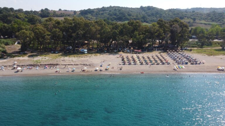
One canteen operates at the beach — not a full bar or restaurant, but a small kiosk that sells drinks, snacks, and rents sunbeds. The number of sunbeds is limited. The consistent visitor advice: arrive early, before 10am, to secure a sunbed. On peak August days the canteen sunbeds are gone by mid-morning. The free area — towels on the pebble and sand — is the alternative.
Camping is prohibited. The area is protected.
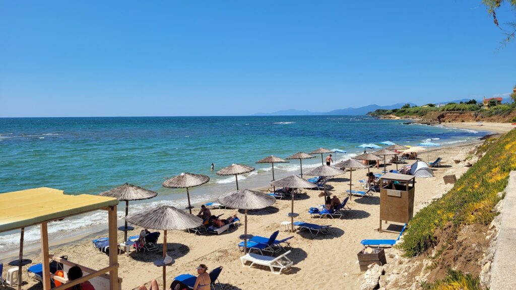
Ammoudia: The Beach 5–8km North, at the Acheron River Mouth, Where Temperature Fluctuations Reveal the River’s Influence
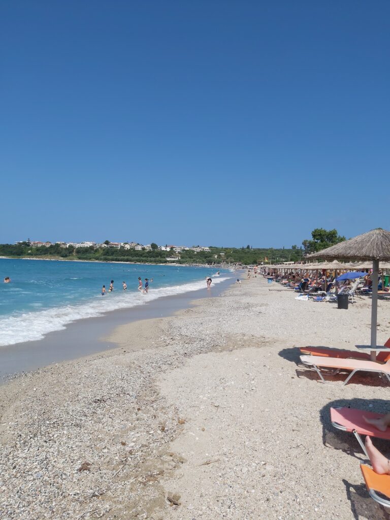
Ammoudia village is 5 to 8 kilometres north of Alonaki, at the point where the Acheron river meets the Ionian Sea. The beach at Ammoudia is wide, sandy, and well-organised — the main family beach for the Fanari area. The specific quality that makes it unusual: sudden temperature fluctuations in the water, where patches of cold river water meet the warmer sea. This is the Acheron’s physical presence in the swimming experience, the river whose mythological identity is the underworld crossing inserting its cold into the summer-warmed Ionian.
The tavernas in Ammoudia village — overlooking the river estuary — are the dining destination for visitors who spend the day at Alonaki. Fresh fish, river-mouth seafood, and the specific atmosphere of a village built where a mythological river meets the sea.
The Acheron: The River of Souls, Kayaking, the Necromanteion, and the Springs
The Acheron river rises in the mountains above Epirus and descends through a gorge before reaching the flat coastal plain and the sea. The river is navigable by kayak and small boat for several kilometres inland from Ammoudia — the kayak tours from Ammoudia follow the route that ancient mythology assigned to the souls of the dead. The Acheron Springs near Glyki village are the upper section, accessible by hiking trail.
The Necromanteion — the oracle of the dead, approximately 3 kilometres from the Acheron estuary — is a site excavated in the 1950s–1960s that revealed an underground chamber, labyrinthine corridors, and a hoist mechanism suggesting the theatrical manipulation of supplicants. Whether it is the site described by Homer and Herodotus as the entrance to the underworld is academically contested; the local tradition is specific and the site is atmospheric regardless.
Necromanteion in the Monolithi Beach Preveza Greece — the 25km EU’s longest sandy beach north of the Preveza entrance, where the same region’s complete archaeological context was introduced. Alonaki adds the specific cove character that Monolithi’s open exposure cannot provide.
Parga: 24km North, the Venetian Castle, Valtos Beach, Lichnos Beach
Parga — the small clifftop town with a Venetian castle, colourful waterfront houses, and beaches on three sides — is 24 kilometres north of Alonaki. The town is the primary tourist base for the Fanari–Parga coast. Visitors staying in Parga use Alonaki as a day trip beach specifically because the cove’s wind protection makes it viable on days when Parga’s more exposed beaches are rough.
Alonaki Beach (Fanariou) near Preveza is the small sandy-and-pebble cove 24km from Parga — the cliffs block wind entirely (calm when Ammoudia is sandstorming), the small rocky islet 20 metres from shore for swimming and jumping, one canteen with limited sunbeds (arrive before 10am in August), fine sand and small pebbles (water shoes comfortable), rough narrow dirt road access through Valanidorrachi (staircase descent, not for motorhomes), camping prohibited, the Acheron river mouth and Ammoudia village 5–8km north, the Necromanteion 3km from the estuary, Parga 24km north, Preveza and Aktio Airport 30–35km south.
Take the E55 exit after the Acheron bridge. Drive through the pine forest. Arrive early. Swim to the islet.

Map
Sorry, no records were found. Please adjust your search criteria and try again.
Sorry, unable to load the Maps API.
Near by places: