Spilies Beach Crete: Monk Seal Caves Near Rethymno


Profile
Spilies Beach (Tou Maliou to Ryaki), Crete: The Mediterranean Monk Seal Cave Beach 15km East of Rethymno, Hidden Behind a Gas Station Sign
Greece | Skaleta | Rethymno Regional Unit, Crete
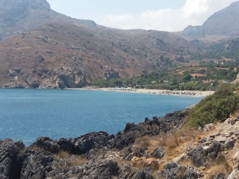
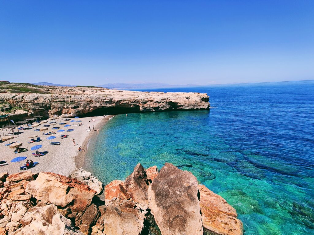
Spilies or “Tou Maliou to Ryaki” (Maliou’s stream) is located 15km east of Rethymno city, in a quiet area, just a few kilometres east of Skaleta and west of Geropotamos. It is quite unknown to most visitors, though it is very close to the highway that connects Heraklion and Rethymno. It is formed in a small rocky bay with a pebbly beach and crystal clear deep waters, protected by vertical cliffs.
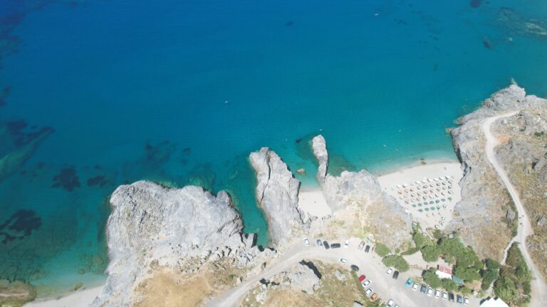
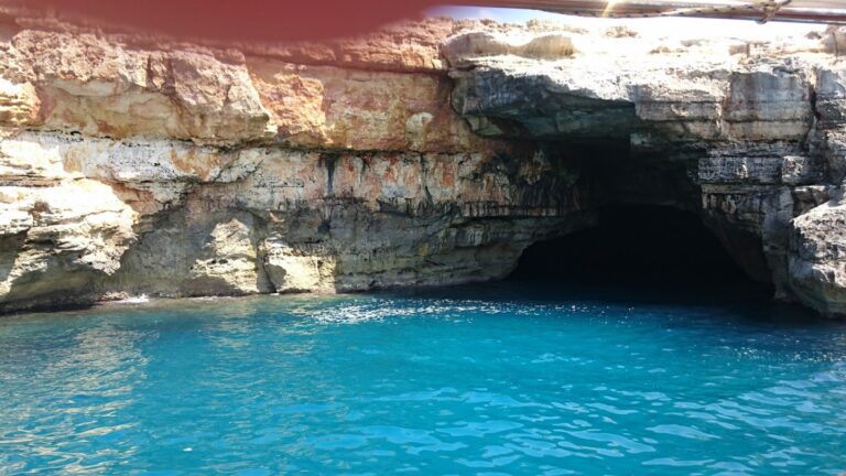
These beautiful cavernous cliffs protecting the west side of the beach are the most recognisable characteristic of the Tou Maliou beach or else called Spilies. There were many caves on the east side of the beach as well, but they collapsed in winter of 2011–2012. Behind the beach, there are more of these caves, where the endangered species of Mediterranean monk seal (Monachus monachus) takes refuge.
The beach is named after the caves. The caves now shelter one of the most endangered marine mammals in the world. The eastern caves that a visitor in 2010 could have swum through collapsed in 2011–2012. The western caves remain. The specific practical note: approaching the cave entrances too closely on the beach sides may disturb the Mediterranean monk seals — the caves are their habitat, not a human recreation infrastructure.
The beach is characterised by pebbles with cliffs that have honey-coloured hues on either side. As the sun moves around during the afternoon, one of these cliffs provides refreshing shade from the intense summer heat.
Getting There: Turn at the Gas Station Sign After Skaleta, Short Road Behind the EKO Station, Limited Parking
To reach the beach from Rethymno, drive on the main road to Heraklion. After Skaleta, you will see “Creta Farm” and after some metres you will see two gas stations on both sides of the road. There is a short road leading to the beach (there is a draft sign to Spilies — ΣΠΗΛΙΕΣ), starting behind the gas station that is located on your left hand. In order not to turn left while on the national road, enter the station on your right and then turn back towards Rethymno.
The gas station navigation instruction is the specific practical direction that every account of Spilies includes — the beach is unmarked on most maps, the sign is described as a “draft” (rough or temporary) sign, and the approach through or behind the gas station is the specific local knowledge required to find it. Without this instruction, most visitors would drive past on the E75 without seeing any indication of the beach below.
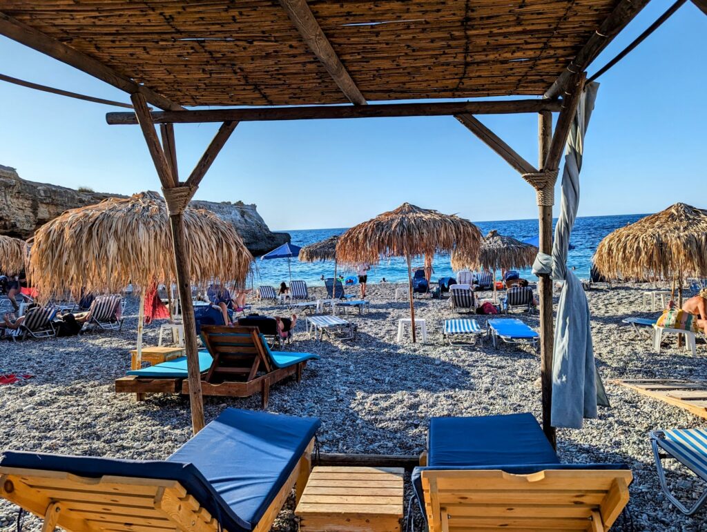
Few umbrellas and sunbeds, showers, coffee, snack, parking. The parking area is small — arriving before 11am in July and August is the consistent advice. From the car park the beach is a short walk down to the water.
The Beach: Pebble, Deep Clear Water, Honey-Coloured Cliffs, North Winds Can Produce Waves
The beach is affected by the north winds.
Though the beach is calm, north winds occasionally create higher waves.
The Cretan Sea north coast is exposed to the Meltemi from the north, and Spilies’ position in the small bay gives partial but not total protection. On high-wind days, the waves arrive and the small beach can become uncomfortable. The morning is the most reliable calm window before the afternoon thermal builds. The pebble beach and the deep, clear water are the conditions that make snorkelling productive here — the pebble and rock seabed sustains the fish habitat that sandy seabeds cannot.
On the beach there are some umbrellas and beds and a small canteen — that’s all!
The minimalism is the honest description: a handful of sunbeds, umbrellas, and a canteen. The beach bar mentioned in some visitor accounts serves basic refreshments and coffee. There are no rows of beach clubs, no music, no jet ski rentals.
The Mediterranean Monk Seal: Why the Caves Matter
A distinguishing feature of the beach is the large cavitation on the east and west, where there are lots of caves with rocks in unique formations. These are the shelters of the endangered Mediterranean monk seal.
The Mediterranean monk seal (Monachus monachus) is one of the rarest pinnipeds in the world — estimates place the total population at approximately 800 individuals. Crete has one of the densest sub-populations. The seals use the sea caves above the waterline as pupping and resting habitat — the caves need to be largely undisturbed for the seals to use them.
The presence of monk seals at Spilies is confirmed by ARCHELON and the MOm (Hellenic Society for the Study and Protection of the Monk Seal). The seals are most likely to be present in the less-visited cave sections. Their presence is the specific reason that approaching cave entrances from the water should be done with caution and distance.
The Eastern Cave Collapse of 2011–2012
A large part of the eastern ones collapsed in 2011.
The eastern cave system — the caves accessible by swimming from the beach’s eastern end — collapsed during the winter of 2011–2012. The rock formation that visitors photographed and swam through in the years before the collapse no longer exists in the same form. The western caves on the cliff face at the beach’s western side remain and are the current snorkelling destination.
The Kamara Beach (Natural Rock Arch): Accessible Only by Boat From Skaleta
Further east there is the impressive Kamara beach (arch), which is accessible only by boat from Skaleta.
A great idea is to explore the rocky shores east of the beach and walk to the amazing natural rocky arch of Geropotamos.
The natural rock arch at Geropotamos — the Kamara — is visible from the cliff walk east of Spilies and accessible by boat from Skaleta. It is the specific geological landmark that makes the stretch of coastline between Skaleta and Geropotamos notable beyond any individual beach. The arch is the dominant photographic subject of the area and the specific destination for the boat tours that depart from Skaleta harbour.
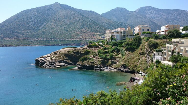
Skaleta and Geropotamos: The Access Points Either Side
Skaleta — a few kilometres west — is the nearest village with a harbour and boat hire for the Kamara arch tour. Geropotamos — to the east — is the river mouth and small resort that marks the eastern boundary of the Spilies beach area.
Spilies Beach (Tou Maliou to Ryaki) in Rethymno, Crete is the honey-cliffed pebble cave beach 15km east of Rethymno — turn at the gas station sign after Creta Farm, short road to the small car park, few sunbeds and a canteen, Mediterranean monk seals in the caves behind the beach (do not disturb the cave entrances), the eastern caves collapsed in 2011, north winds produce waves on windy days, and the Kamara natural rock arch accessible by boat from Skaleta further east.
Drive east from Rethymno. Look for the Creta Farm sign, then the gas stations. The sign for Spilies is behind the one on the left.


Map
Sorry, no records were found. Please adjust your search criteria and try again.
Sorry, unable to load the Maps API.
Near by places: