Koutsounari Long Beach Crete: 5km South Shore

Profile
Koutsounari Long Beach (Long Beach of Agios Ioannis), Crete: The 5km Grey Sand Shore East of Ierapetra Where the Sand Underfoot in the Sea Is Fine but the Shore Exit Is Dry Pebbles, and Roman Fish Tanks Are Carved Into the Rocks 2.5km East
Greece | Koutsounari | Ierapetra, Lassithi, South Crete
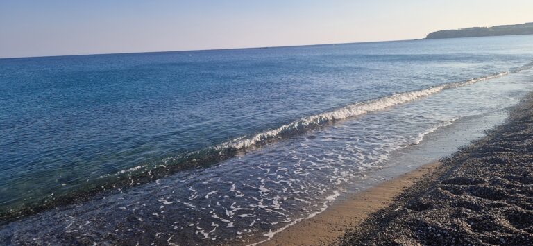
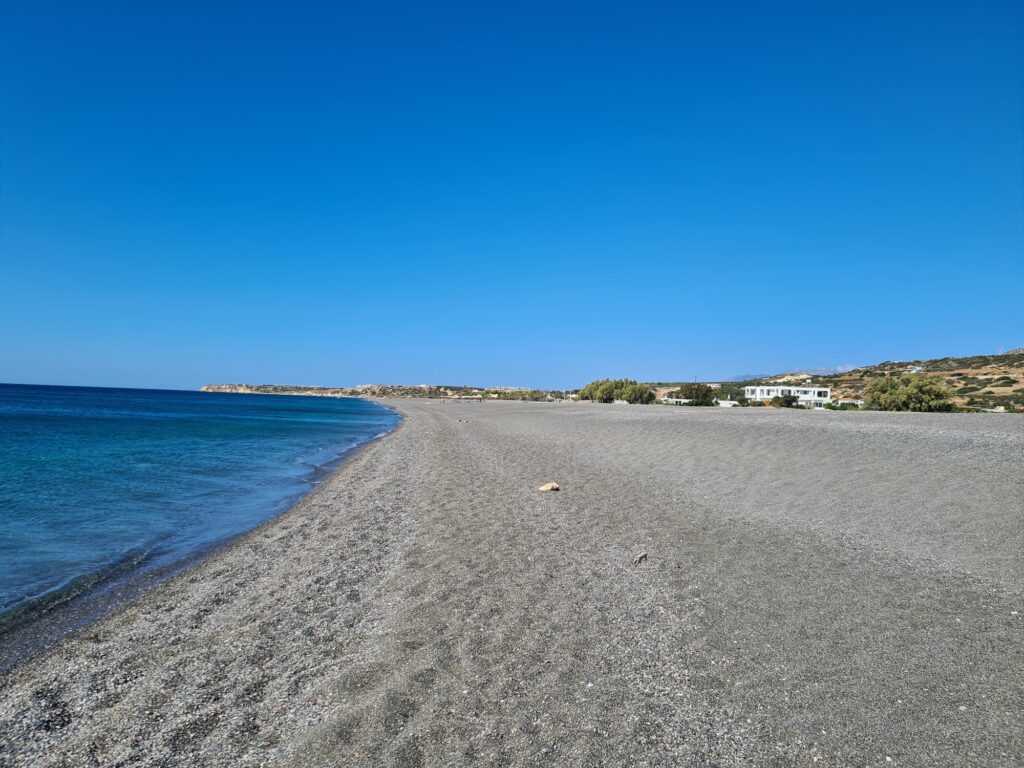
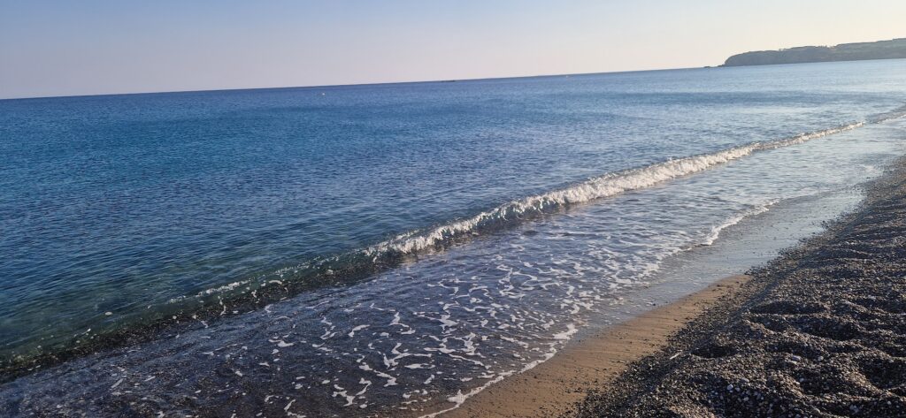
The sand at Koutsounari Long Beach has a specific texture that takes some visitors by surprise. Walking on the shore, the surface is coarse grey pebbles and gritty grey sand — unremarkable, even rough. Walking into the sea, the seabed transitions to fine sand, which is easy and smooth underfoot. And when you come back out of the water, your feet are clean and dry within a few steps, because you are back on the pebbles again. This combination — fine sand in the sea, dry pebble exit — is noted specifically by repeat visitors as a genuinely pleasant quality that most grey-sand beaches don’t replicate.
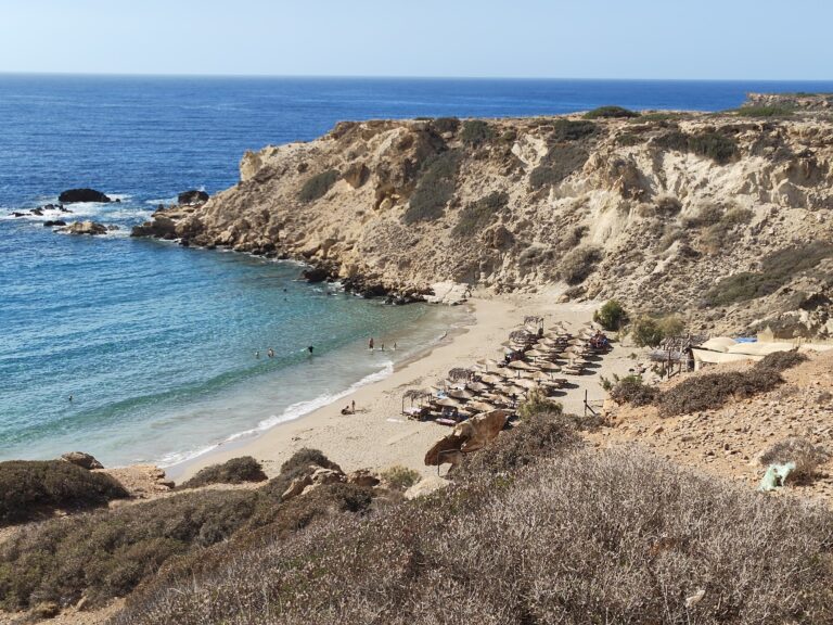
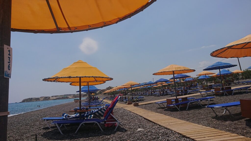
Koutsounari Long Beach is officially the Long Beach of Agios Ioannis — a 5-kilometre stretch of coarse grey sand running along the south Cretan coast, backed by tamarisk trees at intervals and by hotels, restaurants, mini-markets, and a camping site concentrated in the central and western sections. The eastern section becomes progressively quieter as you walk; by the time you reach the bay of Psaropoula at the far end, named after the taverna that gave the bay its local name, the visitor density has reduced to the handful of people who walked the full length.
The beach is 6 kilometres east of Ierapetra — the southernmost town in Europe, a significant geographical fact that the greenhouse-belt landscape around it makes tangible. The plastic greenhouse tunnels visible from the road between Ierapetra and Koutsounari are the agricultural reality behind Ierapetra’s status as a major exporter of tomatoes, cucumbers, and other vegetables to northern Europe during winter. In summer, when the greenhouses are empty, the beach is the alternative economy.
Getting There: 6km East of Ierapetra on the Main South Coast Road, Multiple Beach Access Points, Free Parking
From Ierapetra, drive east on the main coast road toward Sitia. After 6 kilometres, signs for Koutsounari village appear. The village is 1 kilometre inland from the beach; the road continues south to the coast. Multiple access points exist along the 5-kilometre stretch, with free parking behind the beach at each one. The most straightforward access for a first visit is at the western end near the main hotel cluster.
From Agios Nikolaos, the drive south and east takes approximately 45 to 50 minutes — 43 kilometres via the mountain road through the Thrypti range, or slightly longer via the coast road through Ierapetra. From Heraklion Airport, allow approximately 2 hours.
By bus, the KTEL service between Ierapetra and Sitia stops at Koutsounari and the neighbouring villages of Ferma and Makrigialos. The frequency is moderate in summer.
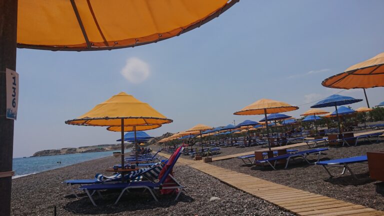
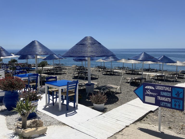
The Beach: 5km Long, Coarse Grey Sand Shore, Fine Sand Seabed, Tamarisk Shade, Organised in Parts, Wild at the Eastern End
Five kilometres is enough length that even on a full August day the beach feels spacious — the 2018 population of Koutsounari village is under 300, and the surrounding settlements generate limited local beach traffic. The organised sections with sunbeds and umbrellas concentrate near the hotels and restaurants in the western half. The eastern half thins out progressively. Walking the full 5 kilometres east is a specific beach activity that takes approximately 1 hour at a moderate pace, with the landscape becoming increasingly quieter and more wild with each kilometre.
The tamarisk trees provide the specific natural shade feature that distinguishes Koutsounari from the open, exposed long beaches on the north coast. Several tamarisks are large enough to give full tree shade — the kind of shade that makes midday sun endurable without an umbrella. The trees are irregular in spacing but consistent enough that shade-seeking visitors can always find a position under them.
Water shoes are recommended for the shore entry and exit due to the pebble texture, though once in the sea the fine sandy seabed means they are not needed for swimming.
The Roman Fish Farming Tanks: 2.5km East, Carved Into Coastal Rocks, Not on Most Tourist Maps
Two and a half kilometres east of the beach, coastal rocks have been carved into rectangular tanks that date to the Roman period — fish farming installations used to cultivate fish in controlled seawater environments. They are carved directly into the rock at the waterline, and accessing them requires descending from the road on rough rocky paths. Comfortable shoes are necessary.
The tanks are not widely promoted on tourist maps and appear on very few mainstream Crete guides. This is the specific type of off-the-path archaeological detail that a visitor walking the full eastern length of Koutsounari beach, or driving a few kilometres further east, can find with minimal planning. The site is free, unattended, and genuinely unusual — fish aquaculture in carved stone tanks is a Roman practice recorded across the Mediterranean, but the examples at Koutsounari are among the less-publicised in Crete.
Psaropoula: The Bay at the East End, Named After a Taverna, Recommended for Seafood
At the eastern end of the Koutsounari long beach, the coast forms a small bay called Psaropoula — named after the old local taverna of the same name that gave it its identity. The taverna is consistently recommended for seafood by visitors who walked far enough east to find it. The Kakkos Bay Hotel at this end has a second beach entrance and car park, making Psaropoula accessible by car rather than only by walking the full 5 kilometres along the shore.
Mylonas Waterfall: 7.4km North, Pine Forest Trail, Best After Rainy Periods
The Mylonas Waterfall is in the hills north of Koutsounari, 7.4 kilometres from the beach by road. A hiking trail through pine forest and rocky terrain reaches the waterfall at the base of a cliff, where it falls into a small pool suitable for a cold swim. The trail is moderate rather than easy — appropriate footwear and water are necessary. The flow is strongest in spring and after rain; in dry summer conditions the cascade reduces but the setting remains worth the walk.
Ierapetra: The Southernmost Town in Europe, 6km West
Ierapetra is the southernmost city in Europe at 35°N latitude — further south than Tunis. It has a Venetian castle, a small archaeological museum, the old town with a Turkish fountain (the Ntambakia fountain) and a mosque from the Ottoman period, and the specific claim to having the most sunshine hours of any city in Europe — an average of 3,300 hours annually. It is also the jumping-off point for the small island of Chryssi (also called Gaidouronisi) — a protected uninhabited island with cedar forest and excellent beaches, accessible by ferry in 30 minutes.
From Koutsounari beach, Ierapetra is 6 kilometres west — a 10-minute drive. The combination of a Koutsounari morning swim and an afternoon boat trip from Ierapetra to Chryssi island is the natural south Lassithi day programme.
Koutsounari Long Beach (officially Long Beach of Agios Ioannis) in south Crete is a 5-kilometre grey sand shore 6 kilometres east of Ierapetra — coarse pebbles on the shore but fine sand in the sea (your feet come out dry and clean), tamarisk tree shade at intervals, organised sections at the western end and progressively wild toward the east, the Psaropoula seafood bay at the far east end, the Roman fish farming tanks carved into rocks 2.5km east (not on most tourist maps), the Mylonas Waterfall 7.4km north by trail, free parking at multiple access points, the southernmost city in Europe 6 kilometres west, and the Chryssi island ferry from Ierapetra as the afternoon option.
Drive east from Ierapetra. Park at the western end. Walk east toward the quiet.

Map
Sorry, no records were found. Please adjust your search criteria and try again.
Sorry, unable to load the Maps API.
Near by places: