Primorsko South Beach: Devil's Bay Shallow Family Shore
Profile
Primorsko South Beach (Devil’s Bay), Bulgaria: The 2.5km Shallow Family Bay Where the Town Was Named After the Bridge, and the River Sometimes Muddies the Water
Bulgaria | Primorsko | Burgas Province, Southern Black Sea Coast
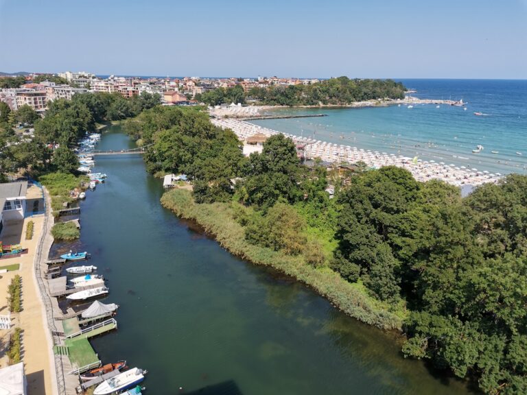
The town was not always called Primorsko. From its founding in 1879 until 1934, it was called Kyupria — from the Turkish köprü meaning bridge. The name came from the old wooden bridge crossing the Dyavolska (Devil’s) River on the main coastal road connecting Pomorie and Sozopol with Constantinople. The bridge was the defining landmark of the settlement before the town name was changed to the more Bulgarian-sounding Primorsko (Seaside) in 1934.
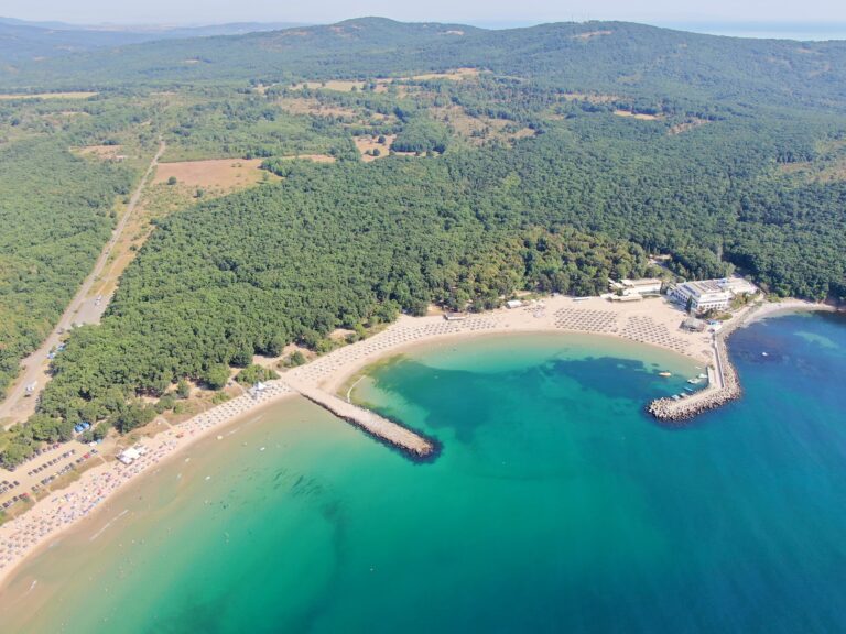
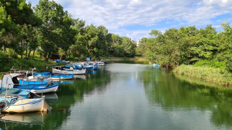
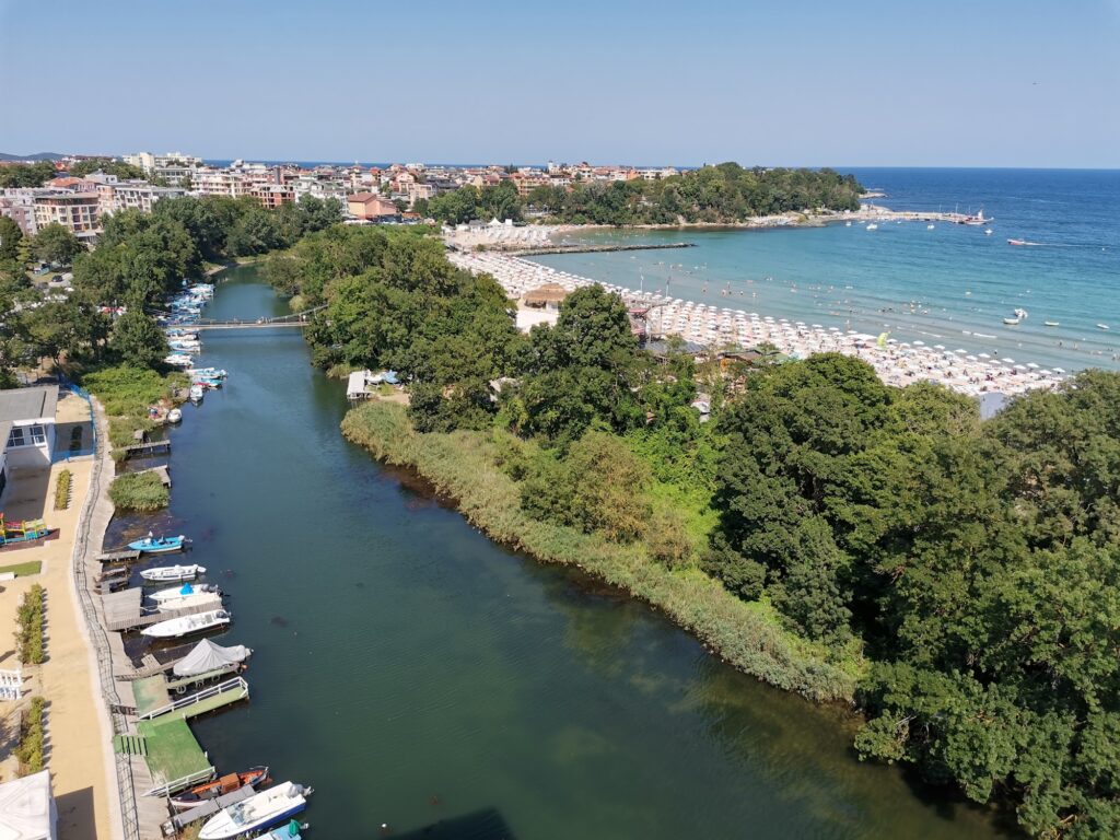
The Dyavolska reka (Devil’s River) is a 37-kilometre river originating in the Strandzha mountains, running near Primorsko, and flowing into the Black Sea at the northern end of the south beach. The Dyavolsko Blato (Devil’s Swamp) is the marshy area in the river’s middle course that gave both the river and the bay their names — only the Devil could survive in the bogs and reeds, as the locals used to say.
The honest water quality note: due to the Devil’s River, which flows into the Black Sea in the northern part of the beach, the water is sometimes muddy. The northern end near the river mouth is the section to avoid on days when the river is running strongly after rain. The southern sections of the beach, away from the river mouth, are consistently clean.
Getting There: 10-Minute Walk From Town Centre, Pedestrian Bridge Over the Dyavolska River, Car to Paid Parking, Tourist Shuttle Train
From Primorsko town centre, the south beach is a 10-minute walk that includes crossing the small pedestrian bridge over the Dyavolska River. The bridge is the specific crossing point that separates the town side from the beach side — a short suspension or fixed bridge over the river mouth that visitors cross on foot.
By car, follow signs into Primorsko and navigate toward the southern district. Paid municipal parking and street parking are available directly behind the resort boundary.
The tourist shuttle train operates on a continuous loop connecting major hotels, the International Youth Centre (MMC), and the beach entrance throughout the day.
From Burgas Airport (60 kilometres), regular buses run to the Primorsko central bus station, which is within walking distance of the south beach.
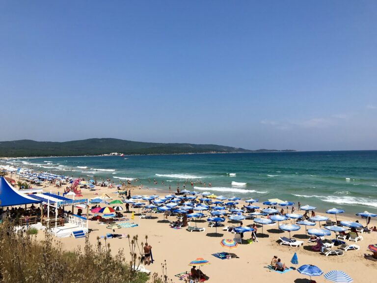
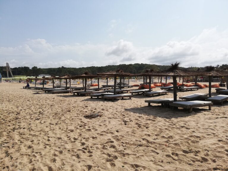
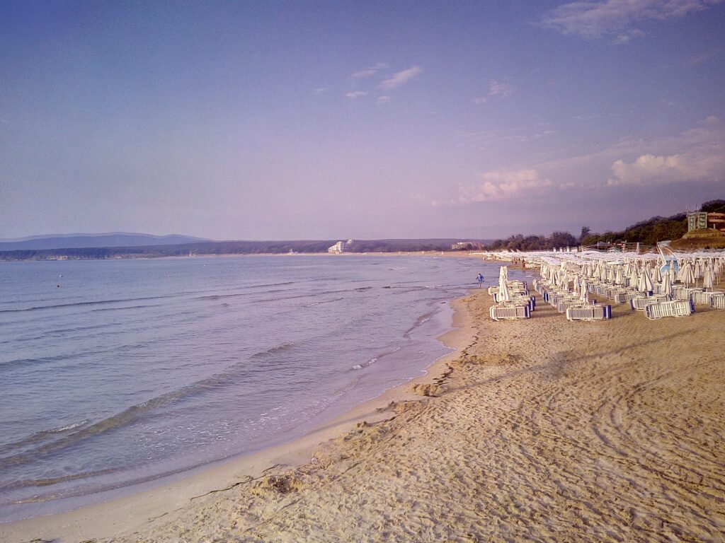
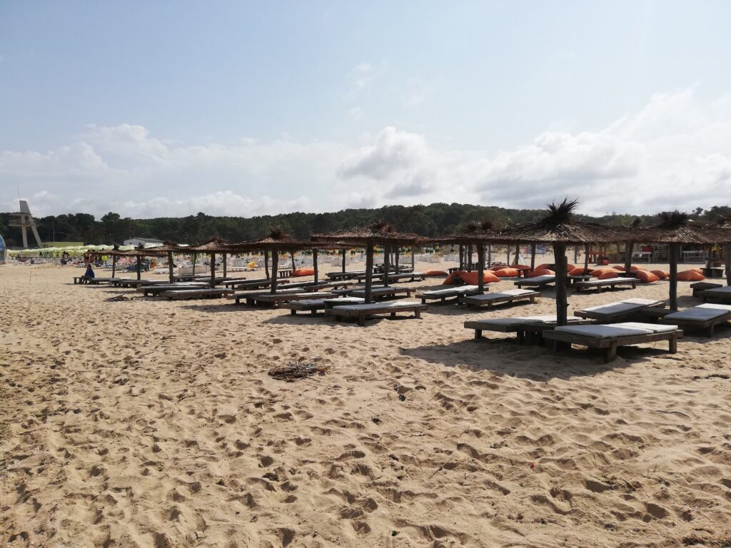
The Beach: 2.5km, Shallow, Dunes, Golden Coarse Sand, River Mouth Muddy on Occasion, Overcrowded in Peak Season
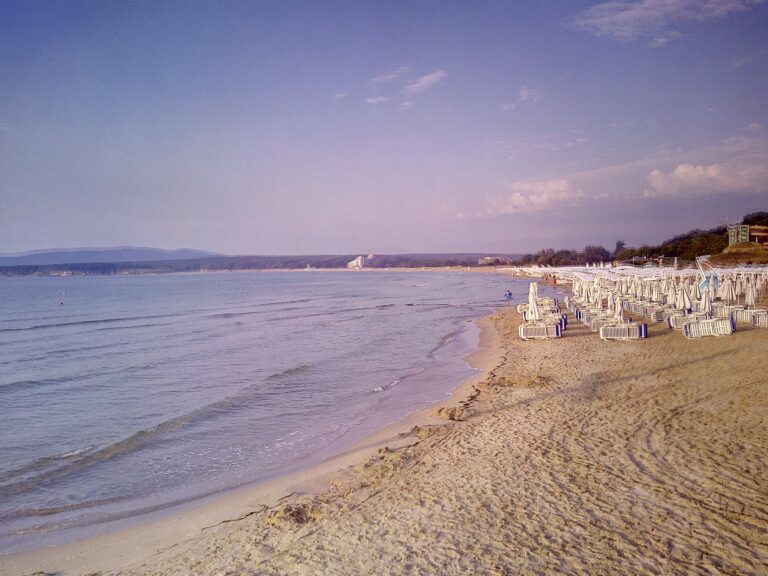
The coastline is very beautiful, almost 2.5 km long and characterised by its many dunes. The sand is golden and coarse but very clean.
The beach is next to the centre of the town and for this reason often overcrowded. Sufficient room for beach volleyball or football is lacking, as the strip is full of tourists and respectively with parasols and chaise lounges.
The overcrowding is the honest peak-season reality — the south beach is the most accessible of Primorsko’s four beaches, and its closeness to the centre means day visitors who arrive without cars use it by default. July and August are the specific months when the beach reaches capacity. Arriving early (before 10am) or later in the afternoon (after 4pm) is the practical strategy.
Guarded by the peninsula, the southern beach has much calmer waters, making it suitable for family vacations with small children. The shore is gently sloping and shallow, the seabed is covered with fine sand.
The calm water is the primary family quality — the Diavolski Zaliv (Devil’s Bay) is the sheltered bay of the Primorsko peninsula, protected from the open sea swell that gives the north beach its wave character. The difference between the two Primorsko beaches is significant: the south is the calm, shallow, family bay; the north is the open, wave-active, sports beach.
The International Youth Centre (MMC) at the Southern End
The International Youth Centre Primorsko (MMC) is at the southern end of the beach. The MMC was established during the socialist period as a youth facility and still operates as a youth and conference centre. Bungalow accommodation is available behind the beach in the MMC zone. The MMC is the specific southern anchor of the south beach — the point where the beach ends and the Kiten direction begins.
The Devil’s Swamp and the Snake Island
The Dyavolsko Blato (Devil’s Swamp) that gave the river, the bay, and the original town name their character is the marshy wetland behind the beach’s northern section. The swamp habitat is wildlife-rich — the reed beds and bogs that the original settlers found only the Devil could navigate.
Snake Island (also known as St. Thomas Island) is visible from the south beach — a tiny island 1 kilometre offshore. The tiny island is part of the Ropotamo Reserve and was named after the large number of water snakes inhabiting it.
The Yacht Harbour and Cape Maslen Nos Boat Trips
On the northern side of South Beach, there are a yacht harbour, fishing boats, and a lighthouse. From here, yachts go for a trip to Cape “Maslen nos”. During this trip, you can see “The seal’s cave”, fjord bays, and visit the wild bay “St.”
The yacht harbour at the northern end of the south beach — adjacent to the Dyavolska River mouth — offers boat trips to Cape Maslen Nos (the headland south of Primorsko) and the wild bays visible from the sea but inaccessible by land.
Primorsko South Beach (Devil’s Bay) in Bulgaria is the 2.5-kilometre shallow family bay where the town was called Kyupria (bridge) until 1934 — the pedestrian bridge crossing the Dyavolska River still in use for beach access, water sometimes muddy near the northern river mouth (use the southern sections), 10 minutes on foot from the centre, overcrowded in July and August (arrive early or late afternoon), the MMC International Youth Centre at the southern end, Snake Island visible offshore, and Aqua Planet water park nearby.
Cross the bridge. Use the southern end of the beach. Watch Snake Island from the water.

Map
Sorry, no records were found. Please adjust your search criteria and try again.
Sorry, unable to load the Maps API.
Near by places: