Ammoudia Beach Preveza: Acheron Mouth, Oracle of Dead

Profile
Ammoudia Beach, Preveza: The Mouth of the Acheron, Where Ancient Greeks Believed Souls Crossed to the Underworld, the Nekromanteion Stands 4km Away, and the Village Was Rebuilt After Wartime Destruction
Greece | Ammoudia | Fanari Municipal Unit, Parga Municipality, Preveza, Epirus
The Acheron disappears underground for sections of its course through the Epirus mountains before re-emerging near Ammoudia and meeting the sea. Ancient Greeks identified this specific stretch of dark gorge and disappearing water as the earthly entrance to the Underworld — the river that Charon ferried souls across to reach Hades, distinct from the Styx (river of hatred) and the Lethe (river of forgetting) among the five rivers of the dead that Hesiod catalogued in the Theogony. Heracles was said to have descended through this landscape to drag Cerberus up from Hades; Orpheus took the same route searching for Eurydice. The river’s genuinely ominous topography — dark canyons, sections where the water vanishes and reappears, the specific atmosphere of the gorge upstream — gave the mythology its plausibility long before anyone wrote it down.
Four kilometres west of Ammoudia, at the village of Mesopotamos, the Nekromanteion — the Oracle of the Dead — was built directly on the belief that this was where the living could consult the deceased. Ancient visitors underwent ritual preparation before descending into underground chambers believed to simulate the passage to Hades itself, consulting oracles who claimed to channel the voices of the departed. The site’s authenticity as a genuine Necromanteion rather than a later structure has been debated by archaeologists, but its connection to the Acheron’s mythology is undisputed and it remains one of the most specific and unusual archaeological sites in Greece.
Before 1928, the village was called Splantza — a name surviving in Albanian as Spllancë, reflecting the fact that into the 1960s, researchers compiling reports for the Hellenic Folklore Research Centre found that most residents spoke Albanian and had limited knowledge of Greek. Splantza was a working commercial harbour until 1950, its position at the river mouth making it a natural trading point for centuries before tourism arrived. During the Ottoman period, the village was the site of fighting remembered locally as “Splantza’s War,” in which Kyriakoulis Mavromichalis — a Mani chieftain from the same Mavromichalis family covered elsewhere in this series at Limeni — fought.
The village’s more recent history includes genuine hardship: during the Axis occupation of Greece in the Second World War, German forces burned Splantza, and the population was displaced for approximately five years before returning to rebuild under the name Ammoudia. The wider region of Thesprotia and Preveza experienced a documented campaign of violence against the civilian population during this period, carried out by German forces working with local Cham Albanian paramilitary units; Ammoudia was among the villages affected by an armed operation in August 1943. This history, while sobering, is a genuine part of the area’s 20th-century experience and is acknowledged in the local record alongside the village’s longer mythological and commercial past.
Getting There: 17km From Parga (20–25 Minutes), Boat Excursions From Parga Harbour in Summer, 15km From the Kanalaki Bus Station
From Parga, follow the national road south toward Preveza and take the marked exit for Ammoudia/Acheron. The drive covers approximately 17 kilometres, taking 20 to 25 minutes. During summer, small excursion boats run daily from Parga harbour directly to the Acheron river mouth, typically allowing several hours of swim time at Ammoudia before the return crossing.
Without a private car, the Kanalaki bus station is approximately 15 kilometres away, with local transport options connecting onward. Aktio Airport near Preveza is approximately 50 kilometres distant; travellers arriving via Corfu face a ferry crossing to Igoumenitsa followed by a further 55-kilometre drive.
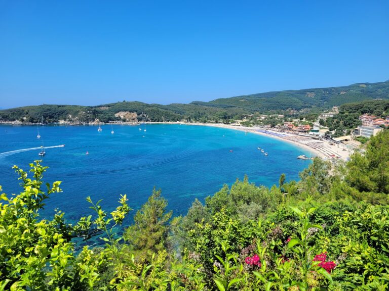
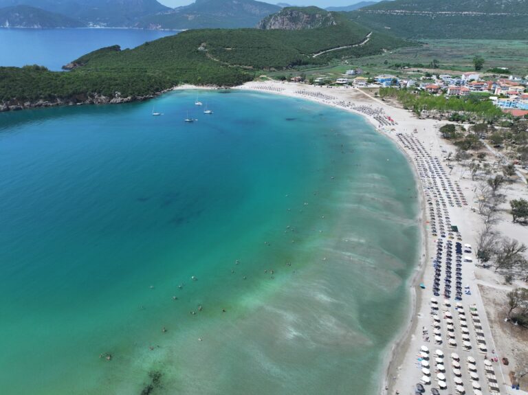
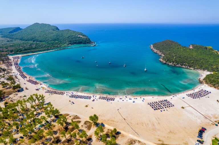
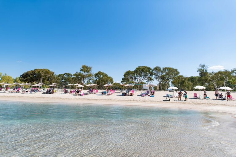
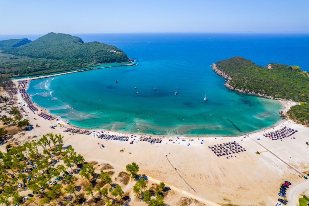
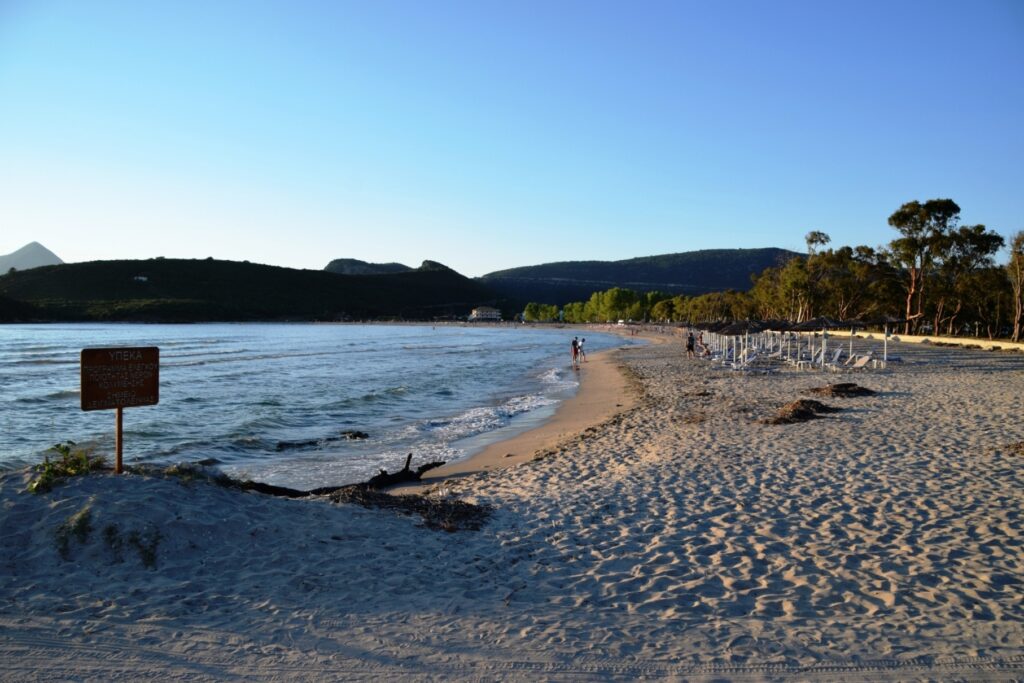
The Beach: Fine Golden-White Sand, Knee-Deep for 100 Metres, Acheron Freshwater Mixing With the Sea, Plane Tree Shade in the Village
Ammoudia’s beach is fine sand — true to the name, which derives from ammos, the Greek word for sand — running in a wide semicircular bay protected by limestone headlands on both sides. The descent into the water is exceptionally gradual: walking out nearly 100 metres while the water remains at knee depth is the specific, well-documented quality that makes this one of the safest beaches in the Preveza prefecture for young children and nervous swimmers.
The Acheron’s freshwater inflow creates a measurable effect on the sea near the river mouth — slightly cooler, slightly less saline than typical Mediterranean water, producing the crisp quality that distinguishes a swim here from a swim at a beach with no river input. Massive plane trees shade the village tavernas directly behind the beach, where fresh seafood and traditional Epirus meat dishes are served.
Boat and Kayak Trips Up the Acheron: Reed Beds, Birdwatching, the Gorge Toward Glyki
Kayak and canoe rentals at the river mouth allow visitors to paddle upstream into the reed-filled delta — a wetland environment specifically protected for its ecological value, rich in birdlife and a genuine draw for photographers. Further upstream, guided boat trips explore the narrower stretches of the river, and the Acheron Springs at Glyki, considerably further inland, offer the dramatic gorge swimming and rafting that the river’s mythological reputation has made into a specific outdoor-adventure destination in its own right. Skala Beach Parga Greece sits on the same coastal stretch a short distance north, sharing the same proximity to the river mouth and its boat excursions.
Nikopolis and Ancient Kassopi: Roman and Hellenistic Sites Within Range
Nikopolis, founded by Octavian (Augustus) in 31 BC to commemorate his victory at Actium, lies approximately 40 kilometres from Ammoudia near Preveza — its odeon, Roman theatre, and city walls substantial enough to occupy a half-day visit. Ancient Kassopi, a major Hellenistic centre on a plateau 555 metres above sea level south of Zalongo, is a similar distance away, its walls, paved paths, and stone theatre offering the elevated coastal views that hilltop ancient cities in this region consistently deliver. The Zalongo Monument, mentioned in connection with nearby Kastrosykia Beach Preveza Greece is on the same inland route.
Ammoudia Beach in Preveza sits at the mouth of the Acheron — the river ancient Greeks believed carried souls to the Underworld, with the Nekromanteion (Oracle of the Dead) 4km away at Mesopotamos. Formerly called Splantza, a working commercial harbour until 1950, with a documented history of Ottoman-era conflict and 20th-century wartime destruction and displacement before the village rebuilt. Fine sand, knee-deep water for nearly 100 metres, the Acheron’s freshwater mixing with the sea, plane tree shade, kayak and boat trips upriver into the reed delta, Skala beach nearby, Nikopolis and Ancient Kassopi roughly 40km inland, 17km from Parga (20–25 minutes), boat excursions from Parga harbour in summer.
Drive south from Parga, or take the summer boat from the harbour. Swim in the shallow bay. Paddle upriver into the reeds before you leave.


Map
Sorry, no records were found. Please adjust your search criteria and try again.
Sorry, unable to load the Maps API.
Near by places: