Kalamata City Beach: 2.5km, Two Blue Flags, Taygetos

Profile
Kalamata City Beach (Paralia Kalamatas): The 2.5km Eastern Shore With Two Blue Flags and Seatrac Access for Every Visitor, Where Mount Taygetos Watches Over Every Swim
Greece | Kalamata | Kalamata Municipality, Messenia, Peloponnese
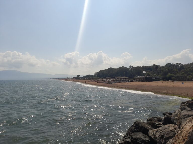
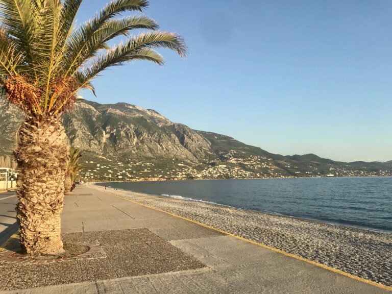
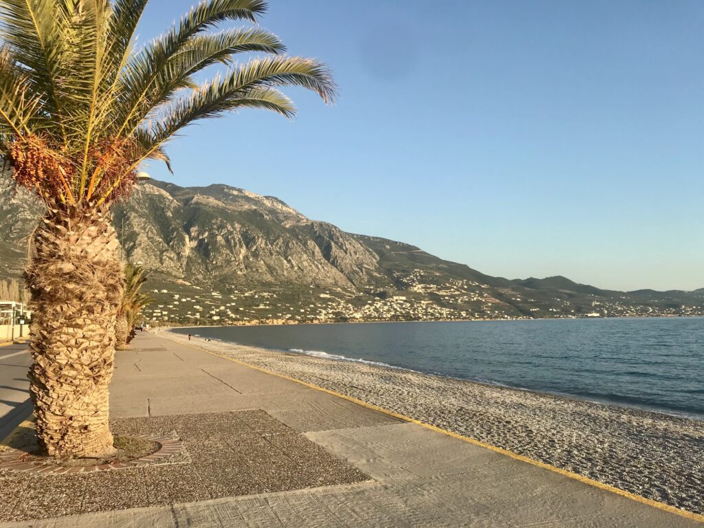
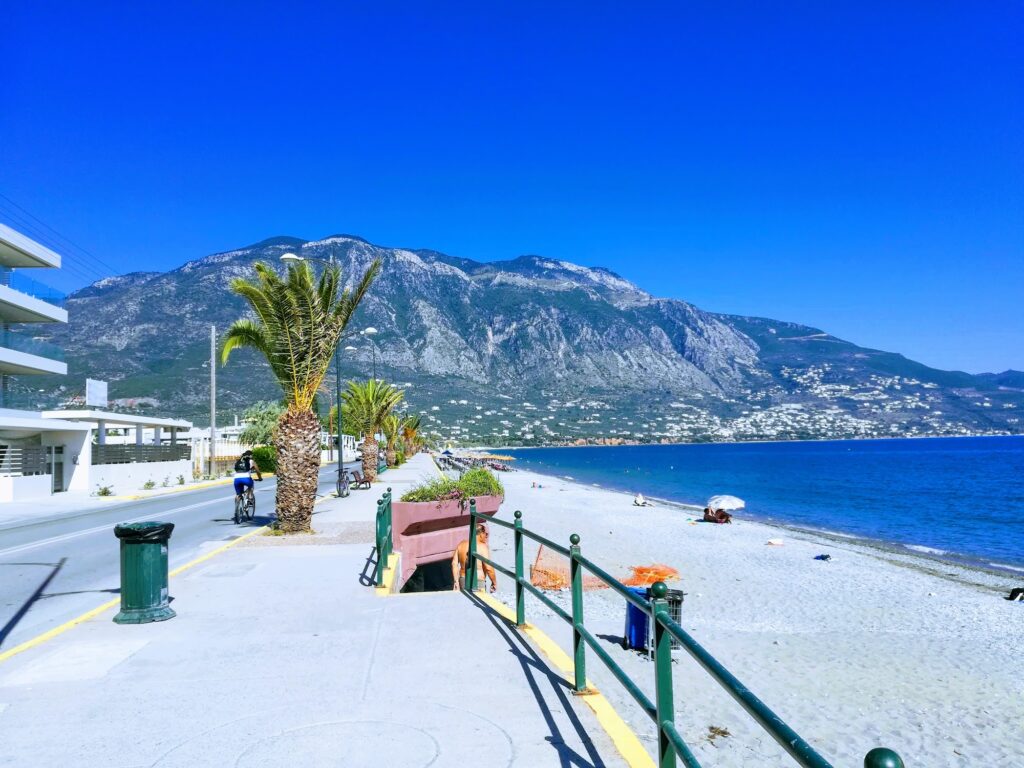
Mount Taygetos is visible from every point of the Kalamata city beach — turning around mid-swim delivers the mountain rising behind the city, 2,407 metres at its highest point, the same range that the Mani peninsula descends from to the south. The beach runs 2.5 kilometres along Navarinou Street, the eastern waterfront of the city, and the mountain backdrop is the constant visual that distinguishes a swim here from a swim at any equivalent city beach without a mountain range standing directly behind it.
Kalamata’s port was inaugurated in 1901 and drove the city’s expansion from the hilltop castle down toward the sea — the urban development pattern that placed the modern beachfront where it now sits, a deliberate consequence of 19th-century commercial growth rather than an accident of geography. The eastern beach along Navarinou holds two Blue Flag awards — one at the Anastasi area, one at the far end of Navarino beach — both recognising water quality and safety standards maintained despite the beach’s position within a residential and commercial city zone.
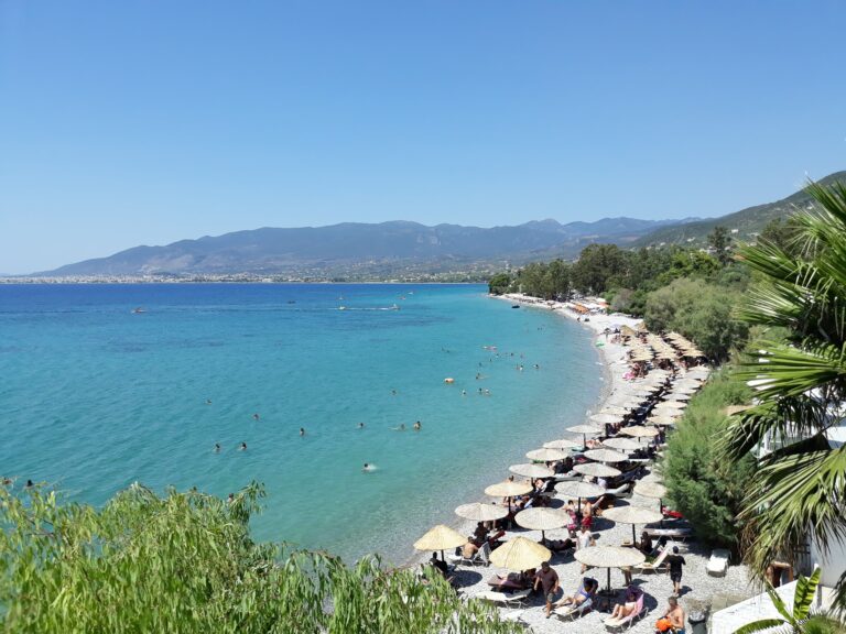
The shore is a mixture of dark sand and fine pebbles characteristic of this part of Messenia. The water is crystal clear and warms quickly at the start of the season — swimmers report comfortable temperatures from May. Seatrac installations have been placed on the eastern beach, providing autonomous sea access for visitors with disabilities and reduced mobility — a specific accessibility feature that distinguishes Kalamata’s beach infrastructure from many comparable Greek city beaches.
Getting There: 10–20 Minutes’ Walk From the Central Square, 5 Minutes From the Harbour District, Bus Line 1 Along Navarinou Street, Parking Before 11am in Peak Season
From Kalamata’s central square, the eastern beach is a 10 to 20-minute walk. From the harbour district, it is closer — approximately 5 minutes. Bus Line 1 runs from the city centre directly along the beach road on Navarinou Street, stopping at intervals along the full 2.5km stretch.
By car, Navarinou Street has extensive street parking, though arriving before 11:00am in July and August is recommended to secure shaded spots — the practical advice that every account of summer parking in Kalamata repeats.
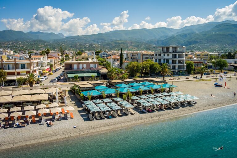
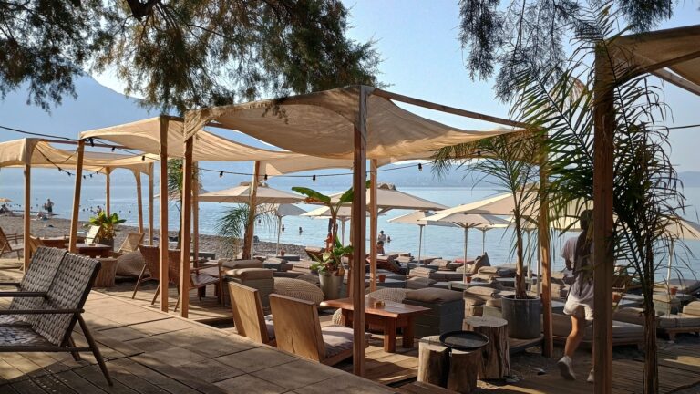
The Eastern Beach: 2.5km, Two Blue Flags, Seatrac Access, Sunbeds Often Included With a Drink Purchase, Amusement Park, Hotels and Tavernas Along the Strip
The eastern beach has everything a city beach of this scale develops: large hotel complexes, busy beach bars, tavernas and ouzo bars, water sports rental points, and an amusement park section. The specific local note from visitors who know the beach well: many beach bars do not charge separately for sunbeds — purchasing something from the bar (a coffee, a drink) often grants extended use of the seating, the informal arrangement that makes a day at Kalamata beach more affordable than the consumption-model beaches elsewhere on this coast.
Water sports — pedalos, kayaking, paddleboarding — operate from rental points along the strip. The depth increases steadily and predictably, comfortable for both confident swimmers and families.
Kordias (Western Beach): 1.5km West of the Port, Fine Pebbles and Sand, Two Stone Breakwaters, Also Seatrac-Equipped
Kordias, the western beach, sits 1.5 kilometres west of the port — a different character from the eastern strip, with fine pebbles mixed with sand, two stone breakwaters extending into the sea, and views across the Messinian Gulf. It is organised and also equipped with a seatrac installation, extending the disability access that the eastern beach pioneered to the western side of the city.
The Castle: 13th Century, Byzantine Begun, Frankish Finished, Above the Old Town
The Kalamata Castle — begun by the Byzantines and completed by the Franks in the 13th century — overlooks the city from the hilltop, the bird’s-eye view from its walls taking in the rooftops, the port, the beach, and Taygetos simultaneously. The walk from the beach through the Old Town to the castle passes architectural layers from German classicism, Italian Renaissance, Athenian neoclassicism, and Venetian elements — the accumulated styles of a city that was rebuilt repeatedly through its post-earthquake and post-war history.
For the broader Kalamata beach context, we covered Almiros Beach Kalamata Greece (6km east, named Verga after the 1826 Maniot barricade against Ibrahim Pasha) and Sadova Beach Avia Greece (12km south toward the Mani, the only sandy beach in its immediate area).
Kalamata City Beach is the 2.5km eastern shore along Navarinou Street — two Blue Flags (Anastasi and the Navarino end), seatrac disability access, Mount Taygetos visible behind every swim, dark sand and fine pebbles, crystal clear water warming early in the season, hotels, beach bars, tavernas, amusement park, often-included sunbeds with a drink purchase, Kordias western beach 1.5km from the port (fine pebbles, two breakwaters, also seatrac-equipped), the 13th-century Byzantine-Frankish castle above the old town, 10–20 minutes’ walk from the central square, Almiros 6km east, Sadova 12km south.
Walk from the centre. Swim with Taygetos behind you. Climb to the castle for the city view.


Map
Sorry, no records were found. Please adjust your search criteria and try again.
Sorry, unable to load the Maps API.
Near by places: