Ai-Lagoudis Beach Kyparissia: Castle, Pausanias, Troy


Profile
Ai-Lagoudis Beach, Kyparissia: The Town Beach Pausanias Mentioned as the Dionysas Spring, Below the Castle Where the Last Frank of the Peloponnese Died in 1432 and Which Homer’s Nestor Sent 11 Ships From to Troy
Greece | Kyparissia | Trifylia Municipality, Messenia, Peloponnese
Pausanias noted the Dionysas spring on the Kyparissia waterfront during his 2nd-century AD travels — the source that VisitPeloponnese and the castle’s own documentation identify as the current Ai Lagoudis beach site. Whether the spring still surfaces or has been absorbed into the coastal development is less important than what it confirms: this beach has been a documented waterfront site since antiquity, visited and recorded by the most thorough geographical writer of the ancient Greek world.
Homer’s Iliad records that Kyparissia belonged to the kingdom of Nestor — the king of Pylos, the oldest and most experienced of the Greek commanders at Troy — and sent 11 ships to the expedition. The town on the hill above the beach has been inhabited continuously since the 2nd millennium BC. On the narrow summit of the hill behind the modern town, the ancient acropolis was followed by a Byzantine fortress, which was followed by the Frankish castle known as the Castle of Giants — named for the enormous blocks of stone the ancient builders used, four metres long and nearly two metres wide, which successive generations interpreted as the work of supernatural beings.
The castle was the last Frankish territory in the Peloponnese. After the Frankish Morea progressively fell to the Byzantine Despotate through the 1420s and early 1430s, Kyparissia (then called Arcadia — the town had taken the name from the mountain Arcadians who relocated to the coast) was the final holdout. The last Frankish prince, Centurione II Zaccaria, died in 1432 and his castle passed to the Byzantine Despot — ending 227 years of Frankish rule in the Peloponnese. Ibrahim Pasha burned the town in 1825 during the Greek War of Independence; when rebuilt, it recovered its ancient name.
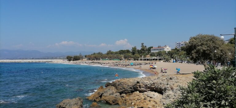
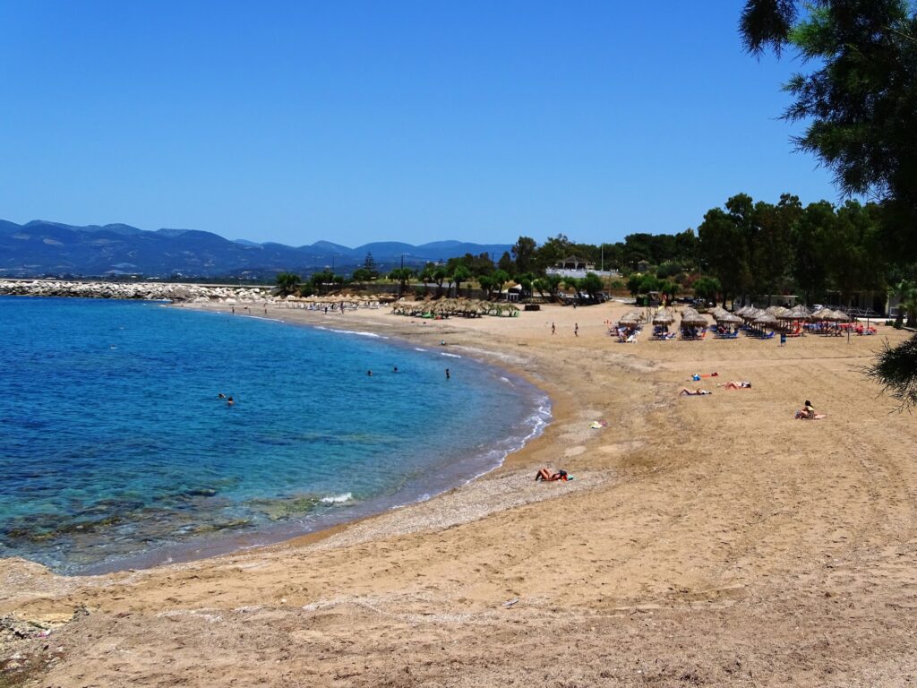
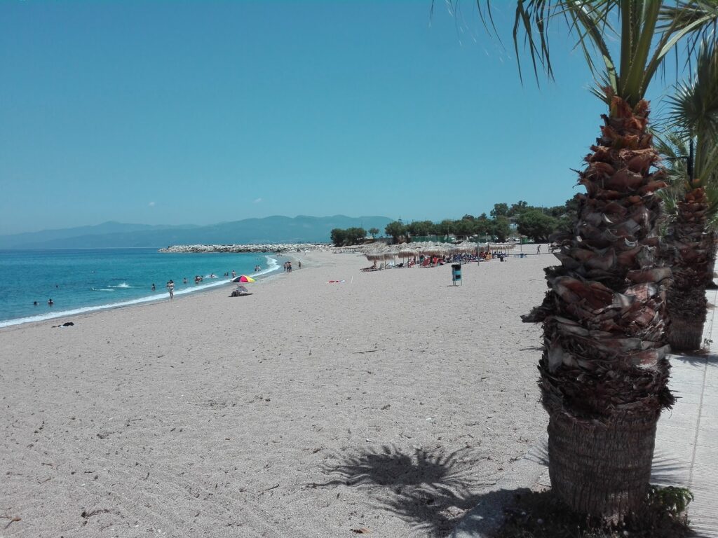
Ai-Lagoudis is the Blue Flag town beach at the base of all this accumulated history — a short walk from the city centre, sandy, family-oriented, directly facing the Ionian Sea.
Getting There: 5–10 Minutes’ Walk From the City Centre, KTEL Buses From Athens (4–5 Hours) and Kalamata, Parking Along the Waterfront Road
From central Kyparissia, the beach is 5 to 10 minutes’ walk down to the waterfront. The modern lower town sits between the hill and the sea; the descent from the main square to the beach is direct.
By bus, KTEL services connect Kyparissia with Athens (4–5 hours from Kifissos terminal), Kalamata, and Patras. Kalamata International Airport is approximately 45km south.
We covered Agiannakis Beach Kyparissia Greece — the ARCHELON monitoring station at the old train station, 12km north in the core Caretta nesting zone — and Elea Beach Kyparissia Greece — where the Neda river mouth meets the Ionian Sea at the northern boundary of Messenia. Ai-Lagoudis is the town beach of the same municipality, at the urban centre rather than the isolated nesting coast.
The Beach: Sandy, Blue Flag, Partly Organised, Afternoon Ionian Waves, Sunsets Directly Into the Sea, 5 Minutes From the Shops
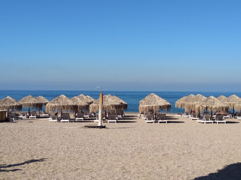
Ai-Lagoudis is sandy and awarded the Blue Flag — the primary organised beach in the Kyparissia sequence. The water faces the open Ionian, which produces the specific afternoon wave energy that the source article accurately captures: the morning is calm; by afternoon a breeze builds and the bay develops playful waves. Sunsets are direct — the Ionian horizon is west-facing and the sun drops into the water rather than behind hills. The beach bars serve from morning coffee through sunset cocktails.
The beach is a short walk from the shops, restaurants, and cafes of the lower town — the practical proximity that makes it work as a family destination where the beach and the town are not separate.
The Castle of Giants: Above the Old Town, Free Entry, Sunset Views Across the Ionian
The castle above the old town is accessible on foot from the lower town — the climb through the Ano Poli (Upper Town) with its preserved Byzantine and Ottoman urban fabric passes Ottoman-era fountains, cobblestoned streets, and the churches of Agios Dimitrios and the Presentation of Mary. The castle itself is free to enter and offers the specific sunset view of the Ionian from the walls that the Frankish barons and Byzantine despots saw before it.
Peristeria: The Mycenaean Site 10km Away, Earlier Than Mycenae
Ancient Peristeria, 10 kilometres northeast of Kyparissia near the village of Myro, is one of the earliest Mycenaean sites in Greece — with vaulted tombs and architectural remains from the 2nd millennium BC. The site predates the great Mycenaean palaces and has been described as an important early Mycenaean settlement, possibly the origin of some of the Mycenaean cultural patterns that later appeared at Mycenae and Tiryns.
Proti Island: WWII Shipwrecks for Diving, 10km Offshore
The small island of Proti lies offshore — visible from the beach and reachable by boat. In the sea around it lie two WWII shipwrecks: one iron vessel 20 metres long at 5 metres depth (carrying petrol cans, sunk by Italian aircraft), and one wooden vessel carrying barrels of milk, lying at 40 metres depth for scuba divers. The shallower wreck is accessible to snorkellers.
Ai-Lagoudis Beach at Kyparissia in Messenia is the Blue Flag town beach Pausanias documented as the Dionysas spring, below the Castle of Giants (Homer’s Nestor sent 11 ships to Troy from here, Byzantine fortress on the ancient acropolis, last Frankish prince of the Peloponnese died here 1432, Ibrahim Pasha burned the town 1825), 5–10 minutes’ walk from the city centre, sandy with afternoon Ionian waves, direct sunset, Peristeria Mycenaean site 10km northeast, Proti island WWII shipwrecks offshore, the Kyparissia Sunshine International Folklore Festival 25–30 August (CIOFF-UNESCO partner).
Walk from the square. Swim in the morning. Climb to the castle for the sunset.


Map
Sorry, no records were found. Please adjust your search criteria and try again.
Sorry, unable to load the Maps API.
Near by places: