Agia Marina Beach Neapoli: Petrified Forest, Unique EU


Profile
Agia Marina Beach, Vatika: The Shore of the Petrified Palm Forest, Unique in Europe, Where 2–3 Million Year Old Trees Were Calcified Under the Sea and Root Knots Still Gush Water When the Waves Hit
Greece | Agia Marina | Voies Municipality, Vatika, Laconia, Peloponnese
Two to three million years ago, the Vatika peninsula was subtropical. Palm trees grew alongside pines and broad-leaved hardwoods in a forest that covered the coastal area. Then earthquakes and geological upheavals submerged the entire forest under the sea — not gradually but quickly enough, in geological terms, to preserve the trees in position rather than allowing them to decay. Under the water, a process called permineralization began: the organic matter of the wood was replaced molecule by molecule by solutions of silicon and calcium carbonate, with extraordinary patience and precision, converting living tissue into stone while preserving the exact three-dimensional structure of the original tree. Trunks, roots, root knots. The palm trees became geological objects.
What makes the Vatika petrified forest unique in Europe is the method of fossilisation. Most petrified forests — including the famous one at Sigri on Lesvos — were petrified through direct contact with volcanic ash, which is the faster and more common process. Here, the calcification happened underwater, through a slower permineralization, producing a different kind of fossil and a different landscape. The sea eventually receded enough to expose the stones again, and the palm trunks now stand under the same Greek sun they stood under three million years before the first human ancestor arrived in this part of the world.
The geopark is free. An information centre opens in July and August from 10:00 to 19:00, offering free guided tours in Greek and English lasting approximately 15 minutes. The petrified forest is included in the Atlas of Geological Monuments of the Aegean and is a strong candidate for the European Geoparks Network.
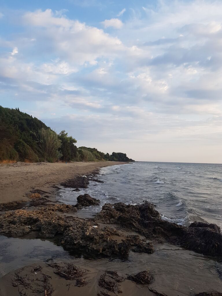
Agia Marina beach is where the forest meets the sea — the rocky shore studded with petrified trunks and root knots, the sandy sections between them providing conventional beach access, the submerged continuation of the forest visible to snorkellers below the surface.
Getting There: 12km From Neapoli (15–20 Minutes), 3.3km Dirt Road From the Agios Nikolaos Harbour Turn-Off, Free Parking at the Geopark Entrance, Information Stand Before the Church
From Neapoli (the main town of Vatika, 12km north), take the road south toward Agios Nikolaos. From Agios Nikolaos village, head toward the harbour of Profitis Ilias. Just before the harbour, a sign marks the turn-off for Agia Marina and the Petrified Forest. Follow the dirt road 3.3km to the geopark. An information stand is located just before the church of Agia Marina. Free parking is at the geopark entrance, two minutes from the water.
From Monemvasia (35km north), the drive takes approximately 45 minutes. Elafonisos — the white sand island visible from the hillsides above — is accessible by ferry from Pounta, 25km north.
The Geopark: Palm Trunks up to 1m Diameter, Root Knots That Gush Water, “The Human” 2m Trunk at Korakas, Walking Routes, Free Guided Tours July–August
The forest covers the coastal zone from Agia Marina through Korakas and Spitha to the Voies plain, extending from this coast toward Cape Maleas and south toward Elafonisos. At Korakas, the tallest surviving trunk is 2 metres — the locals call it “the human” for its upright form. Trunk diameters reach 1 metre. The root knots have a specific behaviour: when a wave breaks over them, water jets up through the knot openings, an effect produced by the hollow channel geometry of the permineralized root system.
Two walking routes are marked through the geopark — a short route of a few dozen metres for casual visitors, and a longer trekking route. Both are free, both pass the information boards, and the July–August guided tour provides the geological context in 15 minutes.
The fossilised molluscs, sea urchins, starfishes, crabs, and shellfish around the trunks are the marine layer — the creatures that lived in the sea above the petrified forest after the trees had been calcified, and which were themselves subsequently fossilised in the same process.
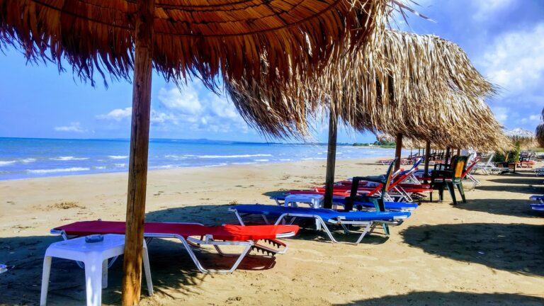
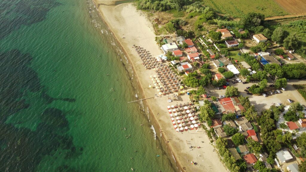
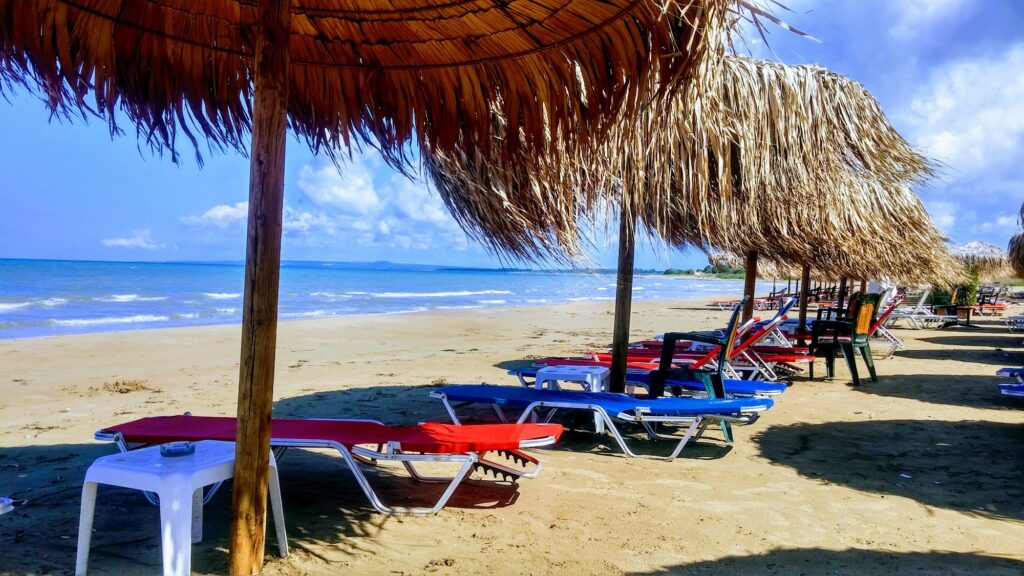
The Beach: Snorkelling the Submerged Forest, Sandy Sections Between the Rocky Trunks, Small Islet Offshore, Sunbeds From the Local Beach Bar
The beach at Agia Marina combines the rocky sections where the petrified trunks emerge from the ground with sandy areas between them. Swimming here is snorkelling over a geological site — the submerged continuation of the forest is visible below the surface, the offshore section of the permineralized trees extending into the shallow water. The small islet of Agia Marina just offshore is the kayak and SUP destination.
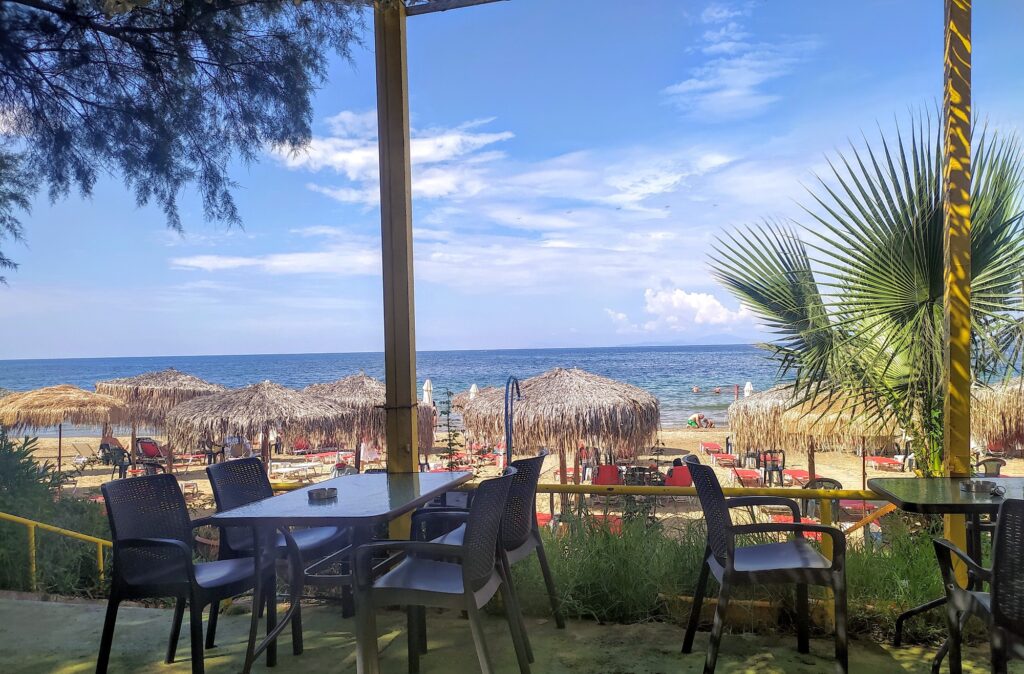
A small beach bar operates seasonally, providing sunbeds, umbrellas, and refreshments.
Cape Maleas: 15km, the Most Feared Cape in Ancient Mediterranean Navigation
Cape Maleas — the southeasternmost tip of the Laconian peninsula, 15km from Agia Marina — was the most feared navigational landmark in the ancient Mediterranean. Ancient mariners’ proverb: “Round Cape Maleas and forget your homeland.” The cape’s unpredictable winds at the junction of the Aegean and Ionian seas made rounding it a genuine gamble. Odysseus was blown off course here on his return from Troy, beginning the 10 years of wandering. Kythira and Antikythira are visible from the heights above Agia Marina, just beyond the cape.
Agia Marina Beach in the Vatika peninsula, Laconia is the shore of the petrified palm forest unique in Europe — 2–3 million years old, calcified underwater by permineralization rather than volcanic ash, free geopark with guided tours July–August 10:00–19:00, palm trunks up to 1m diameter with root knots that gush water when waves hit, “the human” 2m trunk at Korakas, the submerged continuation visible to snorkellers, marine fossils (sea urchins, starfishes, crabs) in the surrounding rock, Cape Maleas 15km (the cape that blew Odysseus off course), Kythira visible from the hills above, Elafonisos 25km north, 12km from Neapoli, 3.3km dirt road from the Agios Nikolaos harbour turn-off.
Drive from Neapoli. Follow the sign at Profitis Ilias. Read the information board. Snorkel over the submerged trunks.
Map
Sorry, no records were found. Please adjust your search criteria and try again.
Sorry, unable to load the Maps API.