Chalikia Beach Mezapos: Cave Shore, Tigani Castle
Profile
Chalikia Beach, Mezapos: The White Coarse Pebble Shore Dominated by a Massive Cave, Overlooking the Frying Pan Peninsula Where the Oldest Castle in Mani Was Built by Justinian in the 6th Century
Greece | Mezapos | East Mani Municipality, Laconia, Deep Mani, Peloponnese
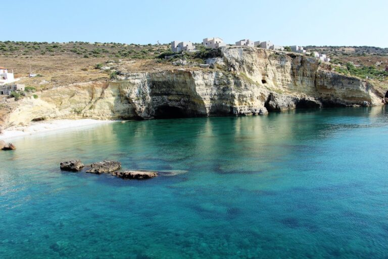
Tigani means frying pan in Greek. The peninsula that juts into the Bay of Mezapos has exactly that shape when seen from above or from the hillsides of Agia Kyriaki village above: a narrow 1,700-metre handle extending from the mainland, terminating in a circular rocky platform that hangs over the sea. The Byzantine settlement and fortress on the platform is the oldest castle in Mani — built under the Emperor Justinian in the 6th century, when this remote peninsula in the southwestern Peloponnese was significant enough to warrant the construction of a military and religious centre with cisterns said to number as many as the days of the year, a three-domed church, churches with frescoes, and walls with cyclopean masonry at their oldest sections. The Vandals tried to take it in 467 AD and were beaten back at the Battle of Tainarus. The Arabs, Crusaders, Slavs, and Turks all tried subsequently. The fortress survived until sometime around 1570, when it was abandoned for the last time.
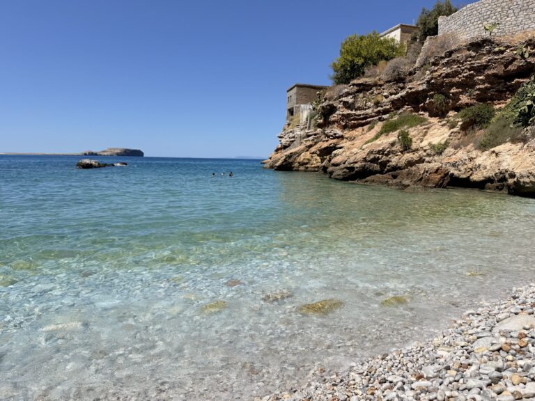
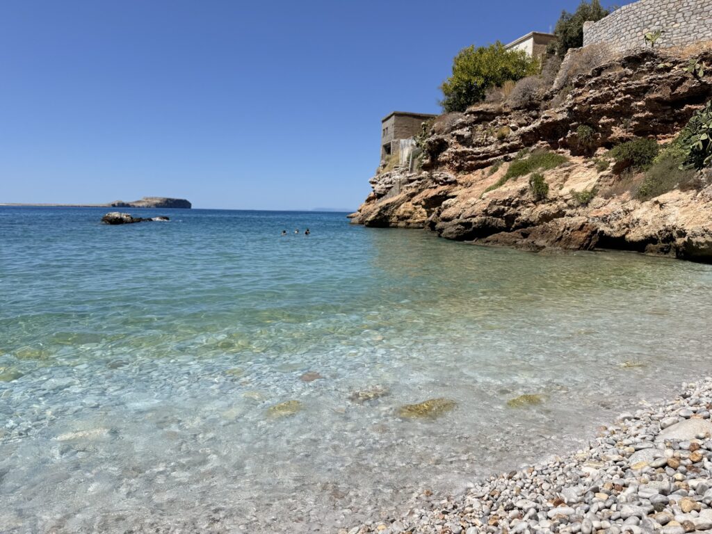
From Chalikia beach at the edge of Mezapos village, Tigani is the specific landmark across the water. The castle ruins on its platform are visible from the shore — a horizon object that every swim takes place in front of. The name chalikia is the plural of chaliki, which is the Greek for pebble or gravel. The beach is white coarse pebbles and one massive cave that dominates the landscape — the cave opening is the specific visual element that makes Chalikia unmistakable in photographs and unmistakable in person.
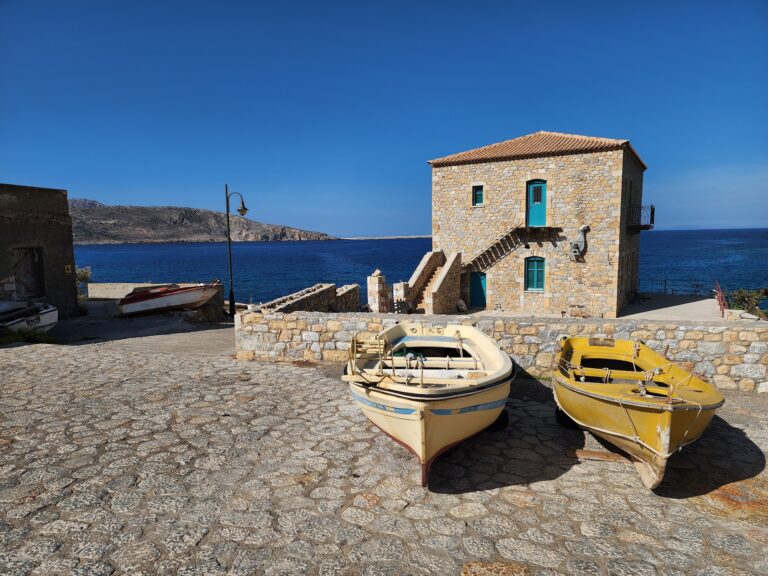
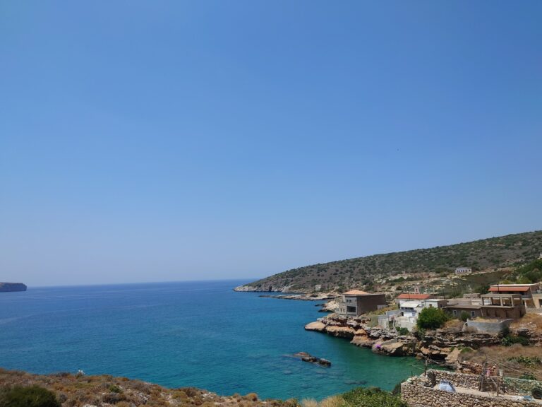
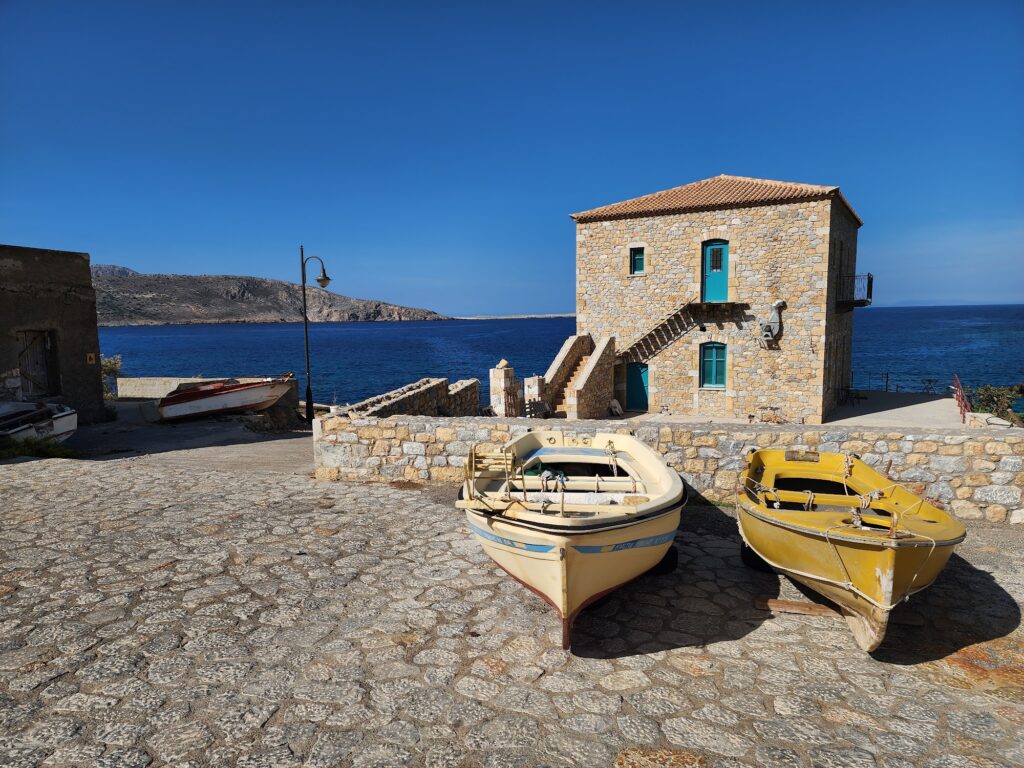
Mezapos is a small traditional settlement built at the sea’s edge — stone houses, ruined towers, domed Byzantine churches in the countryside around it, most of them locked but visible. The Panagia Vlacherna at Fokaloto nearby is between the 12th and 13th centuries; ruins of an earlier church from the 5th–6th century are also in the area. The settlement has the specific Deep Mani character that Vathia (the most photographed abandoned tower village) represents at its extreme: a landscape where history accumulated in stone and was then mostly abandoned, leaving the structures in place for the sea and the sun to work on.
Getting There: 18km South of Areopoli (20–25 Minutes), Road Through Prickly Pears and Stone Towers, Parking at the Village Church and Harbour Road, Short Walk to the Beach
From Areopoli, drive south toward Gerolimenas and follow signs for Mezapos. The road winds through the characteristic Deep Mani landscape — prickly pear cacti, dry stone walls, tower houses at intervals, the arid limestone plateau that the Maniots have been farming and defending for centuries. Mezapos is 18 kilometres from Areopoli, approximately 20 to 25 minutes. Park near the village church or along the harbour road; the walk to Chalikia is short and flat.
The Beach: White Coarse Pebbles, Massive Cave, Wild and Unorganised, Sea Caves for Snorkelling, Tigani Castle Visible, No Facilities — Bring Everything
Chalikia is unorganised and wild — the description from the Mezapos villa complex, whose management knows the beach well, uses exactly those words: “wild, unexplored, and impressive.” The white coarse pebbles are rougher than the smooth limestone pebbles at Dexameni or Mavrovouni — a different stone texture that produces the specific sound when waves move through them. The cave dominating the landscape is visible from the beach as the single largest feature of the shoreline. The sea caves in the limestone that flank the bay are accessible by snorkelling and swimming.
No facilities. No sunbeds. No umbrellas. No lifeguard. No food or drinks on the beach. The village of Mezapos is a few minutes’ walk and provides the nearest shade, food, and shelter. Bring everything needed for the day before descending to the shore.
Kato Mezapos: The Freshwater Cave Springs, the Pirate Tower, 5 Minutes From Chalikia
Kato Mezapos is a separate small beach in the same village area, also with white pebbles and turquoise water. Its specific quality is freshwater springs emerging from within a cave — a rare natural phenomenon where the limestone geology of the peninsula forces groundwater to the surface at the sea’s edge, mixing cold fresh water with the warm salt water in the bay. The Sassari pirate tower stands on the way to this beach — a ruined defensive structure from the period when Mani piracy was an organised economic activity, the tower used as a lookout and signalling point for vessels working the Laconian Gulf.
The Tigani Walk: From Agia Kyriaki Along the Handle of the Frying Pan, Salt Pans in the Rock, Byzantine Ruins
The walk to Tigani begins at Agia Kyriaki village (accessible from the Mezapos road) and follows the 1,700-metre peninsula handle out to the platform. The surface of the platform is rough limestone pitted with hundreds of small and large cavities — natural hollows that the local population used to collect salt, pouring seawater in and waiting for it to evaporate. A more complex salt marsh with multiple partitions is also preserved. The Byzantine remains are at the far end: the cisterns, the wall sections, the church ruins, and the best-preserved eastern section with identifiable Justinian features.
The walk has no shade and the wind can be strong. Solid shoes are necessary — the limestone is rough and uneven. The reward is the specific view back from the platform toward Mezapos bay, the village below, and Taygetos in the distance.
Chalikia Beach at Mezapos in the Deep Mani is the wild white coarse pebble shore dominated by a massive cave, overlooking the Tigani frying pan peninsula where the oldest castle in Mani was built by Justinian in the 6th century (cisterns as many as the days of the year, Vandals defeated 467 AD, abandoned around 1570), Kato Mezapos beach 5 minutes away with freshwater cave springs and the Sassari pirate tower, Byzantine churches in the surrounding countryside, no facilities (bring everything), 18km south of Areopoli, the Tigani walk accessible from Agia Kyriaki (1,700m, limestone salt pans, Byzantine ruins, no shade, strong wind, solid shoes required).
Drive from Areopoli. Park at the church. Walk to the cave shore. Look across at the frying pan.


Map
Sorry, no records were found. Please adjust your search criteria and try again.
Sorry, unable to load the Maps API.