Kavarna City Beach: Below the Cliff Where Bizone Sank


Profile
Kavarna City Beach, Bulgaria: The 500m Harbour Beach Below Cape Chirakman Where Bizone Sank Into the Sea in the 1st Century BC and the Dalboka Mussels Are 5 Minutes Away
Bulgaria | Kavarna | Dobrich Province, Northern Black Sea Coast
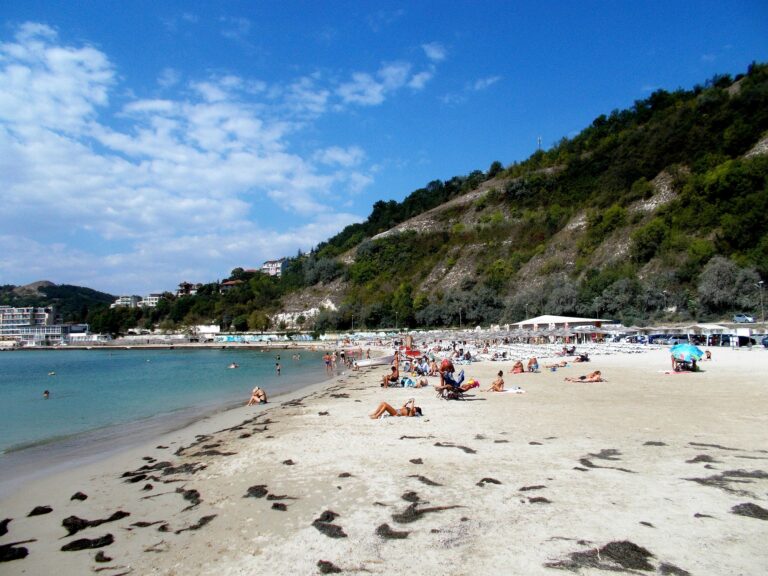
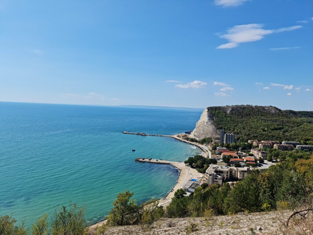
The city that calls itself the Rock Capital of Bulgaria has a beach 3 kilometres down the hill from the town centre, at the bottom of the valley that runs from the plateau to the sea. It isn’t a beach you arrive at by accident. You choose to go down to it, and the road makes the choice explicit. But at the bottom, below Cape Chirakman where the harbour sits, the bay is calm, the water clear, and the view up to the cliff is the specific thing photographs of this beach try and mostly fail to capture.
Cape Chirakman is one of the symbols of Kavarna. It is 3 km south from Kavarna, like a beautiful ending of a pretty valley, through which passes the way from the town to the harbour and the sea. During the Hellenic period a powerful Thracian-Greek colony was founded here, called Bizone. During the 1st century BC a powerful earthquake split the cape and a great part of it sank into the sea.
The sunken city of Bizone is still there, underwater, off the cape. Divers can visit it. The earthquake that split the cape and dropped the city happened roughly 2,000 years ago, and the evidence of it is visible from the beach — the dramatic cliff line and the shape of the cape are the aftermath. The beach exists because the valley opens at the bottom into a harbour bay where the water is sheltered by what remains of the cape after the earthquake took the rest.
Getting There: 60km From Varna on the E87, 3km Downhill From Kavarna Centre, Free Parking at the Harbour, Bus From Varna Every 30 Minutes
From Varna, drive north on the E87 for approximately 60 kilometres to Kavarna. The journey takes about an hour. Regular buses connect Varna Central Bus Station to Kavarna every 30 minutes; the journey takes around an hour. From the Kavarna town centre, the road winds downhill for 3 kilometres to the port area and the beach. Free parking is available next to the beach.
The road down from the town offers elevated views of Kavarna Bay on the descent — worth slowing down for before the final approach to the harbour.
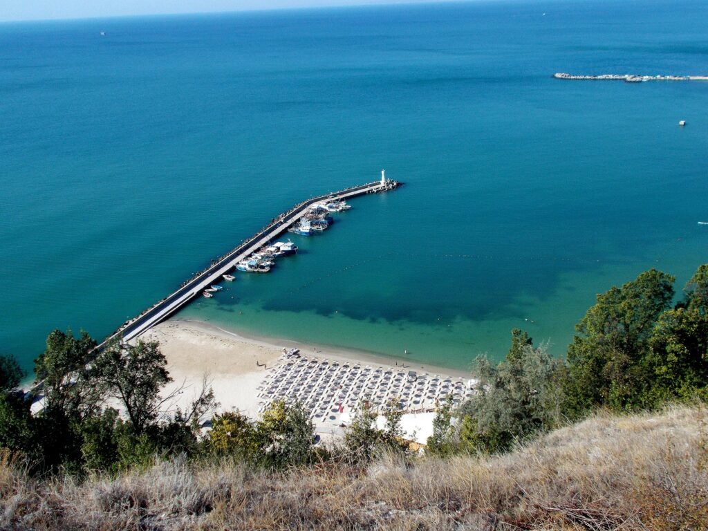
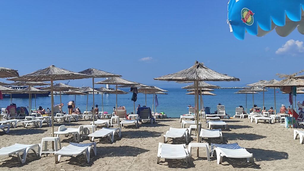
The Beach: 500m, Engineered Sandy Bay, Harbour Adjacent, Calm Water, Lifeguards, Sunbeds
The beach is 500 metres long, engineered with breakwaters to protect the harbour side, and sits inside the bay created by the cape. The protective geometry keeps the water calmer than the open-sea beaches to the north. Sunbeds and umbrellas are available for rent; a free zone exists alongside the organised section. Lifeguards are on duty through the summer season. Showers and changing facilities are available near the main promenade pathways.
The harbour operation alongside the beach — the fishing boats, the local activity, the pier — is what gives the beach its character. It’s a working harbour with a beach attached, rather than a purpose-built resort beach. The mussels on the menu at the seafood restaurants nearby were in the water off Cape Kaliakra a short time before they arrived at the table, which is the specific food quality that the Dalboka proximity enables.
Dalboka Mussel Farm: The First Mussel Farm in Bulgaria, 5 Minutes Away, Mussel Desserts Included
The Dalboka Mussel Farm is the first of its kind in Bulgaria. In 1994, Veselin Prokopiev submerged the first mussels underwater, and a year later they were already about 30 tons.
In addition to any mussel meal you can ever imagine (even mussel desserts!), the Dalboka mussel farm serves an exotic rapa whelk salad and around 20 kinds of Black Sea fish. The waters near Dalboka are renowned for their purity.
Dalboka is between Cape Kaliakra and Balgarevo village, 5 minutes by car from the Kavarna harbour. It’s the specific food experience that visitors to Kavarna city beach organise their afternoon around: beach in the morning, Dalboka for lunch. Boat trips that combine kayaking around Cape Kaliakra with a mussel lunch at the farm are one of the region’s most popular excursions.
The Rock Capital of Bulgaria: Kavarna’s Musical Identity
Kavarna is called the Rock Capital of Bulgaria because it has hosted annual heavy metal and rock concerts on the cliff edge above the town — acts including Whitesnake, Def Leppard, Scorpions, Uriah Heep, and others have played the outdoor stage at Kavarna. The concerts took place annually from 2008 onward, supported by the mayor at the time who turned the town’s cultural identity around them. The summer concert series is the specific reason visitors who wouldn’t otherwise come to the northern Bulgarian coast make the trip.
Cape Kaliakra, Bolata, and the Northern Coast Day Programme
The beach is the right base for the northern Bulgarian cliff coast programme. Cape Kaliakra — the dramatic headland with the 4th-century fortress ruins, the legend of the 40 Bulgarian maidens, and the dolphin sightings — is 20 minutes north. Bolata Beach Bulgaria — the horseshoe red-cliff bay that is a member of the Most Beautiful Bays in the World club — is 25 minutes north. Adora Beach Bulgaria — the hidden white-cliff cove below Topola village — is 15 minutes south.
The day programme from Kavarna city beach: morning swim, Dalboka mussels at noon, Cape Kaliakra fortress in the afternoon, Bolata at the end of the day if there’s time.
Kavarna City Beach is the 500-metre harbour bay 3 kilometres below the Rock Capital of Bulgaria — below Cape Chirakman where the ancient Greek city of Bizone sank into the sea 2,000 years ago, the sunken ruins still diveable offshore, Dalboka — Bulgaria’s first mussel farm — 5 minutes away with mussel desserts on the menu, 60 kilometres from Varna by bus in an hour, free parking at the harbour, and the cliff above the bay as the specific view the photographs try to capture.
Drive down the valley. The cliff gets bigger as you descend. The mussels are not a second thought — plan for them.

Map
Sorry, no records were found. Please adjust your search criteria and try again.
Sorry, unable to load the Maps API.