Byala Beach Bulgaria: White Cliffs and No Sun After 4pm

Profile
Byala (Biala) Beach, Bulgaria: The White Cliff Town Halfway Between Varna and Burgas, Where the Dinosaur-Era Boundary Is Exposed in the Rock and the Sun Disappears Behind the Cliffs at 4pm
Bulgaria | Byala | Varna Province, Black Sea Coast
The town is called Byala because the cliffs are white. Byala means white in Bulgarian, and the chalky limestone formations that flank the bay have been the defining feature of the settlement since Greek colonists called it Aspros — also meaning white — in the 6th century BC. What those colonists didn’t know was what the whiteness encoded: the White Cliffs near Byala are one of only four places in the world where the Cretaceous-Paleogene boundary is visibly exposed in the rock face — the geological marker of the meteorite impact that ended the dinosaurs 66 million years ago. There’s a demonstration centre.
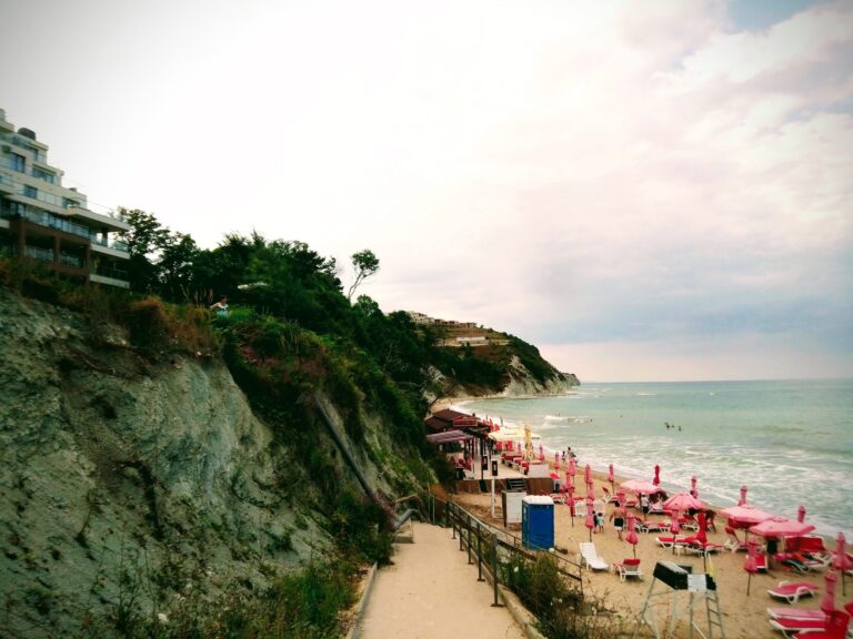
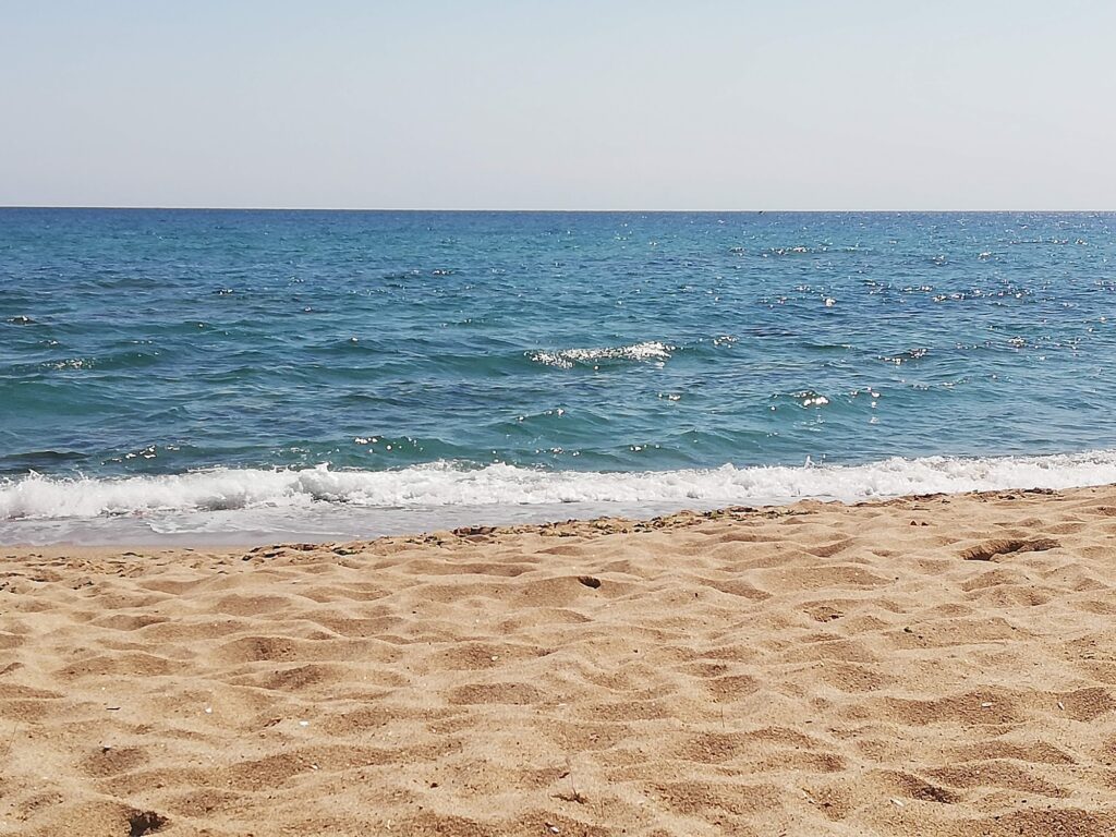
The beach sits below these cliffs, which is beautiful and creates one specific practical consequence: the cliffs provide natural shadow after about 4pm, so sunbathing is not possible after that time on most parts of the beach. This isn’t a minor point if you’re planning an afternoon visit. Come in the morning, and the light on the white rock with the turquoise water is everything the photographs promise. Plan to be elsewhere by late afternoon unless you’re happy with shade.
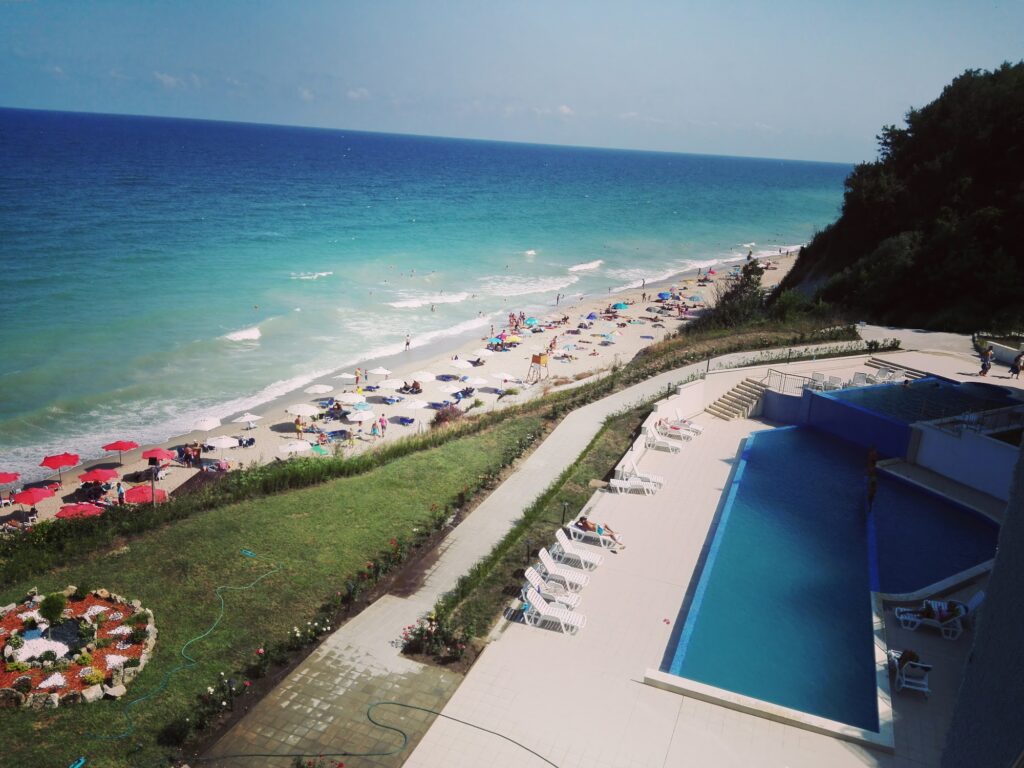
The beach itself is 6 kilometres total, clean, wide, and quiet by northern resort standards. The central organised section is narrower than the full strip suggests. The seabed may have some slippery rocks scattered throughout — water shoes are the sensible precaution.
Getting There: Halfway on the E87 Between Varna and Burgas, Regular Bus Stops, Street Parking, 6km From Obzor
Byala sits on the E87 about halfway between the two main Bulgarian coastal cities — 53 kilometres south of Varna and 75 kilometres north of Burgas. Several bus services running between Varna and Burgas stop in Byala, which means arriving by public transport is straightforward from either city. From the central bus stop, the beach is a 15-minute walk down toward the water, or a short taxi.
By car, the drive from Varna takes about 50 minutes. Street parking is available near the main beach access roads. The neighbouring town of Obzor is just 6 kilometres south — if Byala is full, Obzor is the natural next stop.
The Beach: 6km Total, Central Section Organised, Slippery Rocks on the Seabed, Cliffs Block Sun After 4pm
The combination of sea and mountain climate makes Byala a great place for relaxation — that framing is accurate. The Balkan Mountains rise just a few kilometres inland and the coastal hills produce a microclimate that most visitors describe as fresher than the flat resort strips to the north.
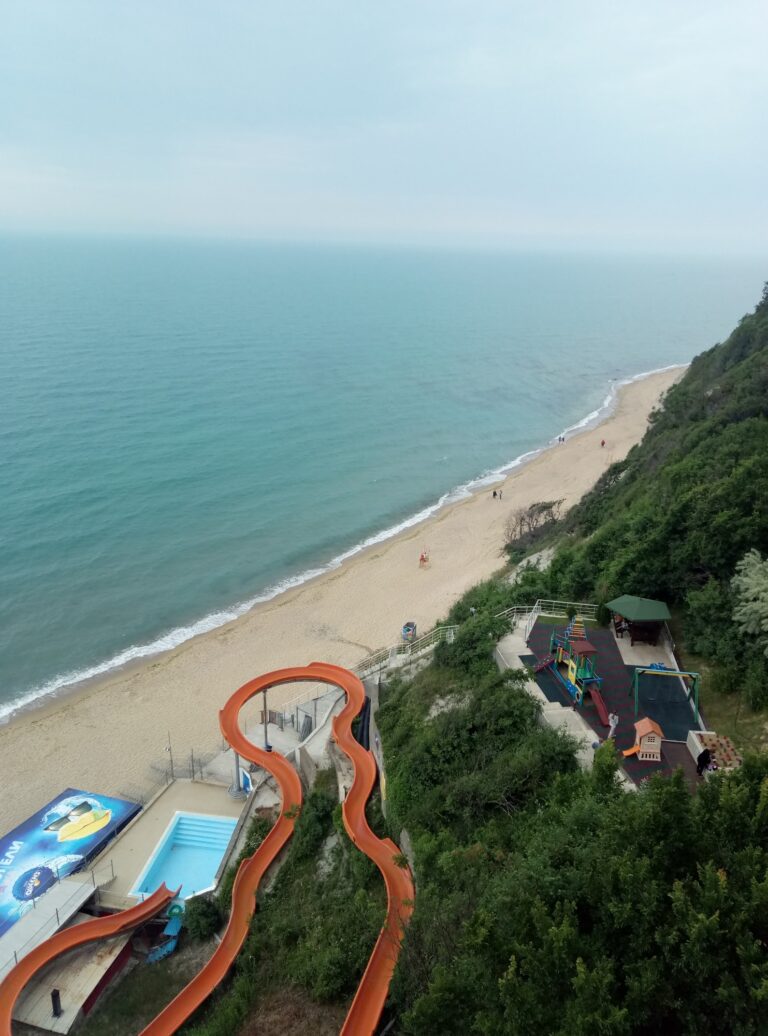
The northern part of the beach is only accessible through stairs, so disabled access can be a problem there. What the beach lacks in resort infrastructure it compensates for with the quality of the water and the scale of the surrounding landscape. It doesn’t get crowded even in peak months — a significant point on a coast where most beaches reach capacity in July and August.
The Dimyat grape variety is local to this region. The white wine made from it is the pairing of choice with the fresh sea bass that local anglers sell at the harbour each morning.
The White Cliffs and the End of the Dinosaurs
The White Cliffs (Belite Skali) near Byala display a classic Cretaceous-Paleogene boundary exposure — the geological stratum marking the mass extinction event 66 million years ago. Byala is the fourth place in the world where such traces have been found. A demonstration centre explains the significance and exhibits fossil fragments found in the area.
The cliffs are accessible on the Cape St. Atanas eco-trail, a coastal path that provides the panoramic views of the full Byala Bay that the beach itself doesn’t offer. Walking the trail first and then descending to the beach is the recommended approach for anyone who arrives before 10am.
Cape St. Atanas: The 5th-Century Fortress, the Basilica, and Bulgaria’s Biggest Ancient Winery
Cape St. Atanas, located south of Byala, used to be a religious centre during the Greek colonisation and later during early Christianity. The fortress dates back to the 5th to 6th centuries. The Basilica, two baptisteries, and Bulgaria’s biggest antique winery — discovered here, dating to the 6th century AD — are the main structures. The restored marble altar table from the 5th to 6th centuries is one of the few preserved almost entirely not only in Bulgaria but in the world.
The fortress and Cape St. Atanas archaeological complex opened to visitors in 2014. On the southern side of the cape there is a small beach, a fishing marina, and a restaurant.
Karadere: The Wild Beach 6km North, No Infrastructure, Still One of the Last
Karadere, 6 kilometres north of Byala, is one of Bulgaria’s last remaining wild beaches — pristine dunes, freshwater wetlands, Natura 2000 protected, popular with campers, naturists, and watersports visitors. Plans for a Norman Foster-designed carbon-neutral resort at Karadere were announced in 2007 and shelved in 2008, which is the best thing that happened to the beach. It remains undeveloped. The 3-kilometre sandy strip is accessible by car as well as on foot.
For anyone visiting Biala Beach with a car and a full day, Karadere in the morning (when it’s still quiet) and Byala beach in the afternoon (before the 4pm cliff shadow) is the sequence that uses both.
Byala Beach in Varna Province sits below white chalk cliffs that exposed the end of the dinosaurs in the geological record — 53 kilometres from Varna, 6 kilometres from Obzor, the sun blocked by the cliffs after 4pm (come in the morning), slippery rocks on the seabed, Cape St. Atanas fortress and winery south of town, the Cretaceous-Paleogene demonstration centre at the White Cliffs, Karadere wild beach 6 kilometres north, and local Dimyat white wine with the morning catch at the harbour.
Walk the cliff trail first. Descend to the beach. Leave before 4pm or accept the shade.


Map
Sorry, no records were found. Please adjust your search criteria and try again.
Sorry, unable to load the Maps API.