Nea Iraklitsa Beach Kavala: Blue Flag, Icon, Sea Caves


Profile
Nea Iraklitsa Beach (Alana), Kavala: The 2km Blue Flag Shore of the 1922 Refugee Settlement, With a Miraculous Icon the Residents Brought From Turkey and Retrieved From Mount Athos, Opposite Two Islands With Sea Caves
Greece | Nea Iraklitsa | Kavala Regional Unit, Eastern Macedonia and Thrace
Nea Iraklitsa was settled in 1922 by refugees from the village of Iraklitsa in Turkey — one of hundreds of communities across northern Greece whose names carry the prefix Nea (new) to indicate the specific geography of displacement. The residents of the Turkish Iraklitsa arrived during the same population exchange that populated Nea Peramos (from Peramos near Bursa) and dozens of other coastal settlements along the Macedonian and Thracian shores. They came with what they could carry. Among the things they brought was an icon.
The Church of Panagia Faneromeni in Nea Iraklitsa houses a miraculous icon of the Virgin Mary that tradition attributes to Apostle Luke himself. The icon was found in the Turkish village of Iraklitsa and carried to the new settlement in Macedonia. In a subsequent transfer, the icon was moved to Mount Athos — the monastic peninsula 80 kilometres west, one of the holiest sites in Orthodox Christianity and one of the most secure locations for religious objects in Greece. The residents of Nea Iraklitsa did not accept the permanent removal of what they considered their community’s most sacred possession. In 1932, they succeeded in having the icon returned. It has remained in the village church since. The church also holds part of the skull of Saint Haralambos among its relics. The celebration of the Assumption of the Virgin Mary in Nea Iraklitsa is one of the significant annual festivals of the region.
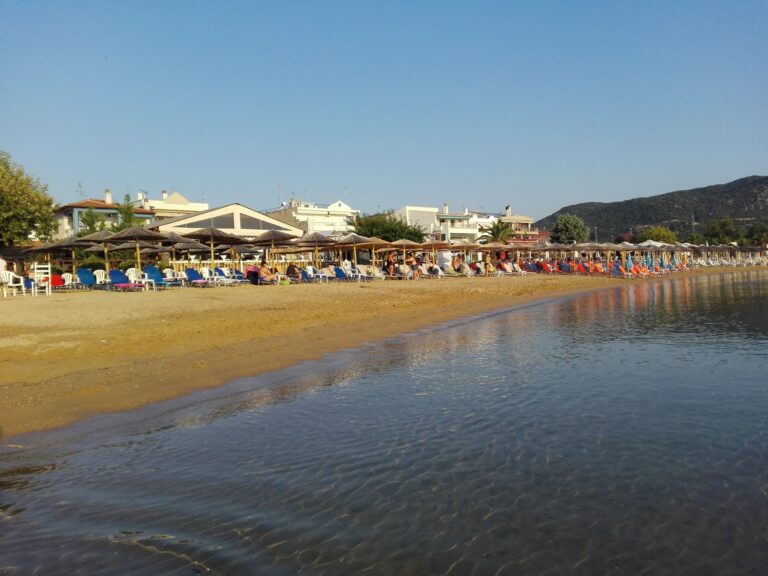
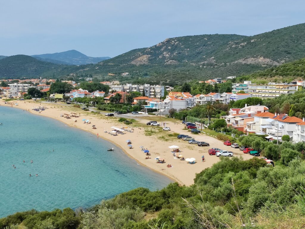
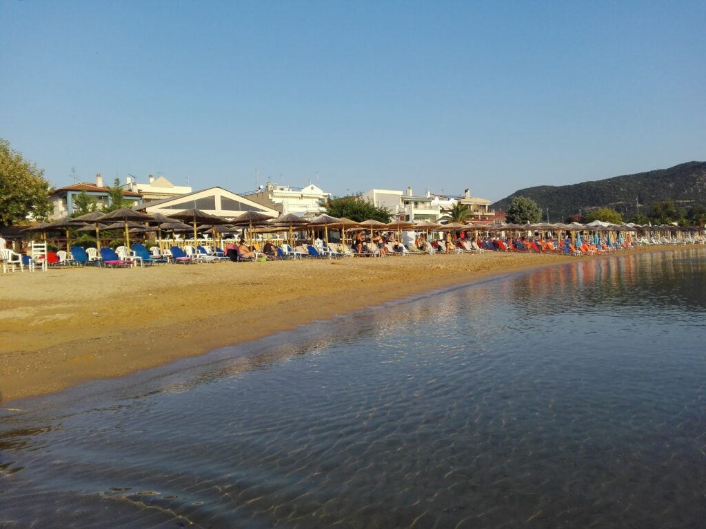
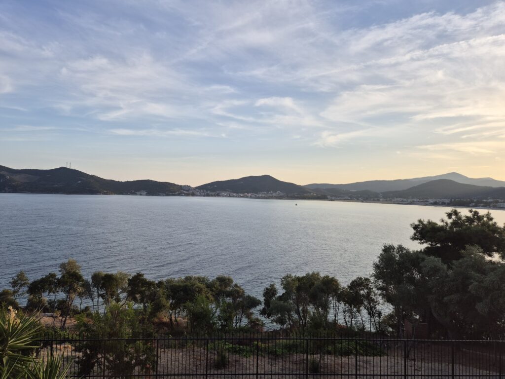
The beach — locally known as Alana — is 2 kilometres long, Blue Flag awarded for over a decade consecutively, sandy, calm, and shallow in its central sections.
Getting There: 13km East of Kavala (20–25 Min), KTEL Bus Connection, Free Parking at Three Points, Disability Sea-Entry Ramp
From Kavala city, drive east along the coastal road toward Chrysoupoli and Xanthi. Nea Iraklitsa is 13 kilometres from the city — approximately 20 to 25 minutes. The KTEL bus connects Kavala to Nea Iraklitsa on its regional routes.
Kavala International Airport (Alexander the Great) at Chrysoupoli is approximately 15 kilometres east — 15 to 20 minutes by car, making Nea Iraklitsa one of the most airport-proximate beaches in the Kavala region.
The central section of the beach has a disability ramp for sea entry — one of the few beach accessibility features in the Kavala area, specifically noted by the Nikana.gr beach guide.
The Beach: Three Sections, 2km Sandy and Calm, Blue Flag, Consumption Model Sunbeds, Football and Volleyball Courts, Sailing Club
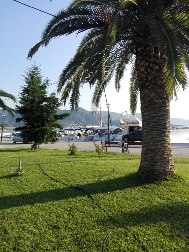
The beach divides into three sections. The central organised section sits next to the village centre — beach bars and cafes with sunbeds and umbrellas on the consumption model, the waterfront promenade running parallel with restaurants and tavernas, the marina with fishing and yacht boats. The section toward Palio (west, toward Kavala) is wilder — some villas and hotels along the waterfront, fewer facilities. The third section extends beyond the yacht marina.
Facilities include volleyball courts, football fields, a sailing club, and a small inflatable waterpark some seasons. Playgrounds and parks are immediately behind the beach. The water is shallow and calm throughout — the bay’s geometry provides protection and the sandy seabed gradients gently.
The beach is notably less crowded than the Kavala city beaches and Ammolofoi even in peak August. The character is a settled residential resort rather than a commercial beach — families from Kavala and the region with houses and apartments in the village use it as a regular rather than occasional destination.
The Two Islets: Fidonisi (Sea Caves, Private) and Arethousa Opposite the Beach
The Fidonisi and Arethousa islets are visible from the beach offshore. Fidonisi is private property but the sea caves that penetrate the islet’s rock are accessible by boat or kayak — a boat or kayak rental from the marina port is the specific way to reach them. The sea caves are specifically described as a destination worth visiting by boat owners and kayakers.
Remvi beach is on the other side of the cape from the main Alana beach — 350 metres long, narrower, accessed from the port side. The initial section has beach lounges; beyond them visitors can place towels freely. The water is clean with some sea urchins in certain spots, making water shoes advisable at Remvi.
The Panagia Faneromeni Church and Its Icon: The Community Heritage
The Church of Panagia Faneromeni sits in the village centre. The icon attributed to Apostle Luke — the miraculous image of the Virgin Mary brought from Turkey in 1922, held briefly by Mount Athos, and recovered by the community in 1932 — is the specific religious heritage that distinguishes Nea Iraklitsa from other beach resort communities along the Kavala coast. The church celebrates the Novena of Mary (the nine days preceding the Assumption of the Virgin Mary on 15 August) as the village fair. The relics of Saint Haralambos are also housed in the church.
The Chapel of Agia Marina near the port, built by the Nea Iraklitsa fishermen’s association, offers panoramic views of the bay from its elevated position on the small peninsula between the main beach and Remvi.
The Caves of Panagia at Moustheni: The Nearby Hermitage
The village of Moustheni, a few kilometres inland from Nea Iraklitsa, has the Caves of Panagia — small hermitage caves with icons devoted to the Virgin Mary carved into the rock. These caves are one of the inland attractions accessible from a Nea Iraklitsa base, combining the beach day with a short drive into the hills behind the coast.
Nea Iraklitsa in the Kavala East Coast Sequence
East of Kavala, the coastal settlements extend toward Kavala Airport and beyond. Nea Iraklitsa is the first significant resort settlement east of the city, followed by Chrysoupoli (the airport town) and then Keramoti and the ferry connection to Thassos. Keramoti Beach Kavala Greece — the 5km Blue Flag sandy tongue 15 minutes from the airport, with the Thassos ferry from the adjacent harbour — and the full Thassos island beach sequence including Saliara Marble Beach Thassos Greece accessible from the Keramoti crossing.
Palio suburb — 6.5 kilometres west toward Kavala, described by the Nikana guide as “Kavala’s Saint Tropez” for its upscale character — is covered as Glastres Beach Kavala Greece.
Nea Iraklitsa Beach (Alana) at Kavala is the 2km Blue Flag sandy shore of the 1922 refugee settlement 13km east of the city — the miraculous icon of Panagia Faneromeni (attributed to Apostle Luke, brought from Turkey in 1922, retrieved from Mount Athos in 1932) in the village church, disability sea-entry ramp, three beach sections (central organised, western wilder, eastern beyond the marina), Fidonisi and Arethousa islets offshore with Fidonisi sea caves by boat or kayak, Remvi beach on the other side of the cape (350m, rockier, some urchins), sailing club, volleyball and football courts, KTEL bus from Kavala, free parking, Kavala Airport 15 minutes east, and the Caves of Panagia at Moustheni inland.
Drive east from Kavala. Park at the central section. Rent a kayak for the Fidonisi sea caves.
Map
Sorry, no records were found. Please adjust your search criteria and try again.
Sorry, unable to load the Maps API.