Katergo Beach Folegandros: Most Beautiful, No Facilities

Profile
Katergo Beach, Folegandros: The Island’s Most Beautiful Beach, Named After the Islet That Looks Like a Galley Ship, Reached by Hourly Boat From Karavostasis or a 30-Minute Scramble From Livadi — and Do Not Swim to the Islet
Greece | Katergo | Folegandros, Cyclades
The name comes from the islet. A long, narrow rocky formation sits off the southeast coast of Folegandros, and when seen from the land it resembles a katergo — the galley ship rowed by convicts in the Ottoman and Venetian periods. The beach behind it took the ship’s name. An alternative etymology connects the name to the island’s old iron ore industry — hematite was extracted from the cliffs here and used to make the red paint that Folegandros fishermen applied to their boats and parts of their homes. The conditions of extraction were harsh enough that workers described it as forced labour, which in Greek is also katergo. Both stories are told by locals; both may be true.
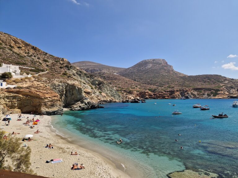
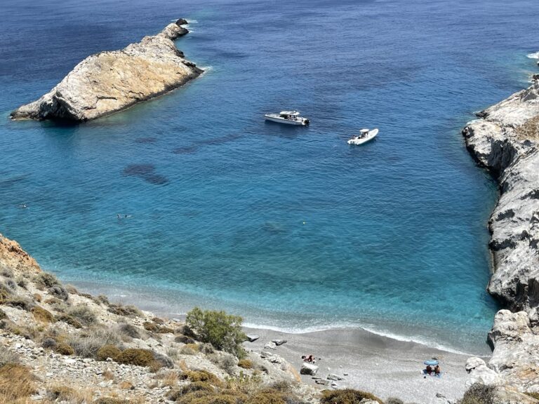
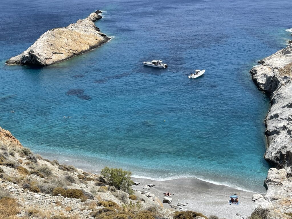
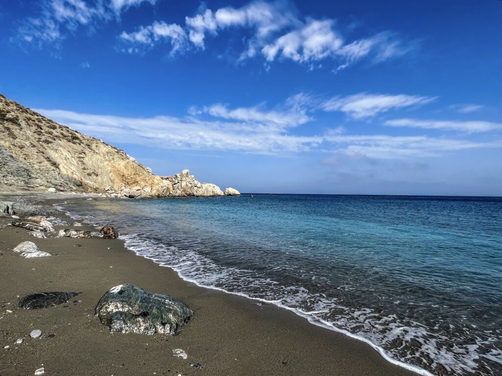
The beach is the most beautiful on Folegandros — this is the consistent consensus from every source, every visitor account, every travel guide. The water here is extraordinarily clear, cooler than the other island beaches because of the open sea currents that flow through the southeast channel. The pebbles are small and white. The cliffs on both sides are tall. The islet sits in the sea just offshore, its shape unmistakably galley-like when you lie on the beach and look at it.
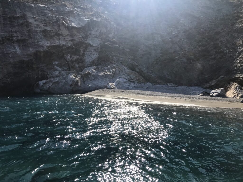
There is nothing else at Katergo. No facilities, no shade structures, no toilets, no taverna, no snack bar. The sun beats directly on the beach from midday onwards. The cliffs provide some shade in the early morning and late afternoon but not at midday. Everything needed for a full day — water, food, sun protection, shade — must be carried in.
The one additional piece of honest safety advice that multiple independent sources specifically state: do not swim to the islet. The currents between the beach and the islet are strong. It looks close and looks swimmable. The currents make it genuinely dangerous. The islet is for looking at, not swimming to.
Getting There: Boat From Karavostasis (€8–10 Return, Roughly Hourly From 11am) or 30-Minute Scramble From Livadi (Closed Shoes Required)
Two options exist, and they are genuinely different in character.
The boat from Karavostasis port takes 10 to 15 minutes and costs approximately €8 to €10 return. Services run roughly hourly from 11am in peak season. No advance booking is necessary — arrive at the port and ask for the boat to Katergo. The port is small and the boat operators are easy to find. The boat gives a view of the southeast coastline from the sea, which is the specific perspective that shows the scale of the cliffs and the islet.
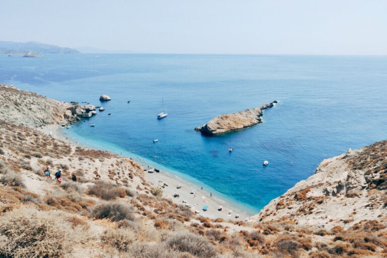
The hike from Livadi settlement (near Karavostasis, 10 minutes from the port by road) starts on a marked path and takes approximately 20 to 30 minutes. The first section is open country — old stone walls, phrygana scrub, views of the island interior. The final section is a steep scramble down to the beach on rough rock and loose pebble. Closed shoes are mandatory — flip-flops will not work on the descent, and bare feet certainly won’t. The view of the beach from the top of the cliff, looking down the steep descent to the white pebbles and electric blue water below, is consistently described as one of the most memorable moments of a Folegandros visit, better than the beach itself.
Going down by hike and returning by boat, or the reverse, avoids repeating the scramble and allows the perspective of both approaches. Arriving at Karavostasis port for the last boat back and having the time right requires checking the return service schedule on arrival.
The Beach: White Pebbles, Steep-Ish Seabed, Cool Open Sea Water, Multiple Islets to Look At (Not to Swim To)
The pebbles are small and white throughout. The seabed slopes more quickly than at Agkali Beach Folegandros Greece — Katergo is deeper, faster, better for confident swimmers and snorkelling. The water temperature is noticeably cooler than Agkali due to the open sea current, which is the same current that creates the dangerous crossing to the islet.
The islet visible from the beach is not the only rocky formation offshore — several smaller islets and rocks are scattered in the sea to the southeast. The underwater rock formations, particularly at the edges of the main cove, are the snorkelling terrain. The visibility in the clear water makes the rocks and fish visible from the surface.
No shade is available after the early morning cliff shadow moves off. A personal umbrella is the only shade option for a full day visit. White pebbles reflect heat upward; the surface temperature of the beach at midday in July is significant — beach sandals rather than bare feet on the pebbles are advised.
The Islet: What to Know About the Currents
The islet directly off Katergo beach is close enough to look swimmable. Lonely Planet specifically notes that swimming to it is not recommended due to strong currents. The island’s own tourism resources say the same. The current runs between the beach and the islet with enough force that it constitutes a genuine hazard for recreational swimmers. The islet is the view — it is the most photographed subject at Katergo, the visual reference that makes the beach identifiable. It is not a swimming destination.
Hematite and the Old Iron Ore Industry
The cliffs around Katergo contain hematite — iron oxide, the mineral that gives certain Cycladic cliffs their red-brown colouring. On Folegandros, the hematite was extracted and used to make a red paint that fishermen applied to the underside of boats and to specific decorative elements of houses. The extraction work was hard, exposed, and physically demanding enough that the place became associated with forced labour — which is the alternative etymology for the name. Whether the name comes from the galley-shaped islet or from the labour conditions of the ore extraction, or from both, the Katergo coastline carries a working history visible in the rocks themselves.
Folegandros Context: The Island, the Ferry, the One Road
Folegandros has no airport. The ferry from Piraeus takes 3.5 to 10 hours depending on the service. The practical approach for visitors from Athens or international airports is to fly to Santorini and take the connecting ferry — 1 to 2 hours. The island has one road, three settlements, and approximately 750 permanent residents. It is one of the smallest inhabited islands in the Cyclades by population.
The southeast location of Katergo places it at the far end from Agkali (southwest) and from Chora (centre). The full island circuit — Karavostasis port, Katergo by boat, return to port, drive or bus to Chora, then west to Agkali Beach Folegandros Greece — is the natural Folegandros day structure.
What to Bring: The Preparation List
The preparation list for Katergo is not a suggestion. Multiple sources list it as mandatory:
Water — more than you think. The boat ride is 10 minutes; the heat on an unshaded white pebble beach from noon is substantial.
Food — there is nothing at the beach. Pack enough for the full duration.
Sun protection — SPF 50 minimum, reapply after swimming.
Personal shade — an umbrella or pop-up tent if you plan to stay past 11am.
Closed shoes — for the hike approach. The pebble descent is not manageable in sandals.
Katergo Beach on Folegandros is the island’s most beautiful beach — white pebbles under tall cliffs, the islet that looks like a galley ship offshore, extraordinarily clear cool water from open sea currents, boat from Karavostasis port (€8–10 return, hourly from 11am, 10–15 minutes) or 30-minute scramble from Livadi (closed shoes, view from the cliff top is the best moment), no facilities whatsoever, no shade after morning, do not swim to the islet (strong currents, specifically warned in multiple sources), bring everything you need for the day.
Take the boat out. Hike back. Look at the islet from the shore.

Map
Sorry, no records were found. Please adjust your search criteria and try again.
Sorry, unable to load the Maps API.
Near by places: